Showing posts with label planning. Show all posts

My Comment on City Arch River


As followers of City to River are undoubtedly aware, the National Park Service just concluded a one-month window to submit comments on the proposed City Arch River project. Basically, the outcome of this comment period determines whether the NPS will have to undergo a real Environmental Assessment with full Environmental Impact Statement or whether they can speed merrily along the current path.

The process thus far has been one of the worst planning processes I have ever witnessed. Public participation has been methodically curtailed: the public comment process for the finalist teams in the design competition was limited to two weeks; this ended before the majority of the public was able to view the entries. City Arch River's social media campaign was dead on arrival. Most troubling, City to River has pointed out that the winning MVVA proposal has been significantly undermined without public consent or awareness.

The text that follows is my official comment for the Environmental Assessment process. You can read City to River's official comment here.

Question 1:
Do the purpose, need, and objectives reflect what you think the NPS needs to accomplish with this project? If not, what else do you think needs to be accomplished?


The current City Arch River proposal addresses neither the majority of significant issues raised during the General Management Plan process nor half of the articulated goals of the City Arch River 2015 Foundation.
During the GMP Process key concerns such as access, connectivity, and boundary were raised (GMP §1.6, p.1-10). The NPS opened the door to rethink the difficult journey from city to park to river, how the riverfront might play a pivotal role for both visitors and residents, and the half-realized vision for the memorial might be broadened to encompass both banks of the river – achieving Saarinen’s vision after a six decade lacuna.

These intentions were supported not only by the NPS, but by the general public as well. During an energetic series of meetings, residents articulated their deference for the daring of the Saarinen monument and advocated equally bold new action. Public comment mandated including the Riverfront in the design competition (GMP §5.4, p.5.8), expanding the design competition beyond the park boundary to study better connections to downtown along Spruce, Locust, and Olive Streets (GMP §5.4, p.5.10), redeveloping the lifeless South end of the Arch Grounds (GMP §5.4, p.5.11), and multiple views supporting the removal of soon-to-be redundant lanes of I-70 and replacement with a pedestrian friendly at-grade urban boulevard (GMP §5.4, p. 5.14-15).

Building on these intentions, the City Arch River design competition included the following goals in the competition structure:

2. Catalyze increased vitality in the St. Louis region

4. Weave connections and transitions from the City and the Arch Grounds to the river.

5. Mitigate the impact of transportation systems

6. Embrace the Mississippi River and the East Bank in Illinois as an integral part of the National Park.

8. Create attractors to promote extended visitation to the Arch, the City, and the River.

As the NPS is undoubtedly aware, this EA process itself has removed the entire East Bank part of the project from consideration. In addition, requested park amenities along the riverfront and South end (water gauges, South skating rink/beer garden, underpass park) in the MVVA Plan have been removed from the original MVVA Arch Grounds. These changes remove much of the activities needed to energize the Arch Grounds while other functions have been displaced away from the Arch and River to Kiener Plaza. These actions are in direct opposition to the criteria established in the City Arch River competition goals, the NPS GMP, and through significant public input.


Question 2:
What concerns do you have about the potential impacts of the project to revitalize the park? How do you think these concerns could be addressed?


The most disturbing element of the revitalization project will be the effects caused by the removal of Memorial Drive and the preservation and illogical expansion of a redundant and soon to be de-designated highway. The removal of Memorial Drive, an action taken without public input, has never been subjected to public scrutiny or comprehensive study. Although curiously eliminated from the scope of this EA, the removal of Memorial Drive will require new highway ramps. Based on current practices these ramps will require a significantly larger infrastructure, will finalize the disconnection of the Arch from all but a select sliver of downtown, and will have ecological repercussions on the immediately contiguous arch grounds.

If the National Park Service does not want to risk turning the gateway to western expansion into a receptacle for windfall refuse from passing cars or an under-engineered arboreal carbon sink for truck exhaust, the NPS must undertake a comprehensive public study of the tangible costs, benefits, and management challenges – environmental, logistic, and economic – of removing Memorial Drive and lining the Arch Grounds with additional highway infrastructure. Such a study should thoroughly investigate at least the following options at a minimum:

1. Removal of I-244 (currently known as I-70) and replacement with a linear park/urban boulevard similar to the Embarcadero in San Francisco or the Rose Kennedy Greenway in Boston

2. Elimination of the proposed Washington Avenue SB entrance and NB exit and relocation of all exits/entrances to the Cass Ave. I-70 interchange

3. Elevation of I-244 to 24 feet above street level (similar to the Strada Aldo Moro adjacent to the old harbor of Genoa, Italy)

4. Maintenance costs of the status quo and attendant expenses in continually decreasing tourism.


Please submit any additional comments in the box provided.
The current challenge of the Jefferson National Expansion Memorial is fundamentally one of disconnection. Visitor numbers are slowly decreasing because, although a compelling experience, it is not enough of a destination to warrant repeat visits. It now exists solely for out-of-town tourists. The park must be made a vital and important part of St. Louis civic life in order to reinvigorate the park. The fortunes of downtown and the JNEM are inorexibly intertwined. A house divided against itself cannot stand, yet the current plan hardens the divisions around the majority of the JNEM boundaries. This sad result is largely the result of unreasoned local interference in a good design.

Residents of St. Louis care deeply about this opportunity, but until now we have remained sidelined by a shamefully anemic public participation process. The National Parks Service now has a chance to exercise true leadership and to openly and carefully evaluate the merits of the current proposal alongside other strong alternatives.

If the NPS can take that step, the residents of St. Louis will meet you. We have already accomplished the resurrection of one great city park with Forest Park. It is not too late; if we are presented with aspirational goals and a chance to make a difference we will do it again.

Realpolitik and Transformational Change for Saint Louis


Current I-70/Memorial Right of Way looking North from Spruce St. Photograph by author.

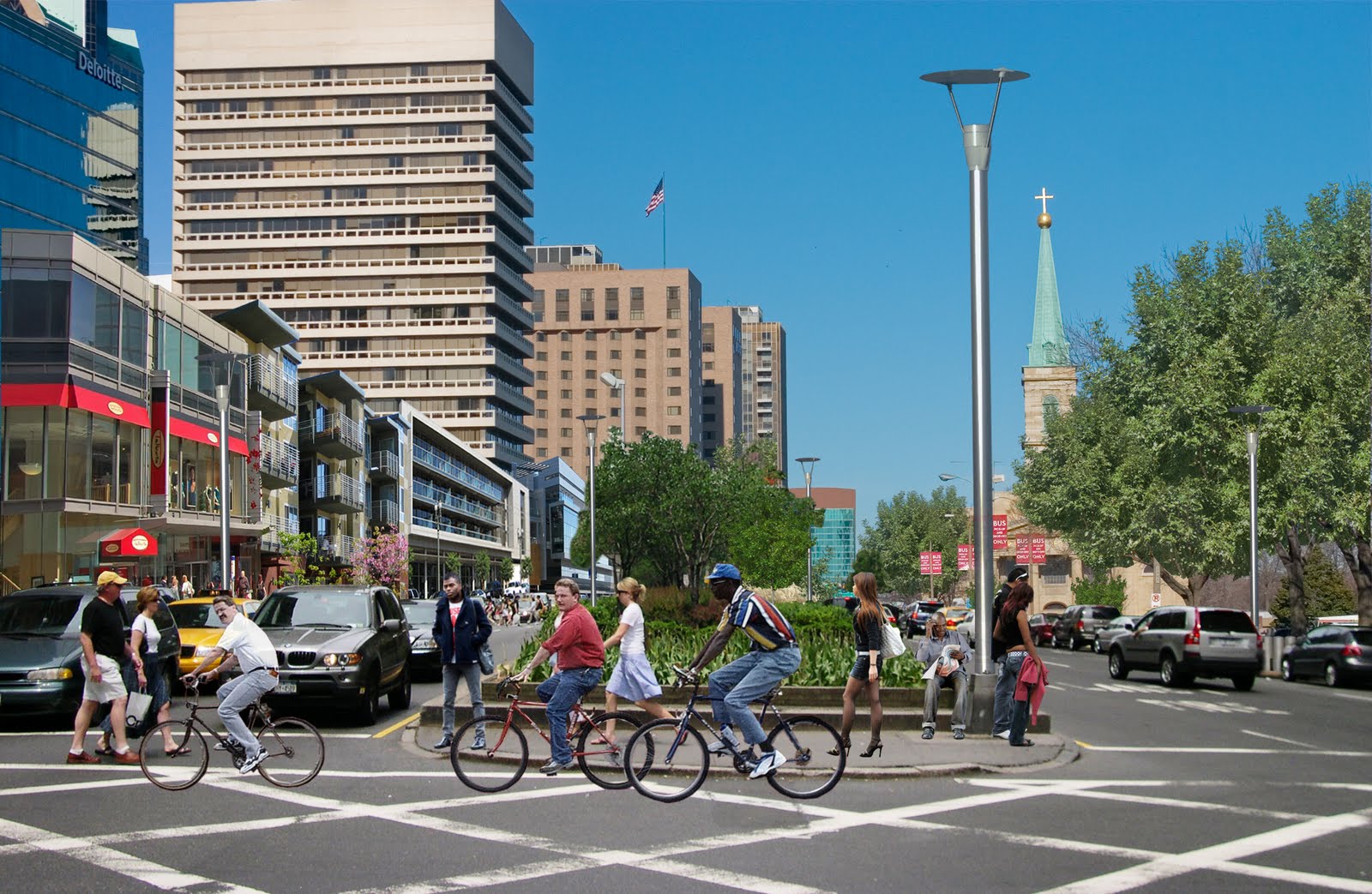
The next several years present a unique opportunity for the city of Saint Louis. As I have previously detailed, a series of ill advised post-war decisions severed the vital connection between Saint Louis and the Mississippi River. We now have a unique opportunity to fix these mistakes and enhance the potential of downtown while reconnecting to a vital identity for 21st century Saint Louis. The convergence of the first new bridge over the Mississippi in 40 years, renewed interest due to an international design competition, and an urban resurgence present a once in a lifetime opportunity. We must take advantage of these circumstances to remove the depressed and elevated lanes that sever the arch grounds and Laclede's Landing from the city, for this transformative change will become the driver for future incremental redevelopment on a scale not currently feasible.

In a recent study by Development Strategies the replacement of 1.2 miles of the existing 12 lane corridor with an adequately sized boulevard would open up to 500,000 square feet of developable land. These properties, in conjunction with adjacent vacant lots, could generate a value of $1.2 billion dollars in the next two decades. Based on this estimate, highway removal and redevelopment could provide as much as $6.3 million in annual property taxes to the city. An observer might bet that this windfall alone would be enough to attract political support, but they would have paradoxically long odds at this point.

In his 2009 presentation at TED Paul Collier prescribes a radical fix for global post-conflict recovery:
The reality is that we need to reverse the sequence. It's not the politics first; it's actually the politics last. The politics become easier as the decade progresses if you're building on a foundation of security and economic development. The rebuilding of prosperity ... The objective of facing reality is to change reality.
This matches the trajectory taken by City to River. The grassroots organization has found it far easier and more productive to engage those people and organizations who have a profound interest in the outcome. Unlike the typical convention center/stadium/museum attraction trope of urban development and more like the civic projects of a century ago, the development of an at-grade boulevard provides an armature for growth rather than a single deal to be closed. This potential and complexity requires a robust conversation with numerous parties and the negotiation of hundreds of varying interests. To echo Ed Morrison: If we were just building a convention center then "civic engagement [would be] a carefully circumscribed event, not a process; a meeting, not a collaboration." The problem with which we are confronted resulted from just such a hierarchical and artificial process -- to be successful our solution must be organic. City to River is developing what Morrison would describe as "complex public/private strategies [that] are developed in a “civic space” outside the four walls of any one organization;" and since January 2010 we have given over a hundred presentations to property owners, business associations, neighborhood groups, non-profits, design teams, and interested citizens.

The end result of this process has been a lengthy series of endorsements and a robust network of potential partners. This network includes non-profits such as the William Kerr Foundation, advocacy organizations such as The Open Space Council, The St. Louis Convention & Visitors Commission, developers such as Spinnaker, LoftWorks, and Chivvis, The US Bank Community Development Corporation, Laclede's Landing Merchant's Association, and the St. Louis Post-Dispatch. For a full list of organizations that endorse the City to River boulevard concept please view the City to River Blog.

As the above list of supporters demonstrates, the network of organizations and individuals that support the idea of reconnecting the C.B.D. of Saint Louis with the Arch Grounds, Laclede's Landing, Chouteau's Landing, and the North Riverfront incorporates diverse sectors: development, real estate, advocacy, non-profit, business, and media. Although updates from the CityArchRiver competition have been regrettably sparse, a recent email highlights major supporters of the CityArchRiver competition:
Congressional leaders from both sides of the Mississippi River have officially voiced their support for the international design competition set to frame the area around the Gateway Arch. The nine Democratic and Republican members of the St. Louis area delegation from Missouri and Illinois have sent a joint letter to the CityArchRiver 2015 Foundation, the group sponsoring the competition to select a design team to invigorate the Arch grounds and connect the Arch to downtown St. Louis, the Mississippi River and the Illinois side. The letter - signed by U.S. Senators Kit Bond, R-Mo., Roland Burris, D-Ill., Dick Durbin, D-Ill. and Claire McCaskill, D-Mo., as well as Congressmen Todd Akin, R-Mo., Russ Carnahan, D-Mo., William Lacy Clay, Jr., D-Mo., Jerry Costello, D-Ill., and John Shimkus, R-Ill. - praises the competition as an event that will have "indelibly positive impact on our region."
...
The competition organizers say the official endorsement reinforces the region's commitment to making sure the vision of a new iconic setting for the Arch on both sides of the river becomes a reality. "We are thrilled that our region's lawmakers have joined to communicate their support and to recognize the significance of the competition and the Arch project," said Walter Metcalfe Jr., senior counsel with Bryan Cave LLP and a member of the foundation board.

While I echo Metcalf's sentiments, I hope that the signatory politicians will find the political foresight to meet the growing mass of City to River supporters by embracing the potential of replacing the obsolete highway with an at-grade urban boulevard.

Please consider leaving a comment supporting highway removal at the CityArchRiver competition website, please examine the competition finalists and give input during the comment period (August 17th-24th), and please contact your representatives and elected officials.

The time is now to reopen our front door!

A potential vision of the New Memorial Drive. Rendering by author for City to River.

UPDATED - Streetcars: things just ain't what they used to be


There has been much consideration and discussion here in Saint Louis about Joe Edwards's plan to reintroduce a streetcar on Delmar Boulevard. The conversation here has been the duplicate of a similar debate raging in my birthplace of Columbus, Ohio. In the case of Columbus, financing was never fully established and that uncertainty, combined with the economic downturn, led to the project being put on indefinite hold.

There are some major differences between the proposals for streetcar lines in Columbus and Saint Louis. In Columbus, the effort was led by a task force formed by the mayor. In Saint Louis, the impetus has come from a private developer, Joe Edwards, who has been the key player in the incremental revitalization of the Delmar Loop. In this case the politicians involved seem to have caught trolley fever and were extremely disconcerted to learn that even in Portland fares only make up 16% of total funding. While this is not earth-shattering if you consider streetcars another form of transit (streetcars pay a larger percentage through revenue than interstate highways for example) but troubling if this is envisioned as merely a novelty.

More tellingly, the philosophy behind each proposal has been different. The lines in Columbus were conceived to connect the 40,000+ population at Ohio State University with jobs downtown and the entertainment and nightlife destinations in the Arena District and Brewery District. The initial plans also involved connecting Columbus State Community College and the Columbus College of Art and Design. As Mayor Michael B. Coleman stated:
I think connecting the Ohio State University to the Brewery District, and the Arena District to the Discovery District, which is CCAD area and Columbus State, is something I think will add to the value of the city, and will be an element of the quality of life to young professionals finding Columbus as a place they want to stay. And anywhere that streetcar is located, you will see restaurants, retail, offices, and residential, all along the line. It will be the spur and difference-maker for economic development in our downtown, in addition to getting around. So it’s a huge catalyst for vibrancy, a huge catalyst for economic development, and a huge catalyst for just getting folks around…

In comparison, the Loop Streetcar connects an already developed area (named one of America's 10 Greatest Streets in 2007 by the American Planning Association) with Forest Park and would run a mere two and one quarter miles. Of this length, only around eight blocks have any potential for the streetcar to serve as a catalyst for significant redevelopment. The Columbus proposal would have been greater than five miles in length, would have connected five distinct economic centers and could have provided the catalyst for over thirty blocks of undervalued property.

The difference is stark, and it is clear that the proposed Loop Trolley (just the use of the term trolley instead of streetcar makes it clear it is planned solely around nostalgia) is meant entirely as a tourist attraction rather than as real transit. This is dangerous for two major reasons. First, as a tourist vehicle, it is especially susceptible to bad publicity. People tend to act much more strongly to entertainment and non-vital establishments once a problem has occurred. Compare the shopping malls to grocery stores; non-essential venues such as shopping malls are exceedingly susceptible to bad publicity. A failure of the Loop Trolley could set back surface transit in Saint Louis for thirty years to come. Furthermore as commenter "Adam" noted at Saint Louis Urban Workshop the brevity of the line is a huge liability in terms of operational sustainability :
When you build only one line, that one line has to absorb all the overhead for operating a streetcar system. It has to have a carbarn; it has to have the electrical substation; it has to have a dedicated trained staff to drive them. And, perhaps worst of all, if there's only one line, it has to be completely shut down for any street maintenance instead of being able to shunt around maintenance on an alternate line. Look at a map of most major cities, including St. Louis, before World War II. Streetcar lines ran up and down practically every major street. They didn't cost $30 million for one mile because resources were shared across many lines (also because labor was cheap). Frankly, $30 million for a single mile along existing streets is absolutely absurd. That's more than $5000 per foot--unless the rails are made of truffles, what is costing that much?

Setting aside the majority of these concerns, how could the proposed streetcar be improved?

It is clear that the trolley backers have not studied the ways trolley traditionally functioned in their proposed study area. A few design changes would have a great impact in recreating a successful streetcar urbanism and increasing safety along the route.

Loop trolley - conceptual rendering.

Looking at the conceptual rendering it is evident that the streetcar is proposed to run in the traffic lanes of already-congested Delmar Boulevard. While running the trolley in traffic lanes romantically hearkens back to the big city urbanism we know from grainy footage, by the time neighborhoods like the Delmar Loop were designed, it was clear that headtimes and safety were improved by separating surface transit from cars.


As this undated image shows, the handicap of streetcar systems is its general inability to detour in the event of accidents

The lushly landscaped boulevards we know today were a design response to this issue. Instead of running in traffic lanes, the streetcars were given a dedicated right of way in the center of the street. In some cities streetcar actuated traffic lights stopped cross-median traffic. The result was increased safety and efficiency for surface transit.


Video from separated ROW of Illinois Terminal Company interurban streetcars, Venice, Illinois.

Former streetcar right of way, now landscape in median, Wydown Bvld..

While not every potential streetcar route has enough width to support a separated system (streetcars typically need at least eighteen feet for unidirectional service) many of St. Louis's boulevards are in excess of 54' in width and some, such as Gravois are in excess of 75' in width. Additional space can also be made on streetcar arteries by limiting parking. Currently Delmar between Kingsland and the Wabash (metrolink) tracks has two lanes of parallel curb parking, two traffic lanes, and a continuous center turn lane (known as a "suicide lane"). The street width from the Wabash (Metrolink) tracks to the end of the line is approximately 48' from curb to curb. In this instance it would make sense to split the line and have one direction loop to the north using Vernon Ave. to avoid overly crowding Delmar and drastically reducing system efficiency.

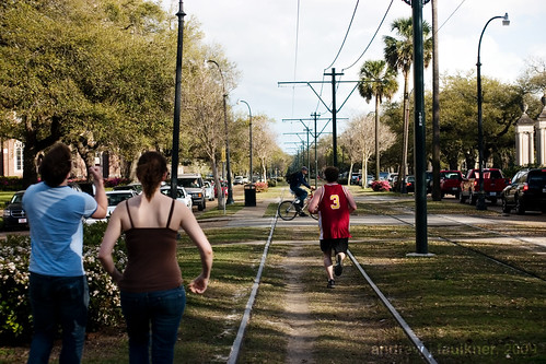
East of the Wabash tracks the situation is far different. Both Delmar and DeBaliviere have ample street width due to their conscious planning for transit in the early 20th century. The street width is 75' on Delmar and 72' on DeBaliviere allowing in both cases for two dedicated tracks in the median and four traffic lanes with bike lanes or expanded sidewalks on either side. To get an idea of how a revised Delmar streetscape might appear we can look to St. Charles in New Orleans.

Neutral ground on St. Charles Ave. at Calhoun St., a transit right of way and pedestrian refuge.

St. Charles Avenue in New Orleans falls roughly between Delmar Boulevard and Gravois in street width. However, due to the streetcar right of way the street is humanized to a much greater extent. Please also note the picture above was taken in the midst of rush hour gridlock and shows how the neutral ground can create a space for recreation while diminishing car/streetcar contact and greatly increasing system efficiency. Such a right of way could also be flanked with bike lanes to increase efficiency.

In future posts I will propose realignments to the Loop Trolley route as well as future expansions, and examine the often overlooked urban design traits and infrastructure that enabled streetcar-based transit to be so successful, and assess what lessons we may learn from these examples to apply to the revitalization of our cities.

7.9.09 UPDATE:
I was unable to attend the forum on the Loop Trolley, but the presentation is online here:

Alex Ihnen, as usual, has thorough coverage at his blog.

I left the following comment:

While the added expense of running the trolley in the median is certainly an important consideration, I am concerned there is no conceivable way the Loop Trolley will be able to maintain efficient service competing with traffic on Delmar in the Loop during peak hours without separation. Note that Portland's "Streetcar System Concept Plan" (http://www.portlandonline.com/transportation/index.cfm?c=46134) expects an average speed of 7 mph riding in traffic as compared with 15mph in a median right of way.

If lanes are used, there should be a one direction bypass such as Des Peres/Rosedale/Vernon/Kingsland because any accident on the Loop with current levels of congestion would shut down the entire system. Ideally it would be best to limit street parking to one side and remove the continuous center turn lane. While politically divisive this would only eliminate around 100 parking spaces which could be accommodated in future development. The implementation of the Loop Trolly is a serious commitment to transit and should not be hindered by the automobile preference that currently dominates the region.

Stoplight Urbanism Pt.II: The current condition


Today I will continue with the second part of my essay on the effect of traffic control on urbanism and my modest anarchic proposal for change.

To recap the first part:

For millenia movement through cities and villages was regulated by mutual interest and rooted in a notion of common-law that began to be restricted with the enclosure movements of the eighteenth and early nineteenth centuries. Under such a system no traveller had a superior right over another; no person or vehicle had dominance and all spatial claims to the space of the road were recognized to have equal value.
...
While in many western countries the establishment of the primacy of the automobile led to a drastic shift in custom and space, in developing nations the assimilation of motorized transportation in society has been unable to change customs regarding road use. Such intense systems of concession, predicated in intense interaction, result in the ability to change formation instantaneously and avoid obstacles and stoppages as they occur. These fluid dynamics utilize the whole of human reaction and intellect and exhibit a complex relation of communication and instinct not present in the smartest mechanical control.

At the dawn of the twentieth century urban areas exploded with growth as millions abandoned rural lives to seek fortune in the industrialized cities of the world. With the overwhelming concentration of people in small geographic areas, the sixty years spanning the years between 1890 and 1950 would see an obsession with congestion as the gravest threat to cities. In some cases, although technological innovations had allowed such congestion to occur, technology was again proposed as the answer. Thomas Edison predicted the wide-scale adoption of automobiles would “so relieve traffic as to make Manhattan Island resemble the ‘The Deserted Village’” [Fogelson, 253]. Others sought less sweeping measures to fight congestion through regulation and traffic control.

Today the concept of right of way is so ingrained in our daily lives that it is shocking to learn that this is a construct of the past century. Initially such rights were based on arbitrary designations that varied erratically between municipalities. In a parochial age each municipality prescribing right of way to either North/South or East/West traffic [Todd, 10] may have been a plausible solution. However over twenty five years after the adoption of standard time in a society of increasing mobility, such an answer was destined to be unsuccessful. The interim solution came in a custom borrowed from France in which vehicles defer to the vehicle on their right. Such a system still relies on informal means and becomes increasingly difficult when applied to the major intersections being constructed as part of ambitious street widening projects. By the 1920’s the current system of rights of way predicated on a deference of minor roads to major roads was in firmly in place. Since that time the only alteration has been the use of traffic light systems weighted to give precedence to the major thoroughfare.


"Only" by BrittneyBush on Flickr

The first modern traffic light was deployed in Salt Lake City in 1912 [Wikipedia, 1]. Although a direct refinement of the London Signal of 1868, the traffic light would undergo a decade of nearly continuous refinement in form and operation until the first interconnected automatic three color traffic lights were installed in Houston.


The traffic lights that we encounter every day are similar to the 1922 Houston traffic lights, with a small degree of technological refinement. Interestingly, several of the most prevalent innovations are designed to subvert the very concept of a signalling system. Most common are the walk light buttons that advance the traffic light cycle to allow pedestrians to cross in a timely manner. Another common subversion is the actuated signal in which embedded sensors in the pavement detect the weight of a waiting vehicle and override arterial right of way at non-peak times. More controversial are devices that allow emergency vehicles to bypass red lights by emitting an infrared signal; predictably such devices were manufactured and sold to general consumers and, as a result, federal law now criminalizes the possession of such devices for consumer use.


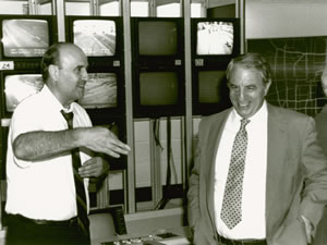
Traffic management center in the Twin Cities. Image from Minnesota DOT

The most advanced systems of traffic lights are coordinated control systems that utilize computers to enable motorists on major thoroughfares to travel miles without encountering lights by adjusting for predicted speed or, in the most advanced systems, average speed as detected by numerous embedded sensors. These systems “signal the dream of the liberal state ... They work best when no one notices them, and when regulation becomes cooperation and facilitation”[Pile, 263]. One subset of such systems are centrally controlled systems (as made famous by the original Italian Job) where data and video are directed to command centers that control entire street networks throughout the city.
While refinements continue to advance the technology of traffic signalling, safety has not improved. More than three decades after the adoption of the traffic light there were still over ten traffic fatalities for every murder [Ross, 231] and this gap continued to widen, despite safer automotive design. Traffic signals are rendered unsafe by human psychology. Traffic light systems “make drivers go fast and keep close behind to the vehicle in front for fear of missing the green light” and furthermore cause drivers to cross intersections “with their eyes up in the air rather than on the road” [Todd, 11] The coordinated control systems previously discussed can actually encourage reckless driving by causing “drivers [to] use excessive speed in order to ‘make’ as many lights as possible” [Wikipedia, 10]. Additionally such systems have become the norm and are frequently demanded by residents leading to the chronic under-funding of local transportation agencies. In a recent survey “68 percent said they have... no documented management plan for their traffic signal operation” [U.S. Traffic Signals get Poor Grades, 1] resulting in the typically poor calibration of signals.


Traffic lights also contribute to more dangerous streets by altering the psychological and sociological relationships of drivers to their surroundings. The traffic light is responsible in large part for an abnormal conditioning of motorists. Traffic lights alter the standard control relationships seen in society for, once the visible police officer is replaced by the unseeing mechanical device, the “guilt and ... recognition of the gap between our actions and those of the ideal citizen” [Pile, 263] is lessened by proxy. This condition has recently given rise to the use of red-light cameras to remind motorists that traffic lights have all the authority and power of a live police officer. Another, more dangerous, conditioning resulting from acclamation to traffic lights is complacency. Drivers develop expectations for operating within the current system and that deprives them of the necessity to be aware.


"Playing in Traffic" by Geognerd on Flickr

It is assumed that merely following the rules should keep them safe. Of course when externalities inevitably arise drivers are ill-prepared to adapt.

Malfunctioning traffic light causes mayhem in Russia.

This complacency can be seen in the vast rise of alternative motoring activities such as grooming, eating, and cellular phone use while driving. While these behaviors are a result of expectations conditioned by the system, another problem lies in the conditioning of actions. In those rare occasions, such as power failures, when drivers must actively negotiate passage they are not confident in their abilities to physically negotiate and communicate with other drivers.


A second problematic result of modern traffic control should be plainly evident to anyone who has walked, cycled or run on public streets: The controlled situation of driving has resulted in a systemic aggrandizement of the driver over other forms of transportation. Modern right-of-way rules, one-way streets and traffic lights encourage “motorists to travel at high speed on urban arterial roads and intersections without looking for opposing traffic” [Todd, 11]. The physical and often psychological separation of thoroughfares into vehicular roads and pedestrian walkways or bicycle paths has caused the “driver to see that he or she has priority. And the child who forgets for a moment ... is a child in the wrong place” [Baker 2004, 2]. The conditioning leads to inadvertent or intentional arrogance on the part of drivers and, at its worst, is manifested in the much discussed phenomena of road rage.


The aggrandizement of the driver is mirrored in society at large as illegal traffic acts are “not stigmatized by the public as criminal” [Ross, 241] except in extreme cases of negligence and the majority of traffic crimes receive much more lenient sentencing than other categories such as drug or weapons offences. This situation has been examined through a Marxist lens by some who observe that because “the law is made and operated in the interests of the well-to-do,” then driving offenses such as speeding “are not ordinarily thought to ‘count’ as crimes” [Ross, 235].


In part III I will examine alternatives to structured traffic control and theorize an urbanism without stoplights.


Works Cited:

1. Baker, Linda. “Why Don’t We Do It in the Road?” 25 October 2007. Salon.com. .

2. Fogelson, Robert M. Downtown: Its Rise and Fall, 1880-1950. New Haven, Connecticut: Yale University Press, 2001. p, 253

3. “Report: U.S. Traffic Signals Get Poor Grades”. 25 October 2007. MSNBC.com. .

4. Ross, H. Lawrence. "Traffic Law Violation: A Folk Crime." Social Problems, Vol. 8. 1960-1961: 231-241.

5. Todd, Kenneth. “Traffic Control: An Exercise in Self-Doubt.” Regulation. Fall 2004: 10.

6. “Traffic Light”. 10 October 2007. Wikipedia. .

7. City A-Z: Urban Fragments. Ed. Steve Pile and Nigel Thrift. New York: Routledge, 2000. p. 263.

So many shades of green (or how to get the green)


Avenida Luis Xavier, Curitiba Brazil by Mathieu Struck

Well, it is officially summer again and that means it is time for an annual ritual. No, not Naked Hiking Day which was notable this year for the supposed attendance of one governor. Rather, this week marks the onslaught of numerous new rankings of sustainable cities. While sustainability remains a term that, in its complexity, allows for astonishingly broad leeway, lists of sustainable cities even exceed that flexibility. While metrics for ranking sustainable cities may range from personal indoctrination to more objective analysis, there are of course a number of common finalists.

MotherNature Network listed their Top 10 Green US Cities today:

1. Portland, Oregon
2. San Francisco, California
3. Boston, Massachusetts
4. Oakland, California
5. Eugene, Oregon
6. Cambridge, Massachusetts
7. Berkeley, California
8. Seattle, Washington
9. Chicago, Illinois
10. Austin, Texas


On June 17th Treehugger listed their picks for 5 of the Greenest Cities in the World to Visit

1. Portland, Oregon
2. Freiburg, Germany
3. Zermatt, Switzerland
4. Montreal, Quebec, Canada
5. Austin, Texas, USA


While comparing an international green travel list to a national green city list is strictly a chronologically motivated artifice (much like apples and oranges or electric and diesel locomotives) certain commonalities are striking. The majority of the cities on the list are home to institutes of research and higher education which provide both a foundation for diverse and advanced economies. The majority of cities on the list are located on navigable bodies of water that may again serve in the future as thoroughfares for freight and goods. The majority of cities have carefully balanced bold political decisions, such as banning automobiles or plastic bags, with bold economic decisions such as the creation of large-scale alternative energy generation. These cities have also thoroughly embraced low-tech solutions such as tree planting and public composting. All cities on the list have championed transportation flexibility by facilitating widespread bicycling, developing walkability, and supporting public transportation.

The single most striking element shared by the majority of cities on the list was an educational component. While the majority of cities on the list exhibit higher than average socio-economic and educational statuses, such programs could prove even more vital for more average cities. An educated public is the cornerstone of sustainability. Without an understanding of the economic and environmental results of current lifestyles and an appreciation of the long term effects on the community any recycling program is doomed to fail. Furthermore, without education and appreciation of sustainable measures, even citizen-initiated progressive efforts are doomed to fail.

Another interesting point is that we must judge sustainability through the lens of cities. While there are dozens of lists of top "sustainable" or "green" cities there are virtually none for states, provinces or countries. This is especially interesting given the tenuous stance of cities in the United States. While Europe and Africa have strong traditions of city states (Venice and Carthage come to mind) cities have no legal basis within the U.S. Constitution. Rather the American city exists solely as a subunit of state government. Despite this subservient status, in the United States and in countries throughout the world, the city unit has played the primary role in the struggle for urban sustainability. While city administrations typically lack the technical proficiency and ability of bureaucrats at higher levels and often make corrupt and shortsighted decisions that impair future efforts, their smaller size typically makes them more responsive and often allows for greater flexibility in decision making than higher forms of government.

The downside to the primary role of the city in sustainability is increasingly uncoordinated and cutthroat competition for green sector industries. As the carbon clock ticks, cities must keep themselves ahead of the curve in order to attract skilled residents and create new jobs. Cities will benefit from investment programs in existing industries as well; for every million dollars invested in retrofitting infrastructure and increasing existing energy efficiency, 22 new jobs are created. Furthermore, European companies like Siemens have capitalized on the slow response of United States industry towards sustainable products and stand to gain billions from world-wide bailout programs. A century ago the majority of light-rail infrastructure in the United States was manufactured by companies like the St. Louis Car Company .
St. Louis Car Company circa 1908

Today even the Metrolink trains operated in St. Louis are manufactured by Siemens. Since 1982 all new subway cars ordered for our nation's capitol have been manufactured overseas. While this phenomena is endemic across all industries, it points to a huge opportunity for American cities who are seeking to center their economic growth on sustainability. Many of the cities on the list above rank highly only because they have outsourced most of their manufacturing to India and China. Despite greening claims and endless restricted bike lanes no city can remain sustainable or think of self-sufficiency without an industrial base. Anything else will be a missed opportunity. The challenge assumed by the leading cities of the twenty first century is the balance of clean industry with waste remediation. After all, innovation is the foundation of sustainability and, while important, planting trees and recycling cans can only take you so far.

Open Season


Note:
Throughout the brief history of this blog I strove to make the content as universal as possible. While I understand the gravitas that place-specific writing can imbue I had preferred to leave specific local issues to other bloggers.

That time has ended. I feel I must comment on the rapidly changing situation in North Saint Louis.


While the situation is covered thoroughly at Ecology of Absence and Built St. Louis I will summarize the situation. Additionally, a two year old primer on the situation can be found here.


A private developer working secretly through many shell companies has acquired 1,080 parcels throughout five neighborhoods over the past half decade. The parcels, once acquired, have been left unsecured leading to crime, collapse, and the particular plague of Saint Louis: brick rustling. Soon after the scale of the acquisitions became public knowledge due to the vital efforts of residents Michael Allen, Barbara Manzara and others, a lawyer working for the prominent developer linked to the companies involved drafted the Missouri Distressed Land Assemblage Tax Credit. Due to the sheer scale required to qualify the legislation was widely understood to be a tax handout to one specific developer. That developer? The intensely connected Paul McKee Jr. (chairman of the board for Barnes Jewish hospital and major diocesan fundraiser) who in the post-secrecy period is restyling himself as a community builder.


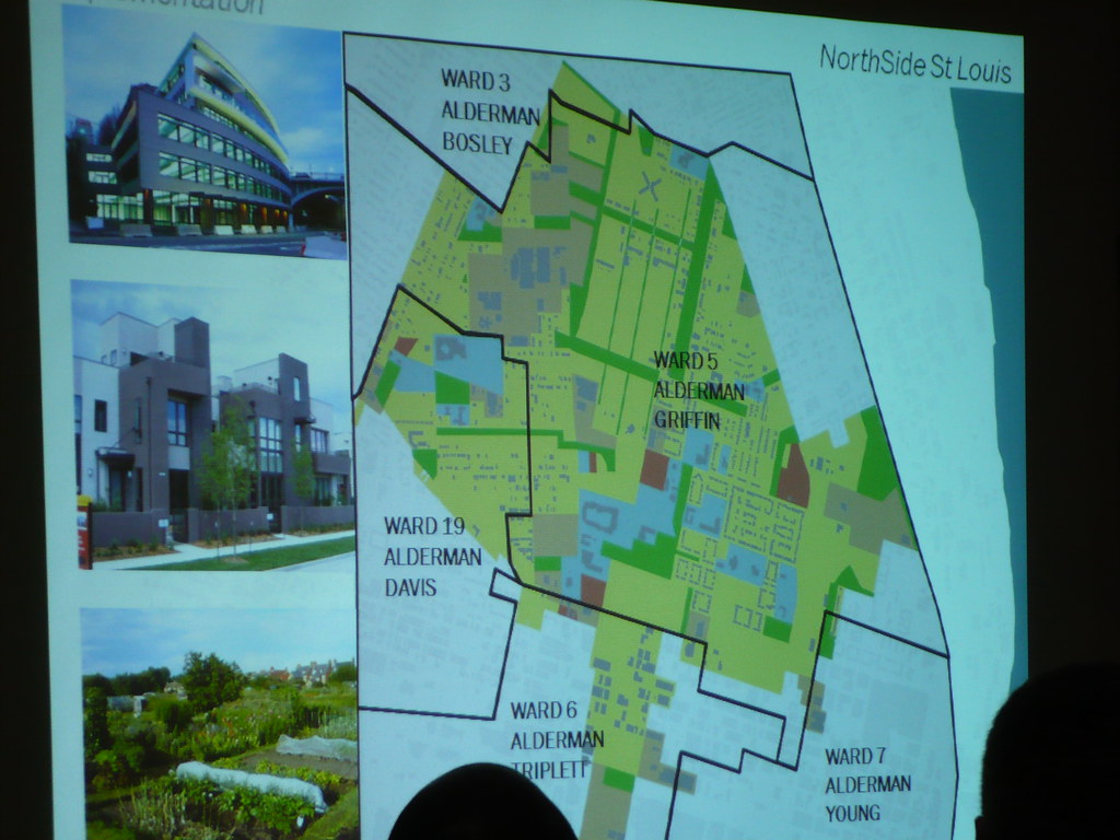
This week we have seen for the first time the "plan" for the redevelopment.

Perhaps more interesting have been the backflips by the formerly critical sources who are now rushing to support the NorthSide plan in a vacuum of detail, leadership, and common sense. (Most notable is one realtor-turned urban crusader eager to burnish his unaccredited planning degree to defend what appears to be yet another rehash of mid-century planning hubris.)

In the spirit of debate I will address my comments on the plan to the aforementioned blogger.


While I was earning my Masters degree in Urban Design (many people have one or more masters degrees these days) a defining moment came in studio while working on projects directly addressing post-Katrina New Orleans. We presented our master plans to our professor only to be told that what we had developed was not a master plan. We created transportation plans, zoning plans, land-use plans, environmental plans, asset retention plans, and yet still we were rebuked for lacking a master plan. It was only at the end of the process that our professor told us to bind dozens of these plans together. This, finally, we learned was a modern master plan.


This is exactly my problem with what has come from McEagle/McKee. There is no unified vision and, despite the oft-repeated expenditure of $46 million, nothing presented has transcended the level of the vaguest diagram. The reductionism of these plans coupled with the unfathomable hubris of the developer and the smugness of the political elite make one feel like it is the 1950's all over again. While this type of proposal has been history in most successful cities for decades, the combination of political ineptitude and corruption with an uninformed and disengaged public has made Saint Louis fertile ground for the swindling of the century.

The era that gave us Pruitt-Igoe indelibly changed the city and in reaction it changed the planning profession. As it became evident that massive public investiture coupled with reductive processes begat ever more striking failures, planners embraced pluralism. As Paul Davidoff wrote [in 1965!]
"Lively political dispute aided by plural plans could do much to improve the level of rationality in the process of preparing the public plan. "

In comparison with the type of planning Davidoff initiated every step of this process has been proprietary and no alternatives have or will ever be considered in an appropriate public forum. The illusion of input has been used, but instead of reshaping planning such comments have been used to redirect rhetoric and develop spin.

Davidoff also states that improved planning would come by
"forcing the public agency [Read: The private developer] to compete with other planning groups to win political support. In the absence of opposition or alternative plans presented by interest groups the public agencies [or private developer in a planning vacuum] have had little incentive to improve the quality of their work..."

The problem with the NorthSide process has been the complacent submission of government at all stages of the project. At this point the McKee coalition needs only ceremonial approval from the government for the project. The city government of Saint Louis has been delegating planning authority to private entities for a half century [it must be noted that this half century saw a precipitous decline in the tax base, population and prestige of St. Louis] and in this case the private entity was able to not only flaunt existing laws with impunity, but to create new legislation for its express benefit.


Finally, the financial end of the project is troubling for several reasons. The development area is staggering in its size and I believe there to be no possibility of funding the entire project. My supposition is born out by the admission by McKee himself that the third of three TIF-financed focus areas will not receive any developer funding at all.

In essence that means that Tax Increment Financing will be awarded for a development that may or may not happen in the future with no commitments whatsoever. The potential for redevelopment for the hundred or so blocks that fall between these questionably-financed focus areas is anyone's guess. The fate of these areas is all the more concerning given that McKee "doesn't do housing" and if anything happens they will be farmed out to suburban homebuilders like McBride Homes. With the combination of TIF financing and the Distressed Land Assemblage Tax Credit we taxpayers are asked to short the tax bases of the City of St. Louis and the State of Missouri a considerable amount. In addition we must build infrastructure and essentially donate city property to a private developer who may or may not actually develop the improved land he holds based on "market conditions". Absent any development he will surely allow his properties to fall further into decay.

Most troubling is that other developers are trying to play this game too. Since last fall another anonymous company has acquired 225 parcels throughout neighborhoods to the north and west of the McKee holdings. This company [Urban Assets] has connections to McKee's acquisition agent Harvey Noble. The question remains: is this more McKee purchasing or is an all out war beginning?

The real question is whether St. Louis is capable of saving itself... or is it too late already?
66 square miles. 800 blocks gone already. 52nd most important city. How much more can we allow ourselves to fail?

Stoplight Urbanism Pt. I


Many of the interventions that have most radically reconfigured the urban environment are also those which paradoxically have evaded examination and refinement through their ubiquity. On a walk or drive through the city recent interventions such as parking meters, traffic lights, signage and one-way streets remain out of mind due to their prosaic and common nature. While some degree of control is of course necessary, there has been little inquiry into the effects of the present systems and into the possibilities that exist beyond the current reality. The following series of writings on the traffic light seek to detail its history, to examine its effect on social life, and to explore alternatives to the automated device. While almost any such element in the city could have been chosen, the traffic light poses an intriguing subject at the confluence of philosophies of control, technologic determination, and modernization.


For millenia movement through cities and villages was regulated by mutual interest and rooted in a notion of common-law that began to be restricted with the enclosure movements of the eighteenth and early nineteenth centuries. Under such a system no traveller had a superior right over another; no person or vehicle had dominance and all spatial claims to the space of the road were recognized to have equal value. Such informal systems did not end with the enclosure movement or industrial revolution, they continued decades into the early twentieth century.

While in many western countries the establishment of the primacy of the automobile led to a drastic shift in custom and space, in developing nations the assimilation of motorized transportation in society has been unable to change customs regarding road use. In this regard, Stanford Gregory’s comparison of the informal driving practices of Egyptians with the linguistics of pidgin languages is fascinating. As a modern western observer, Gregory paints the typical first impression of chaos but is able to “discern an order in the madness,” which he believes is clearly emblematic of “social interaction at a fever pitch” [Gregory, 337]. Such intense systems of concession, predicated in intense interaction, result in the ability to change formation instantaneously and avoid obstacles and stoppages as they occur. These fluid dynamics utilize the whole of human reaction and intellect and exhibit a complex relation of communication and instinct not present in the smartest mechanical control.

In the developed world the industrial revolution initiated an era of technological determinism in which centuries of developments in civilization were rejected or radically reconfigured by an increasing reliance on totalizing rationalism and a preoccupation with efficiency through mechanical means. The technological pace of development was far faster than ever seen in human history. As a result of this pace, nothing other than the easily quantifiable instantaneous result was considered to have value. In the face of the accepted perfection of the machine, humans, especially those of lesser breeding and education, were considered to have little value.

The first traffic signal in human history was installed on December 10th 1868, outside the Houses of Parliament in London. The signals were intended to protect Members of Parliament crossing the busy street. They also helped to afford them a degree of separation from those whose interests they ostensibly represented. Like many traffic control devices, it had its lineage in railroads, who had been using semaphores for several decades. The London signal was a combination of a standard railroad semaphore arms and gas warning lamps but was not automatically controlled. The signal acted as a mechanical appendage of the constable who stood on the traffic island by telegraphing his orders to the mass of carriages, carts, and pedestrians. The signal was a technological aid but not a technological determinant. The London Signal was also an epitomization of the uneasy relationship between human and technological control: less than a month after the signal was installed the gas lamps exploded injuring the police officer “who had thought he was in control” [Pile and Thrift, 262]
and the age of the machine in traffic control had begun.

To be continued in Part II.

Works Cited

1. Gregory Jr, Stanford W. “Auto Traffic in Egypt as a Verdant Grammar.” Social
Psychology Quarterly, Vol. 48, No.4. 1985: 337.

2. City A-Z. Ed. Steve Pile and Nigel Thrift. New York: Routledge, 2000. p. 262.