Showing posts with label transportation. Show all posts

Walkscore Gains Full Transit Operability


WalkScore.com, the mapping website devoted to walkability, rolled out full integration of transit this morning. A search on WalkScore now results in the following screen.

The new TransitScore algorithm is based on three major parameters:
1. How close are you to transit (distance)
2. How readily available is it? (frequency)
3. Can it get to where I need to go? (this is the hard one)

While the first two criteria can be easily satisfied with existing geolocation and open transit data, the third parameter is hardest to quantify. The solution at the heart of TransitScore is to analyze the number of transit options within a half mile radius, the frequency of service, and the total number of businesses accessible by those lines (including calculating WalkScore at all stops along the route). For a discussion of the complete algorithm click here.

While the combination of these factors works well at a base level, ideally the TransitScore would depend on your destination. For example, if you live in a dense, walkable area that is well-served by transit, but those transit lines fan out into a low-density and under-served region, then the resulting transit score would be lower than a similar area with lines only extending into a mid or high density area. Furthermore, what if you live at the top of a steep hill or mountain and all the transit options are at the bottom? Geolocation would still indicate a high transit score.

WalkScore has anticipated this problem with a second new feature: WalkScore Commute. Accessible from the "Commute" tab on the results page this feature lets you use your starting point and specify an end point. The destination could be a job location or any other destination for that matter. The result gives a map with walking, cycling, driving, and transit durations (a la google maps) and an elevation graph such as that used by Veloroutes.org for several years.
Interestingly, given that the start point and end point are finalized, the commute function does not give a definitive walk or transit score. Since the algorithm is compromised by the aforementioned limitations, it seems that the lack of a Commute TransitScore/WalkScore is a missed opportunity.

In any case, the inclusion of full transit analyses into WalkScore is a major improvement. Since its inception WalkScore has caught the eye of the media and has become an essential instrument for emphasizing the power of walkability in the real estate market (pdf link). With the greying of the baby boomer generation, the importance of walkability cannot be understated and the importance of quantifying walkability has been recognized by the Robert Wood Johnson Foundation.

So where do we go from here? WalkScore is enabling web developers to embed maps, access data, and use their API. It is my hope that this move will make walkability as ubiquitous as Google Maps has made geographic data. In the near future WalkScore will be releasing open source code for their algorithm. It is my hope that this action will drive programmers to develop the next generation of wayfinding that will not only give you options for modes of travel, but incorporate externalities and facilitate spur-of-the moment side trips via mobile application. Since many people do not currently use transit due to its complexity, the seamless integration of WalkScore with mapping software and social wayfinding services such as Foursquare and Yelp has the potential to drive a large increase in ridership. Such a sea change will have the related effect of moving walkability from the realm of theory and analysis and into everyday life.

Saint Louis: More Progressive than Denver?*


* For the time-being anyway.

Many times, when dealing with intractable problems it is impossible to resist succumbing to the grass-is-greener approach. In Saint Louis, during conversations with a wide array of advocates and transit professionals, the comparison to Denver is inevitable: "if we had a transit district like Denver", "Denver can expend that much per capita of transit because of their political situation", or simply "St. Louis is not Denver". I have always felt that this class of statement exist solely to obviate the responsibility for a lack of progress. Resignedness to the status quo is a protective mechanism for those who have tried and failed.

Who would have thought three months ago that someone in Denver might be saying "if only we had the political courage to support transit like Saint Louis"?

Today Yonah Freemark broke news that transit leader Denver has scuttled plans to approach voters in its Regional Transit District for a sales tax increase. It appears that in the current economy, with heightened pressure from the Tea Party and anti-tax crowd and falling revenue from existing taxes Denver politicians would not risk even putting a sales tax increase in front of the voters. This decision will substantially postpone the completion of the 122 miles FasTracks expansion plan until after 2042. As you might remember, the St. Louis region passed a sales tax increase last week. What can we take away from the situation in Denver?
1. Sales taxes should not form the financial foundation of something as critical as a transit system.
I am inclined to share this view with zealous anti-government critics. As regressive taxes, sales taxes and are extremely vulnerable to economic instability. While there is no golden bullet, relying on sales taxes is dangerous. Other options are not much better: income taxes would be difficult to justify given that those who would contribute the most typically use the system the least, and property taxes place the burden solely on landowners. State appropriations vary based on the political breeze and uneducated rural legislators can easily hold urban areas hostage.

If transit plays as vital role in regional economies as the supporters of Prop M claim, then the least bad single tax option might be a corporate earning tax solely devoted to the development of economic infrastructure and, specifically, transit.

2. Regional Transit Districts are not a panacea for funding troubles.
At a recent City Affair panel discussion the executive director of Citizens for Modern Transit seemed to indicate that the establishment of a bi-state regional transportation district would solve Metro's perennial financial woes. Denver now proves that my skepticism was founded. Casting a broader net adds some stability, but a broader geographic area of support does not change the fundamental unsustainability of the system.
The ideal revenue stream should combine a mix federal grants [new infrastructure] with corporate taxes [for operations], and sales and income taxes [for citizen buy-in].

Only when a balanced funding mechanism is in place for the region can a transit district be successful.

3. Transit organizations have a greater onus to be responsible and transparent in decision-making and operations than charitable organizations .
A commenter to the story condenses the anticipated public opposition to a .4% sales tax increase:

"Nobody trusts the RTD ... The former head got $3 million in compensation ... There's no oversight ... The proposed expansions don't make sense."


These comments should be eerily familiar to anyone following the coverage in Saint Louis. Whether these reactions are the result of true problems or a post-rationalization based on antagonism to transit, it is clear that the RTD must do a better job explaining itself to the public. While Metro in Saint Louis has made great progress in this regard, it cannot afford to rest either.

As Freemark writes:

Denver could learn a lesson or two from its Midwestern peer [Saint Louis]: A bad economy does not improve anyone’s mobility, nor does it eliminate voter hopes for the future of their region. Deciding not to hold a vote this year amounts to giving up on FasTracks’ quick completion without even trying to save it.

Saint Louis: the quiet dawn of regionalism?


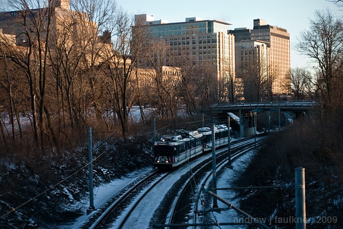
A view of the future?
A View of the Future? Image by Andrew J. Faulkner.

St. Louis County approves Proposition A for increased funding of the Metro system by a 62.91% majority


"This is not a political issue," said Metro President and Chief Executive Robert Baer. "This was a matter of the whole region coming together — the north, south, central, west."
-- St. Louis Post-Dispatch.

While the passage of Proposition A, a ½-cent sales tax in St. Louis County, is certainly a testament to the tireless efforts of transit campaigners and the effort Metro has put into recuperating its image, the important story here is the hopeful emergence of a new regional consciousness.

The St. Louis region has long been plagued by intense political fragmentation, and the saga of Metro funding reflects this situation. Unlike cities such as Denver, Saint Louis has not been able to enact a Transportation District to provide funding for operations. Rather, in a state that ranks 35th in transit funding, Metro was forced to turn to the relatively unsustainable method of sales taxes to generate operating revenue. Hamstrung by local political realities, Metro was forced to win separate referendums in both the independent city of St. Louis and in St. Louis County. While St. Louis city passed their ¼-cent in 1998, it took three referendums for the county to pass the other part. The situation of Metro was made more dire by the 1998 loss of $22 million in federal funds with the federal change from operations to capital funding, and the 2008 decision by St. Louis county to change the transit/road tax percentage from 63%/37% to 50%/50%. Throughout this time period, the county rejected sales tax referendums twice.

This year has been different. The coalition supporting Proposition M included John Nations -- the mayor of the municipality synonymous with the perceived values of St. Louis county. Yet Nations has realized what many others have failed to. St. Louis county is now fully developed and greenfield development is far outside its ambit. While disconnection from Saint Louis city benefited the County's edge cities twenty years ago, those aging municipalities must now rely on their infrastructure for competitive advantage. Without connectivity, the municipalities of St. Louis County will not be able to avoid becoming the victim of the same job migration to far-flung greenfield development that created them in the first place. This Metro vote marks the first noteworthy step towards regional functionality; hopefully some day April 6, 2010 will be understood as the first corrective to a much closer vote that happened on August 22, 1876.

With the emergence of spring in the past week, I cannot help but cast the current situation in terms of Luke 8:5-8. St. Louis County is the seed on rocky ground; if it doesn't put down roots it will wither. County residents chose to disregard the divisive arguments of a few and to establish the roots of a new growth. Hopefully it will be the first of a long series of such changes.

STL: Catch the tale of the TIGER!


A recent op-ed in the Boston Globe by the previously mentioned economist Edward Glaeser outlines the pervasive anti-urban bias in federal stimulus funding.

In 2009, America’s five least dense states were awarded $1,100 per capita in federal recovery grants while the five densest states, including Massachusetts, got $561 per capita. President Obama can change the tilt toward low density. The most urban president since Teddy Roosevelt, Obama needs to fight for cities, not just as a matter of justice, but because cities, and the creativity that comes when humans connect and learn from each other in dense areas, are the best hope for the country.

While Glaeser's Roosevelt assessment is mildly dubious, his summation of funding distribution has been accurate and reflects a lack of organization and coordinated voice on behalf of urban constituents. While it was once easy to overlook the stereotyped urban minorities in the age of cheap oil, in the next fifty years increasingly interrelated energy and economic constraints will increase the profile of urban areas and tilt this balance back towards urban issues. A country strapped for resources simply cannot continue dissipating funding over vast swaths of land for negligible economic gain; whether by hook or by crook, funding will be concentrated in defined areas to maximize investment.

While the 2009 statistics reflect conventional subsidization, there is an emerging shift in pattern that indicates that federal departments understand the allocation dilemma. The recent announcement of the 2010 recipients of the TIGER (Transportation Investment Generating Economic Recovery) Grants reveal the changing landscape of government subsidy. Of the top 20 largest grants (ranging from $105 million to $25 million):

FIVE went to Passenger rail and light rail stations and infrastructure
FIVE went to streetcar/express and bus rapid transit projects
FOUR went to complete streets/streetscape Improvements
THREE went to freight rail infrastructure improvements
THREE went to highway redesign/construction


TIGER Appropriation. Image by Rob Vargas/Fast Company.

The city of Saint Louis was passed over for five submitted projects.

The Delmar Loop streetcar (previously discussed here) lacked the distance, development impact, and matching funding promised by the Tucson Streetcar.

The applications for unnamed Chouteau Lake improvements and the rebuilt 22nd street 64/40 interchange were long-shot submittals to bolster long-term speculative projects that could not meet the "livability" paradigm.

Another proposal was for the addition of truck-only lanes on Interstate 70 . Wisely, federal TIGER stimulus was not used on a twentieth century project designed to support the unsustainable "rolling warehouse" supply model.

The final application for TIGER funds was for a dense mixed-use Transit Oriented Development at the Forest Park/DeBaliviere Metrolink station. In this case, the TIGER funding was to extend the development through the acquisition of an adjacent strip mall. While it is impossible to pontificate on what the grant reviewers were thinking, the relatively small scale of this project in comparison to other submissions probably contributed to its unfavorable review.

What can we learn from our failure?
1. Planning cannot be done in a vacuum and projects must be coordinated.
The projects that are now being subsidized are large scale and increase their impact by coordinating development focus across multiple areas.

2. Traditional projects no longer cut it.
To be successful all projects must promote alternatives to the automobile paradigm. One of the criteria of evaluation was “enhancing community livability” and the results seem to have balanced the priority for public transportation to enable automotive dependance and the physical infrastructure that creates complete and walkable streets.

3. Pay attention to your residents
Over 25% of Saint Louis residents do not even own a car, let alone use a car frequently, yet 60% of our most innovative public projects require automobile usage for access and benefit. Is this a responsible vision or the result of responsible oversight and governance?

We must start developing for the approximately 8,900 residents who have no car at all, for thousands more who struggle to afford one, and for those of us who prioritize neighborhoods where you don't need a car to live. Weaning our urban areas from automotive dependance will secure our civic futures. Not only will we be healthier, but a recent report notes that we will be wealthier as well. In the report, Walking the Walk: How Walkability Raises Housing Values in U.S. Cities, Joseph Cortright describes a direct correlation between walkability and value:

In the typical metropolitan area, a one-point increase in Walk Score was associated with an increase in value ranging from $700 to $3,000 depending on the market. The gains were larger in denser, urban areas like Chicago and San Francisco and smaller in less dense markets like Tucson and Fresno.

"These findings are significant for policy makers,” said Carol Coletta, President and CEO of CEOs for Cities, which commissioned the research. “They tell us that if urban leaders are intentional about developing and redeveloping their cities to make them more walkable, it will not only enhance the local tax base but will also contribute to individual wealth by increasing the value of what is, for most people, their biggest asset."

A new round of TIGER Grant is on the horizon. Will we forge intergovernmental partnerships to create coordinated projects that increase walkable streets, enable Transit Oriented Development, and expand a resilient multi-modal infrastructure to support commerce and industry?

The stakes are high and every round we lose puts our metropolitan competition further ahead of us.

A view of the future?
A View of the Future? Image by Andrew J. Faulkner.

Of course, any amount of Transit Oriented Development will be meaningless if we allow our public transportation system to be crippled. If you or your family and friends are a registered voter in Saint Louis County Support Proposition A in April.

City and River Pt. II: TEAR DOWN THIS WALL!


This is Part II of a series advocating for the reconnection of Saint Louis and the Mississippi River.

I have already examined the importance of the Mississippi River to the identity of the City of Saint Louis. But why is this historical identity important?

Identity is important because it is the one inducement Saint Louis currently has to attract new residents.

For its first two centuries Saint Louis has relied on its major transportation routes and geographic location as an economic inducement. With the rise of globalization, this will not suffice. As globalized trade decimated the manufacturing lifeblood of the city, governmental focus turned to finance and technology in order to attract well educated residents and maintain tax bases. However, the digital revolution of the past two decades has broken the location-based restraints for this significant segment of the population. Before this time period you had to live in some proximity to your job; now you can work anywhere a suitable communications infrastructure and well-connected airport exists.

If you could live anywhere in the world, why would you live in Saint Louis?
We must develop a compelling answer to this question to survive, but given the rate of out-migration of our graduates we have not.

The increased level of competition evident in this century is problematic because, as economist Edward Glaeser understands from studying Boston, the "ability [of a city] to regenerate itself is hinged upon its ability to attract residents, not just firms." In short, a reserve of talent is necessary given the increasing vicissitudes of the economy because skilled and educated workers can react more quickly to massive change and prevent urban decay.

If there is one strategy Saint Louis must embrace, it must take strong action to attract and induce new residents to move here. While policy and subsidy may prove effective, we must overcome an overwhelmingly negative national image first. Until recently, the city has focused on strategies of beautification and tourism promotion rather than creating vibrant livable communities. Over twenty years ago reporter William Allman assessed his native city:

“Coming back to St. Louis after many years ... the city’s surface has changed considerably...
[T]hese changes, while putting a shine on the old city, are merely cosmetic. The downtown areas seemed designed primarily for tourists”.
Allman, William F. “St. Louis” U.S. News & World Report, vol. 107. December 18, 1989: p.49-50. As quoted in Beauregard, Robert A. Voices of Decline. p. 222


While this mentality is still present in the city, (one snarky commentator described the visionary implementation of City Garden as "putting lipstick on a pig") the influx of 3,800 new residents downtown in the past decade (a 40% increase) marks a turning point for the city. With a modest residential population downtown and amenities beginning to develop, a bold, unifying stroke is still needed.

As I discussed in part I, the riverfront provides the authenticity and ability to attract residents by differentiating Saint Louis from numerous other competing cities. In addition, the reconnection of city and river has the potential to create an unrivaled amenity by serving as a hinge between the revitalized urban space of Gateway Mall with the Arch grounds/riverfront and the regional Great River Ring beyond. The imperative for connection in this area has been in the news for several years as a result of the Danforth Foundation's plan for a three block lid over the depressed lanes of I-70.


The 3 Block Lid would not change the miserable condition under the elevated lanes of I-70. Image by City to River.

While the lid concept is appealing, it is a band-aid solution to a much larger problem. Lids require expensive retrofitting and engineering and entail increased inspection and maintenance. The lid concept should only be used as a last resort. When we examine the use of I-70 alongside with the plans for the New Mississippi River Bridge, better alternatives present themselves.


New highway routings planned for the new Mississippi River Bridge. Image by Andrew Faulkner/City to River.

An examination of the bridge plans reveals that a four lane interstate will be constructed to carry I-70 from the junction of I-70/I-64/I-44/US-40 at St. Clair Avenue in East Saint Louis. From there a new 4 lane roadway designated I-70 will travel north in parallel with Illinois route 3, cross the new bridge and rejoin the current routing of I-70 around Cass Ave. This routing makes eminent sense as the new corridor will have the potential for eventual expansion to 6 lanes.

With the opening of the bridge, the downtown lanes will become a spur connector and duplicate the linkage of eastbound I-44 with westbound I-70. According to MODOT the downtown lanes are one of the least travelled sections of interstate in the Saint Louis area. Currently the majority of the 73,000 vehicles per day in this section is traveling through Saint Louis to points west. With the rerouting of I-70 it is probable that that amount of traffic could be reduced by greater than 50%.

Given the imminent reduction of traffic on the depressed and elevated segments of I-70, is their contribution worth the depressing effect they have on acres of surrounding property? What could we do instead of maintaining an obsolete eyesore?

We could demolish this section and replace it with an urban boulevard. With synchronized traffic lights, boulevards in many cities throughout the country carry in excess of 40,000 vehicles a day without problems.


Replacing the existing I-70 and Memorial Drive configuration would free land for new development. Image by Andrew Faulkner/City to River.

A boulevard would also be cheaper than the lid concept. The depressed lanes currently feature five bridges and a half mile of elevated viaduct that require annual maintenance. While a boulevard would also require maintenance, it would not be as expensive as the elevated and depressed lanes. Furthermore, the removal of I-70 opens up the potential for revenue generation through new development. Currently, the transportation corridor consists of 4-8 traffic lanes and four interstate lanes that add up to between 200 and 250 feet in width. A sufficient boulevard designed to carry the predicted traffic in this area would only need to be 6 lanes and would only use 70 feet of width (or 90 if it included on-street parking). That would free between 110 and 180 feet per block for 19 blocks. That would create 16 acres of government-owned developable land in a prime location to sell or lease, and this could be used to pay for highway demolition and offset the cost of building the boulevard.


Reopening Our Front Door: Washington Avenue and Memorial Drive. Image by Jeremy Clagett/City to River.

The transformative power of demolishing a highway to reconnect the city and river cannot be ignored either. While Saint Louis is gaining momentum towards walkability, simultaneously reopening our front door to the river and creating an urban and walkable spine downtown will send a message to the region and the nation that this city has finally learned from our mistakes.

The construction of the Ronald Wilson Reagan Mississippi River Bridge and the demolition of the obsolete lanes of I-70 for a more walkable alternative will position our city for a more vibrant and sustainable future. We must take action for the future of the city and

TEAR DOWN THIS WALL!!


Saint Louis: City and River Pt. I


Saint Louis has had a difficult relationship with the Mississippi River through most of its existence. Obviously, the city owes its location to a sizable bluff in proximity to the confluence of two of the largest rivers on the continent and its storied history to the trade generated by its location. The riverfront was a center for economic activity and a melting pot for many distinct races and ethnicities and a stage for some of Saint Louis's greatest figures. Over time the riverfront became a center of civic identity to the extent that created events like the Veiled Prophet Parade were deliberately intertwined with the setting of the river.


Saint Louis once opened its front door to the river. (1907 aerial view)

The importance of the river began to falter as the city was eclipsed by the rail capital of Chicago. The losing battle for dominance engendered desperation and bold proposals throughout the 20th century. While the clearance of 40 blocks of irreplaceable 19th century cast-iron architecture for the construction Gateway Arch and Jefferson National Expansion Monument was, in the end an even trade, many other decisions were shortsighted at the least.


The demolition of an intact 19th century riverfront in 1940 made way for the arch

Certainly, Saint Louis wasn't alone in undertaking such grand plans. What sets Saint Louis apart was the early date at which it started and the massive scale of operation. As an efficient labor force combined with federal incentives in the postwar period, demolitions for interstate corridors, slum clearance for industry, and the development of massive public housing projects eviscerated the city. By the 1980's over 800 blocks of urban fabric had been erased -- almost 11% of the total land area of the city. The mid-century desire to reinvent the city coincided with the implementation of the The Federal-Aid Highway Act of 1956. While interstates were originally conceived to skirt cities and connect to existing boulevard and parkway networks, powerful interests in the city demanded direct access to lure development. As David J. Masenten writes in his excellent thesis, optimism prevailed and "few thought these elevated expressways would have a serious detrimental effect on the cities they served." This was the case in downtown Saint Louis, where the effort to create a bold new connection between city and river was cut off by the construction of depressed and elevated lanes of Interstate 70.


Interstate 70 blockaded the front door of Saint Louis for half a century.

The existence of Interstate 70 prevented Dan Kiley's masterful landscape from becoming a vital part of Saint Louis. Furthermore, the alternating elevated and depressed lanes have stunted redevelopment on both sides of the highway.

While Saint Louis's front door has been closed for over 50 years, the next decade will be a once in a lifetime chance to reconnect city and river. Three events are converging to make reconsideration of this condition possible. First, The National Parks Service has updated their General Management Plan for the arch grounds. Secondly, the new Ronald Wilson Reagan Mississippi River Bridge will be the first new river crossing since 1967, and will provide a radical restructuring of the current highway network in both Saint Louis and Illinois. Finally, as part of the NPS GMP, an international design competition is underway to rethink the arch grounds and riverfront. This competition, consisting of globally recognized teams of architects, engineers, urban designers and historians will undoubtedly interject some bold new vision into an under-considered area.

As a number of designers and urbanists saw this confluence on the horizon, we formed an advocacy group we call City to River. We successfully lobbied the National Parks Service to issue the following statement in the GMP:

"The National Park Service would prefer and strongly supports the removal of the Interstate highway between Poplar Street Bridge and Eads Bridge at some point in the future. [emphasis added]

NPS JNEM Final General Management Plan p.5-15

We have been meeting with stakeholders ranging from MoDOT to local business associations since that time and have now substantiated our vision enough to present it to the public. We are calling for the removal of 1.3 miles of Interstate 70 to be removed from downtown Saint Louis and replaced with an urban boulevard. Beginning with a presentation at Pecha Kucha STL we have been bringing our vision to the broader community.


Paul Hohmann and I Present at Pecha Kucha STL. Image by Geoff Story.

In the past two weeks, we have been lucky enough to receive coverage from The Saint Louis Beacon, The Urbanophile, KMOV, and the St. Louis Post-Dispatch. Three days ago the Post-Dispatch editorial board formally endorsed the concept of highway removal.

In Part II of this article I will argue for the replacement of the downtown stretch of I-70 with an urban boulevard and explain the potential for highway removal.

Transportation alternatives: walkability and sking to work


Skis on walkbridge over Metrolink tracks, Forest Park. Photograph by author.

One of the hallmarks of our species is the efficient mobility which has resulted from one hundred millennia of evolution. We developed bipedal locomotion to better watch for predators and locate food and this adaptation drove brain development and led to higher intelligence. Over thousands of years we were able to develop multiple modes of transportation from the the taming of the horse to the cart to the bicycle and the steam locomotive. Many populations in extreme climates tailored specialized transportation devices to their environments. Similar inventions in far flung locations arose separately or became globalized through trade networks. What is striking is that through this entire process humanity did not discard previous solutions, but rather added new solutions alongside existing technologies.

That is until the twentieth century.

If I were to survey today, the vast majority of Americans used automobiles as our only means of transportation. To many, anything other than automotive transportation is "strange", "a novelty", or even worse "exercise". While everyone looks fondly back on their college years when everyone walked or biked to class, loves the freedom and leisure that alternative transportation provides on vacation, or sees it as an enticement to visit the land of fruit and nuts we avoid it in everyday life.

While it may be quite easy to naïvely crusade to enlighten people and yank them from their cars, such effort will run into a half century of governmental subsidization. According to Stanley Hart and Alvin Spivak, government subsidies towards automobile manufacturing and usage account for as much as 10% of the annual Gross National Product. The reason that Amsterdam can boast more bicycle trips than automobile trips on an annual basis is that the Netherlands has never skewed subsidy in the way that the United States has. Raising the gas tax will help to close this gap, but we must rethink our entire way of living and doing business and create corresponding policy.

By favoring the redevelopment of existing urban communities and prioritizing dense, walkable infill on brownfield sites we can begin to (re)build the conditions that make multi-modality possible. However, building construction is not the whole answer. We must also devise financial assistance to small businesses in dense areas, adopt form-based zoning overlays for mixed use districts, drastically reduce existing parking requirements, and require creation of complete street infrastructure . While this will require political courage and effort, such changes will also keep cities competitive and attract a new generation of future entrepreneurs and leaders.

To use a personal example I am a member of the so-called "millennial generation", I can attest that, like myself, the majority of my classmates in graduate school prioritize urban life, transit accessibility, and alternatives to driving when looking for places to live. For every few acquaintances who moved to the sunbelt, many more moved to a handful of multi-modal connected hotspots such as San Francisco, New York, Portland, Seattle, or Chicago.

When I chose to move within Saint Louis, I picked my neighborhood based on a combination of known bike routes, light rail accessibility, amenities, price analysis on Zilpy, and geographic analysis on WalkScore. As Jamais Cascio writes in the Atlantic new web-based technologies "offer the capacity to do something that was once limited to a hermetic priesthood. Intelligence augmentation decreases the need for specialization and increases participatory complexity." This could well be the rallying cry of the millennial generation. We have unimagined access to data, and we have the tools to use it to shape our decisions. These developments will result in increasingly bloodthirsty competition between cities for desired demographics; conversely the complacent will swiftly decline.

WalkScore™ of Central West End via WalkScore.

Physical conditions alone constitute only half of the battle of sustainable transit alternatives. The remainder is a battle of hearts and minds. When we examine the neighborhood my priorities have led me to select, we find that it has a WalkScore of 94. According to the site, only 4% of users have a higher walkscore. Yet, when I think of my daily life I do not live like I am in the ninety-sixth percentile for walkability. While I am lucky enough to have a part time position less than a mile away, the bulk of my employment requires a commute of four and a half miles. While I am able to commute there by bicycle often, job demands and weather compel me to drive more than I'd like.

Yet, as someone who advocates for access to alternative transportation methods and tries to minimize my car usage accordingly, I was pleased to be pictured on page A2 of the St. Louis Post-Dispatch on January 8th.


Photo of the author in the Post-Dispatch Image by Dawn Majors.

I was on my way to my part-time job and unable to bicycle due to four inches of powdery snow on the ground. My next instinct was to drive, but my car had been parked in. Since I was lucky enough to live close enough to that place of employment, I grabbed my skis and headed to work. On the way Ms. Majors spotted me and took a series of pictures.

Soon thereafter I received a letter from Gregory F.X. Daly, the Saint Louis Collector of Revenue commending for my "dedication to my employer". While I appreciate his kind gesture, I think that associating non-automotive transit with extraordinary dedication indicates a conditioning antithetical with the wide-scale acceptance of transportation alternatives. Interestingly enough, an identical response occured in comment thread concerning skiing to work in Madison, Wi, while in Alaska a company pays employees to bike, ski, or skate to work . Perhaps a little latitude makes all the difference?


I do not endorse this skier's disregard for traffic law nor the abuse he causes to the bottoms of his skis

In a related note, I have started a statistical microblog at Daytum where I am tabulating my life. Of particular relevance to this entry is transportation. My resolution for this year is to equalize my sustainable transit usage with automobile usage. I hope that by tracking this over the coming months I can cut down on the 152 gallons of gas (and 2900 pounds of resulting CO2) I used last year.


View my life in statistics at Daytum.

The grass, perhaps, is greener?


St. Louis skyline at night. Photograph by author.

My adopted city of Saint Louis has increasingly been the focus of national media in the past six months. While coverage formerly focused on Saint Louis being designated as America's Most Dangerous City in 2006 or dwelled on the sordid tale of Michael Devlin. Compared to these stories almost anything would seem an improvement, especially for a city with notoriously low civic esteem. While a lack of vision and regressive attitudes still constitute the largest challenge to Saint Louis, the view from outside has begun to change markedly.

While the summary demolition of Charles Colbert's San Luis Apartments was viewed with concern outside the city, the NorthSide project has been commended for its visionary scale with the caution that "If it's done right, it could be transformative" and potentially an example to the rest of the Rust Belt. Whether that example is positive remains to be seen, but eyes around the nation are watching and we must demand a higher standard and cannot allow this opportunity to become a failure.

Saint Louis CityGarden -- a project by the Gateway Foundation designed by Nelson Byrd Woltz. Photograph by author.

City Garden, the most significant improvement to the city of Saint Louis since the restoration of Forest Park, and like Forest Park, is an extremely positive example of the utility of public/private partnerships in the face of diminished local planning. City Garden has received glowing reviews in a number of sources from parenting and travel magazines to industry publications. East West Gateway's Great Streets pilot program on South Grand has provided momentum for a sorely overdue assessment of the urban design of commercial corridors in the city and provides a vision for a move away from the strict prioritization of single-occupant automobile transit on city streets. While the trial narrowing of Grand has gotten the most attention, the participatory process leading to the proposed option set an excellent local example by combining education with participation.

Visitors to the UrbanNexus conference included Sarah Szurpicki of the Great Lakes Urban Exchange and Sharon Carney of the Michigan Suburbs Alliance pictured here with Jeff Vines at Chouteau's Landing. Photograph by author.

Perhaps it was the growing national recognition of a changing attitude that brought Next American City to St. Louis for a conference. I was honored to be invited to participate on a panel of emerging voices in the Vanguard Regional Roundtable. As Michael Allen has noted, the Next American City conference was fated to be in both chronological and philosophical opposition to another event: the hearing on the McKee NorthSide TIFF request.

The latest public exposure is perhaps the most striking: Richard Layman, author of Rebuilding Place in the Urban Space is examining St. Louis Metro's Moving Transit Forward planning campaign. As a transplant to St. Louis I find the transit issue infuriating. While most outsiders will readily admit that both the St. Louis Metrolink light rail system and MetroBus system is effective and even unexpectedly good for a city of St. Louis's resources, the local perception is that public transportation here is defunct, unworkable, and that ownership of an automobile is essential for daily life. At a recent conference on urban issues Alvin Reid, editor of the St. Louis Argus compared the MetroLink to a toy. As an example of a functional system he pointed to Washington's metro system.

This is exactly what makes Layman's post so interesting. The subtitle is "St. Louis regional transit planning process as a model for what needs to be done in the DC Metropolitan region." Layman focuses on the efforts of metro to educate the public as part of the process. This is a long overdue effort. In hindsight it was poor communication and an inability to justify the importance of Metro funding that doomed last year's Proposition M. In a vacuum of information it ceased to be an initiative on badly needed expansion, and instead became a referendum on past problems. Metro must take an active role in justifying its importance to the region and in educating residents. To echo Layman, another needed step would be to clarify the subsidization of automotive transportation to eliminate the transit-welfare stigma. Despite the antipathy towards transit frequently evidenced here, it is gratifying to know that Metro's ambitious and inclusive new initiative is at least recognized outside of the Mississippi valley.

For the first time in years Saint Louis is receiving noteworthy attention on the national stage. With attention comes increased expectations. We must build on the foundation of participatory involvement and education evidenced in the best projects of this past year, reject negativity and insecurity, and advocate for a city that can once again serve as an example to the region and to the nation beyond.

Streetcar Urbanism in St. Louis: A Proposal


Note: This piece is the continuation of a previous post examining the proposal by Joe Edwards to build a two mile streetcar (neé Trolley) line to connect the Delmar Loop area with the Missouri History Museum and Forest Park.

In the first article I compared the Loop Trolley project to a streetcar project in Columbus, Ohio:

"...the Loop Streetcar connects an already developed area (named one of America's 10 Greatest Streets in 2007 by the American Planning Association) with Forest Park and would run a mere two and one quarter miles. Of this length, only around eight blocks have any potential for the streetcar to serve as a catalyst for significant redevelopment. The Columbus proposal would have been greater than five miles in length, would have connected five distinct economic centers and could have provided the catalyst for over thirty blocks of undervalued property."


My contention is that the Loop Trolley should not be envisioned as a tourist attraction as it is now, but should be understood to be the start of a restoration of an effective surface transit network and as an engine for incremental growth.

"Cleveland’s [St. Louis's] leadership has no apparent theory of change. Overwhelmingly, the strategy is now driven by individual projects. These projects, pushed by the real estate interests... confuse real estate development with economic development. This leads to the 'Big Thing Theory' of economic development: Prosperity results from building one more big thing."
- Ed Morrison, "Cleveland: Reconstructing the Comeback" via The Urbanophile

St. Louis, like many mid-sized cities, represents Morrison's assessments of Cleveland to a tee. The influential industrialists that motivated major changes a century ago are gone. Names like Wachovia have replaced the financial firms that outlasted the demise of industrial powerhouses like the St. Louis Car Company or the American Stove Company. Other powerhouses such as Anheuser-Busch have been sold overseas. As the Urbanophile describes, transactional businesses such as real estate have completely replaced the industrial/commercial ogliarchy of old. Thus, real-estate development is conceptualized as economic development, and the major infrastructural improvements that could drive the development of revitalization and attract the necessary workforce for innovation are sacrificed for strip malls, warehouses, or failed commercial redevelopments.

The political and economic situation bears striking similarities to Paul Collier's assessment on post-conflict recovery:
The first principle is, it's the politics that matters. So, the first thing that is prioritized is politics.

[Development should proceed in the most apolitical way possible. Decisions should be made with the entire city and region in mind, not for one ward at the expense of another or one region at the expense of another.]

And then the second step is to say, "The situation is admittedly dangerous, but only for a short time."

[Development decisions should be made with a view towards fostering sustainable growth and future development, not through short-term job creation and TIF-baiting]

And thirdly, what is the exit strategy for the peacekeepers? It's an election. That will produce a legitimate and accountable government.

[Development (especially infrastructure development) should be freed from electoral cycles and the control of aldermanic discretion]

So that's the conventional approach. I think that approach denies reality. We see that there is no quick fix. The reality is that we need to reverse the sequence. It's not the politics first; it's actually the politics last. The politics become easier as the decade progresses if you're building on a foundation of security and economic development. The rebuilding of prosperity.

Why does the politics get easier? And why is it so difficult initially? Because after years of stagnation and decline, the mentality of politics is that it's a zero-sum game. If the reality is stagnation, I can only go up, if you go down. And that doesn't produce a productive politics. And so the mentality has to shift from zero-sum to positive-sum before you can get a productive politics. You can only get positive, that mental shift, if the reality is that prosperity is being built...

But the objective of facing reality is to change reality.
--Paul Collier "New Rules for Rebuilding a Broken Nation", 2009.
(emphasis and bracketed comments added)

In the interest of changing reality, I will show how extending the Loop Trolley beyond Joe Edwards's vision could begin to act as an economic driver for urban redevelopment and could be leveraged in subsequent phases for future growth.

Phase I: 2015
Changes to proposed route: Light Blue
Beginning with the initial route proposal, I examined the street widths along the route and efficiency statistics from several cities. The Loop Trolley is currently planned to occupy two traffic lanes (two way traffic) on Delmar through the Loop. At this point Delmar is only 48' wide and Loop Trolley planners intend to retain two lanes of street parking. Note that Portland's Streetcar System Concept Plan predicts an average speed of 7 mph riding in traffic. By comparison, a streetcar in a median right of way will typically achieve a speed twice as fast.

In order to facilitate a separated right of way, the streetcar has been routed to run westbound on Delmar, looping around to Kingsland via Loop S. The streetcar would the head north on Kingsland before heading eastbound on the Vernon Ave. Loop bypass and would rejoin Delmar at the MetroLink station (Des Peres Ave.).


View Streetcar Proposal in a larger map

This route would have other benefits beyond merely increasing line speed. The eastbound routing on Vernon follows the #2 Bus and would connect the 1,500 residents in the Parkview Gardens neighborhood with the MetroLink station. This proximity to transit would also spur redevelopment of the underutilized commercial strip along Vernon between Kingsland and Westgate.

Amendments to proposed route: Light Blue
The two major problems with the existing route are that the History Museum is not a strong enough draw for a terminus, and it does not service any major job centers. In the turn of the twentieth century streetcar companies addressed this issue by building amusement parks at the end of their lines to draw more traffic.

To solve this problem, I proposed extending the route on Delmar to the Central West End and looping around the West End. While the Olive streetcar originally ran in a zigzag west from McPherson to Waterman (at Kingshighway) to Pershing (at Union), Delmar is an excessively wide boulevard with ample width for two dedicated and separated tracks.
The CWE loop would take advantage of the wide median on Kingshighway to loop south to Laclede (within easy walking distance of the Barnes Jewish/Wash U/Children's hospital complex) and then continue on Buckingham (reversed one way from present) to North Ct./York Ave. and then through the heart of the CWE on the old Maryland #12 Streetcar ROW. The loop would then follow that ROW left on Boyle and turn westbound at Delmar.


View Streetcar Proposal in a larger map

Besides connecting an estimated 26,000 employees at the hospital with numerous commercial businesses in the Loop and the CWE, this alignment would provide a major impetus towards redevelopment on the north side of the CWE. Over 14 blocks of underdeveloped land would see an increase in value and the streetcar would provide considerable assistance to redevelopment efforts in the former Gaslight Square area. This route, around seven miles in length, would require more route investment, but would not require additional carbarns or maintenance areas. Such an extension would drastically increase boarding and would secure the viability of the Loop Trolley proposal.

Phase II: 2020: Green
Pending successful operation of the Delmar Loop/Central West End, an expansion could be easily planned along the former Olive St. ROW and McPherson/Washington. This expansion would be a compact figure eight meant to connect the Delmar Loop/Central West End with the museums and entertainment facilities in Grand Center. The figure eight would run as a spur from the CWE route during designated hours. The estimated time on the extended original line from City Hall in University City to the Fox theater would be 25 minutes.

At the same time construction would begin on the reinstallation of the #70 Grand streetcar line between a loop opposite John Cochran VA hospital to a loop just north of Grand and Gravois. This section would completely follow former streetcar right of way and be able to run in a dedicated median as a result of the wide street width.


View Streetcar Proposal in a larger map

This route would replicate one of St. Louis's most used streetcar routes and would connect the VA Hospital with Saint Louis University Hospital, and the cultural institutions in Grand Center with the populations of both University City and the near south side. The CWE extension could bring more redevelopment on the eastern fringes of the Central West End and both routes provide valuable support to the nascent efforts of the Locust Business District.

Phase III: 2025: Yellow
Phase III would include a Washington Avenue/Olive Street line that would run from the Blue line loop east of Grand through the loft district to Laclede's landing and the Arch MetroLink station. In addition, a new line would be built running south on Florissant from Palm St. through downtown on Tucker with a connection to the 14th St. Greyhound/Amtrack/MetroLink station, and south on Gravois to Grand.


View Streetcar Proposal in a larger map

The Washington/Olive route would provide economic support for the underdeveloped areas between Grand Center and the Loft District and would integrate the faltering entertainment district at Laclede's Landing with downtown institutions such as the Convention Center. The Florissant/Tucker/Gravois route would connect some of the most densely populated areas of the city with jobs downtown and with other necessary amenities while spurring redevelopment in St. Louis Place and integrating Old North St. Louis with downtown.

Phase IV: 2035: Purple
Phase IV would include an extension on the #70 line north from the VA Hospital to N. Florissant Ave, an extension south on the Gravois line from Grand to Germania St, and a line on Natural Bridge from the UMSL South MetroLink stop to Palm and North Florissant.


View Streetcar Proposal in a larger map

These routes would leverage existing streetcar routes and would connect with existing transit corridors. Furthermore these routes would tap into dense population centers in the city and would facilitate small scale economic and storefront redevelopment.

Phase V: 2050: Brown
The final planned phase would consist of three lines along former streetcar routes. A Goodfellow/Union/Hampton line would connect from the Riverfront transit center to Forest Park and the end of the Gravois streetcar in far south city. A Martin Luther King/Cass Avenue streetcar would provide an East/West connection on the near north side from the St. Charles Rock Road MetroLink Station to downtown. A Broadway/Chippewa line would connect the Cass Ave. line through downtown/Soulard and south city to the Shrewsbury MetroLink station. While it is too far in the future to prognosticate development potential, this line could provide a great development impetus to the neglected industrial land along the south riverfront.


View Streetcar Proposal in a larger map

While this was an intellectual exercise, it emphasized some key lessons. First, any proposed transit as expensive as a streetcar line must serve a vital connection need and must connect key employment destinations. Cultural destinations are important draws, but major employers are vital. Secondly, while there are parts of the city that suffer from a lack of transit, the best route is an already successful route. More revenue upon opening will provide a greater impetus to expand the system. Finally, due to the era of development in St. Louis, the built environment and infrastructure was specifically designed for streetcar-based transit and a considerable amount of infrastructure remains to this day. Therefore, implementation is not as difficult as in other cities.

For other route proposals look here and here.

The heights of irony: protecting our children in a "ClusterF**k Nation"


There was recently an interesting article on anti-urban media bias from Greater Greater Washington, a blog focusing on urbanism in Washington DC. Dissecting the Washington Post coverage of Fairfax County Virginia's proposed incorporation as a city, the blog emphasizes how the article's authors repeatedly use codewords for city such as "blight" and "crime". Furthermore, they revealed their biases in an illustration of the difference between a city and a county through an explanation
"which juxtaposes suburbs ‘where Washington goes to walk the dog and water the lawn’ with something ‘many have tried to avoid: high-rise offices, blight, crime and housing that's more likely to have a balcony than a back yard.’"
.
While this is an egregious and perhaps malicious example of anti-urbanism in reporting, many other examples can stem from overly sensational reporting or from the natural biases caused by a set lifestyle. For example, since reporters presumably represent an average cross-section of the american population, it is not unreasonable to assume that few reporters walk or bike to work. Thus, the act of driving colors their view of the world and that coloration inevitably seeps into their writing.

There are, however, some stories that are so ridiculous as to overwhelm whatever personal urban or anti-urban bias a reporter might have. The events of May 15th in Saratoga Springs, New York are one such event. Andrew J. Bernstein reports the events occurring on National Bike to Work Day:
Janette Kaddo Marino and her son, Adam, 12, wanted to participate in the commuting event, so the two set off to Maple Avenue Middle School on bicycles May 15. The two pedaled the 7 miles from their east side home, riding along a path that extends north from North Broadway straight onto school property.

After they arrived, mother and son were approached first by school security and then school administrators, who informed Marino that students are not permitted to ride their bikes to school.

“Unbeknownst to us there is a policy,” she said, “but it wasn’t in any of the brochures given to us.”

School officials took her son’s bike and stored it in the boiler room. They told her she would have to return with a car to retrieve the bike later in the day.

I will ignore the possible legal ramifications of illegal seizure of private property and examine the school environment. Maple Avenue Middle School, like the vast majority of educational facilities in the country, is built on the periphery of Saratoga Springs. While this location presumably made consolidation easier and facilitated a larger athletic complex, it put it out of easy reach for the majority of students.


Maple Avenue Middle School in relation to Saratoga Springs.
View Larger Map


Maple Avenue Middle School aerial.

The school was built in 1992 on busy US Route 9 (Maple Avenue--bucolic in name only) to facilitate bussing students not only from the city, but from the suburban developments ringing the former resort town. Two years after the school was built the school district issued Transportation policy No. 741 forbidding students to ride or walk to the school.

The school was designed to accommodate 1,800 students (in a middle school-- that averages to around six hundred students per grade!) divided into four sub-sections, each named for one of the Saratoga Springs Lakes. The school, from the aerial is all but indistinguishable from a minimum security prison and the urban design reinforces the idea of containment. There is no clear path to the entrance and the school sits nearly a hundred feet back from the road behind parking lots. Route 9 is atypical of high-traffic rural routes, despite being an undivided two way road, it does have ample shoulder room at least a lane wide. This is immaterial however, the route Mrs. Marino and her son took was on a quiet neighboring street that dead-ends into the school property.

The principal, one Stuart Byrne, explained that the prohibition on self-transportation to school is, of course, designed to protect students:
“I would be a nervous wreck every day if kids were riding to school,” he said. “Traffic isn’t bumper to bumper, but it’s non-stop. He said the district’s policy does not allow students to ride or walk to schools outside of the city’s urban core.

While traffic is one concern, Byrne said he also worries about children traveling unsupervised through the community. He noted that students are under school supervision until they are dropped off by the bus or picked up at the end of the day.

“If you look at the North Broadway route that the parent used that day: (Even if) there were going to be some exceptions or monitoring (to allow riding to school), you’re still going into a substantially wooded area,” he said. “I don’t know how you say to the community at large that is a safe area.”

In one statement the principal has raised every parental boogeyman from traffic accidents and abduction to fear of the wild to substantiate the need for continuous monitoring and control.

Of course, the public health implications of policies that prohibit walking and riding are not considered. According to Dr. Richard Jackson, one third of children born in the past year will contract Type II Diabetes if current trends continue. The Centers for Disease Control just reported that the rate of clinical obesity in adults in the United States has hit an all-time high: 26.1 %. Type II Diabetes causes an average of a 15 year reduction in life span and considerable related health problems. Today diabetes costs the US medical system $218 billion dollars annually. If Jackson's prognostication holds true that cost will rise by one hundred and fifty times by 2059 to $32,700,000,000,000. Can our nation afford that cost?

There is a solution. Jackson points out that walking more than 10,000 steps a day (roughly 4 miles) helps diabetics control blood glucose levels and prevents the onset of Type II diabetes.

This brings us back to upstate New York and Maple Avenue Middle School. While nearly 60% of students walked to school in 1973, now only 13% do. Undoubtedly, while many children can no longer walk or bike to school due to ill-conceived sprawling and car-oriented communities and the growing trend of school consolidation, it is also worth asking whether misguided policies shaped by our overly-litigious society and over protective attitudes prevent another segment of the school-age population from living a more healthy way of life.

Mrs. Marino has not given up. She has biked with her son several times and, as of 9 June was petitioning the school district to join the Safe Routes to School Program.


The ironies to this story are many. To begin with, the photograph above shows that, despite Transportation policy No. 741, there is clearly a crosswalk in front of the school that appears to connect to a well used path. Whether a cross-walk on a two lane country road without a traffic light or a stop sign is an invitation to frogger is an open question. Secondly, Kaid Benfield of the Natural Resources Defense Council notes that Saratoga Springs was commended only a week ago by Business Week for being an "anti-suburbia" where "you can walk to work and shopping".

In a greater irony Saratoga Springs is, of course, the chosen home of anti-sprawl post-peak oil zealot James Howard Kunstler. [As a side comment I have always wondered how he rationalizes living in a town of 28,500 with a tourist-based economy that will inevitably be disconnected from all markets and even workshop-based industry if the future is as dire as he predicts.] In any case, Kunstler has yet to acknowledge the story brewing in his own backyard.

UPDATED - Streetcars: things just ain't what they used to be


There has been much consideration and discussion here in Saint Louis about Joe Edwards's plan to reintroduce a streetcar on Delmar Boulevard. The conversation here has been the duplicate of a similar debate raging in my birthplace of Columbus, Ohio. In the case of Columbus, financing was never fully established and that uncertainty, combined with the economic downturn, led to the project being put on indefinite hold.

There are some major differences between the proposals for streetcar lines in Columbus and Saint Louis. In Columbus, the effort was led by a task force formed by the mayor. In Saint Louis, the impetus has come from a private developer, Joe Edwards, who has been the key player in the incremental revitalization of the Delmar Loop. In this case the politicians involved seem to have caught trolley fever and were extremely disconcerted to learn that even in Portland fares only make up 16% of total funding. While this is not earth-shattering if you consider streetcars another form of transit (streetcars pay a larger percentage through revenue than interstate highways for example) but troubling if this is envisioned as merely a novelty.

More tellingly, the philosophy behind each proposal has been different. The lines in Columbus were conceived to connect the 40,000+ population at Ohio State University with jobs downtown and the entertainment and nightlife destinations in the Arena District and Brewery District. The initial plans also involved connecting Columbus State Community College and the Columbus College of Art and Design. As Mayor Michael B. Coleman stated:
I think connecting the Ohio State University to the Brewery District, and the Arena District to the Discovery District, which is CCAD area and Columbus State, is something I think will add to the value of the city, and will be an element of the quality of life to young professionals finding Columbus as a place they want to stay. And anywhere that streetcar is located, you will see restaurants, retail, offices, and residential, all along the line. It will be the spur and difference-maker for economic development in our downtown, in addition to getting around. So it’s a huge catalyst for vibrancy, a huge catalyst for economic development, and a huge catalyst for just getting folks around…

In comparison, the Loop Streetcar connects an already developed area (named one of America's 10 Greatest Streets in 2007 by the American Planning Association) with Forest Park and would run a mere two and one quarter miles. Of this length, only around eight blocks have any potential for the streetcar to serve as a catalyst for significant redevelopment. The Columbus proposal would have been greater than five miles in length, would have connected five distinct economic centers and could have provided the catalyst for over thirty blocks of undervalued property.

The difference is stark, and it is clear that the proposed Loop Trolley (just the use of the term trolley instead of streetcar makes it clear it is planned solely around nostalgia) is meant entirely as a tourist attraction rather than as real transit. This is dangerous for two major reasons. First, as a tourist vehicle, it is especially susceptible to bad publicity. People tend to act much more strongly to entertainment and non-vital establishments once a problem has occurred. Compare the shopping malls to grocery stores; non-essential venues such as shopping malls are exceedingly susceptible to bad publicity. A failure of the Loop Trolley could set back surface transit in Saint Louis for thirty years to come. Furthermore as commenter "Adam" noted at Saint Louis Urban Workshop the brevity of the line is a huge liability in terms of operational sustainability :
When you build only one line, that one line has to absorb all the overhead for operating a streetcar system. It has to have a carbarn; it has to have the electrical substation; it has to have a dedicated trained staff to drive them. And, perhaps worst of all, if there's only one line, it has to be completely shut down for any street maintenance instead of being able to shunt around maintenance on an alternate line. Look at a map of most major cities, including St. Louis, before World War II. Streetcar lines ran up and down practically every major street. They didn't cost $30 million for one mile because resources were shared across many lines (also because labor was cheap). Frankly, $30 million for a single mile along existing streets is absolutely absurd. That's more than $5000 per foot--unless the rails are made of truffles, what is costing that much?

Setting aside the majority of these concerns, how could the proposed streetcar be improved?

It is clear that the trolley backers have not studied the ways trolley traditionally functioned in their proposed study area. A few design changes would have a great impact in recreating a successful streetcar urbanism and increasing safety along the route.

Loop trolley - conceptual rendering.

Looking at the conceptual rendering it is evident that the streetcar is proposed to run in the traffic lanes of already-congested Delmar Boulevard. While running the trolley in traffic lanes romantically hearkens back to the big city urbanism we know from grainy footage, by the time neighborhoods like the Delmar Loop were designed, it was clear that headtimes and safety were improved by separating surface transit from cars.


As this undated image shows, the handicap of streetcar systems is its general inability to detour in the event of accidents

The lushly landscaped boulevards we know today were a design response to this issue. Instead of running in traffic lanes, the streetcars were given a dedicated right of way in the center of the street. In some cities streetcar actuated traffic lights stopped cross-median traffic. The result was increased safety and efficiency for surface transit.


Video from separated ROW of Illinois Terminal Company interurban streetcars, Venice, Illinois.

Former streetcar right of way, now landscape in median, Wydown Bvld..

While not every potential streetcar route has enough width to support a separated system (streetcars typically need at least eighteen feet for unidirectional service) many of St. Louis's boulevards are in excess of 54' in width and some, such as Gravois are in excess of 75' in width. Additional space can also be made on streetcar arteries by limiting parking. Currently Delmar between Kingsland and the Wabash (metrolink) tracks has two lanes of parallel curb parking, two traffic lanes, and a continuous center turn lane (known as a "suicide lane"). The street width from the Wabash (Metrolink) tracks to the end of the line is approximately 48' from curb to curb. In this instance it would make sense to split the line and have one direction loop to the north using Vernon Ave. to avoid overly crowding Delmar and drastically reducing system efficiency.

East of the Wabash tracks the situation is far different. Both Delmar and DeBaliviere have ample street width due to their conscious planning for transit in the early 20th century. The street width is 75' on Delmar and 72' on DeBaliviere allowing in both cases for two dedicated tracks in the median and four traffic lanes with bike lanes or expanded sidewalks on either side. To get an idea of how a revised Delmar streetscape might appear we can look to St. Charles in New Orleans.

Neutral ground on St. Charles Ave. at Calhoun St., a transit right of way and pedestrian refuge.

St. Charles Avenue in New Orleans falls roughly between Delmar Boulevard and Gravois in street width. However, due to the streetcar right of way the street is humanized to a much greater extent. Please also note the picture above was taken in the midst of rush hour gridlock and shows how the neutral ground can create a space for recreation while diminishing car/streetcar contact and greatly increasing system efficiency. Such a right of way could also be flanked with bike lanes to increase efficiency.

In future posts I will propose realignments to the Loop Trolley route as well as future expansions, and examine the often overlooked urban design traits and infrastructure that enabled streetcar-based transit to be so successful, and assess what lessons we may learn from these examples to apply to the revitalization of our cities.

7.9.09 UPDATE:
I was unable to attend the forum on the Loop Trolley, but the presentation is online here:

Alex Ihnen, as usual, has thorough coverage at his blog.

I left the following comment:

While the added expense of running the trolley in the median is certainly an important consideration, I am concerned there is no conceivable way the Loop Trolley will be able to maintain efficient service competing with traffic on Delmar in the Loop during peak hours without separation. Note that Portland's "Streetcar System Concept Plan" (http://www.portlandonline.com/transportation/index.cfm?c=46134) expects an average speed of 7 mph riding in traffic as compared with 15mph in a median right of way.

If lanes are used, there should be a one direction bypass such as Des Peres/Rosedale/Vernon/Kingsland because any accident on the Loop with current levels of congestion would shut down the entire system. Ideally it would be best to limit street parking to one side and remove the continuous center turn lane. While politically divisive this would only eliminate around 100 parking spaces which could be accommodated in future development. The implementation of the Loop Trolly is a serious commitment to transit and should not be hindered by the automobile preference that currently dominates the region.