Showing posts with label urban design. Show all posts

My Comment on City Arch River


As followers of City to River are undoubtedly aware, the National Park Service just concluded a one-month window to submit comments on the proposed City Arch River project. Basically, the outcome of this comment period determines whether the NPS will have to undergo a real Environmental Assessment with full Environmental Impact Statement or whether they can speed merrily along the current path.

The process thus far has been one of the worst planning processes I have ever witnessed. Public participation has been methodically curtailed: the public comment process for the finalist teams in the design competition was limited to two weeks; this ended before the majority of the public was able to view the entries. City Arch River's social media campaign was dead on arrival. Most troubling, City to River has pointed out that the winning MVVA proposal has been significantly undermined without public consent or awareness.

The text that follows is my official comment for the Environmental Assessment process. You can read City to River's official comment here.

Question 1:
Do the purpose, need, and objectives reflect what you think the NPS needs to accomplish with this project? If not, what else do you think needs to be accomplished?


The current City Arch River proposal addresses neither the majority of significant issues raised during the General Management Plan process nor half of the articulated goals of the City Arch River 2015 Foundation.
During the GMP Process key concerns such as access, connectivity, and boundary were raised (GMP §1.6, p.1-10). The NPS opened the door to rethink the difficult journey from city to park to river, how the riverfront might play a pivotal role for both visitors and residents, and the half-realized vision for the memorial might be broadened to encompass both banks of the river – achieving Saarinen’s vision after a six decade lacuna.

These intentions were supported not only by the NPS, but by the general public as well. During an energetic series of meetings, residents articulated their deference for the daring of the Saarinen monument and advocated equally bold new action. Public comment mandated including the Riverfront in the design competition (GMP §5.4, p.5.8), expanding the design competition beyond the park boundary to study better connections to downtown along Spruce, Locust, and Olive Streets (GMP §5.4, p.5.10), redeveloping the lifeless South end of the Arch Grounds (GMP §5.4, p.5.11), and multiple views supporting the removal of soon-to-be redundant lanes of I-70 and replacement with a pedestrian friendly at-grade urban boulevard (GMP §5.4, p. 5.14-15).

Building on these intentions, the City Arch River design competition included the following goals in the competition structure:

2. Catalyze increased vitality in the St. Louis region

4. Weave connections and transitions from the City and the Arch Grounds to the river.

5. Mitigate the impact of transportation systems

6. Embrace the Mississippi River and the East Bank in Illinois as an integral part of the National Park.

8. Create attractors to promote extended visitation to the Arch, the City, and the River.

As the NPS is undoubtedly aware, this EA process itself has removed the entire East Bank part of the project from consideration. In addition, requested park amenities along the riverfront and South end (water gauges, South skating rink/beer garden, underpass park) in the MVVA Plan have been removed from the original MVVA Arch Grounds. These changes remove much of the activities needed to energize the Arch Grounds while other functions have been displaced away from the Arch and River to Kiener Plaza. These actions are in direct opposition to the criteria established in the City Arch River competition goals, the NPS GMP, and through significant public input.


Question 2:
What concerns do you have about the potential impacts of the project to revitalize the park? How do you think these concerns could be addressed?


The most disturbing element of the revitalization project will be the effects caused by the removal of Memorial Drive and the preservation and illogical expansion of a redundant and soon to be de-designated highway. The removal of Memorial Drive, an action taken without public input, has never been subjected to public scrutiny or comprehensive study. Although curiously eliminated from the scope of this EA, the removal of Memorial Drive will require new highway ramps. Based on current practices these ramps will require a significantly larger infrastructure, will finalize the disconnection of the Arch from all but a select sliver of downtown, and will have ecological repercussions on the immediately contiguous arch grounds.

If the National Park Service does not want to risk turning the gateway to western expansion into a receptacle for windfall refuse from passing cars or an under-engineered arboreal carbon sink for truck exhaust, the NPS must undertake a comprehensive public study of the tangible costs, benefits, and management challenges – environmental, logistic, and economic – of removing Memorial Drive and lining the Arch Grounds with additional highway infrastructure. Such a study should thoroughly investigate at least the following options at a minimum:

1. Removal of I-244 (currently known as I-70) and replacement with a linear park/urban boulevard similar to the Embarcadero in San Francisco or the Rose Kennedy Greenway in Boston

2. Elimination of the proposed Washington Avenue SB entrance and NB exit and relocation of all exits/entrances to the Cass Ave. I-70 interchange

3. Elevation of I-244 to 24 feet above street level (similar to the Strada Aldo Moro adjacent to the old harbor of Genoa, Italy)

4. Maintenance costs of the status quo and attendant expenses in continually decreasing tourism.


Please submit any additional comments in the box provided.
The current challenge of the Jefferson National Expansion Memorial is fundamentally one of disconnection. Visitor numbers are slowly decreasing because, although a compelling experience, it is not enough of a destination to warrant repeat visits. It now exists solely for out-of-town tourists. The park must be made a vital and important part of St. Louis civic life in order to reinvigorate the park. The fortunes of downtown and the JNEM are inorexibly intertwined. A house divided against itself cannot stand, yet the current plan hardens the divisions around the majority of the JNEM boundaries. This sad result is largely the result of unreasoned local interference in a good design.

Residents of St. Louis care deeply about this opportunity, but until now we have remained sidelined by a shamefully anemic public participation process. The National Parks Service now has a chance to exercise true leadership and to openly and carefully evaluate the merits of the current proposal alongside other strong alternatives.

If the NPS can take that step, the residents of St. Louis will meet you. We have already accomplished the resurrection of one great city park with Forest Park. It is not too late; if we are presented with aspirational goals and a chance to make a difference we will do it again.

Join Us Tonight to Open Our Front Door!


Yesterday was a big day for the city of St. Louis. Five finalists in the CityArchRiver competition unveiled their proposals for the the St. Louis riverfront. Together we took our first step towards a bold and vibrant re-imagining of the arch grounds that will shape the image of St. Louis for the next half century.

While highway removal was not made explicit in every design scheme, a closer look reveals amazing support for highway removal. To quote the teams themselves:
“City to River articulates an enormous number of benefits arising from such a scheme…”
Skidmore Owings Merrill/Hargreaves/BIG

“..the benefits of removing the highway altogether are clear...”
Michael Van Valkenburgh Associates

“Full Circle’s grand loop of transportation facilities could be easily integrated into its [City to River’s] design."
Weiss-Manfredi

"We predict fanfare should the elevated highway that cuts off Laclede’s Landing be removed."
Behnisch

These proposals make it clear that experts from around the nation and world agree with City to River's growing network of supporters that highway removal is the ultimate solution to reconnect the city and riverfront.

Please join us tonight to learn more about the entries, show support for highway removal, and make your voice heard on this pivotal issue.

The front door of St. Louis has been unlocked. Can you help us open it?

Schlafly Tap Room Club Room

2100 Locust Street

7:30 PM

Free + Music and Trivia

http://www.facebook.com/event.php?eid=122314691149933&ref=ts

If you cannot attend this event Please submit comments to the National Parks Service website

The grass, perhaps, is greener?


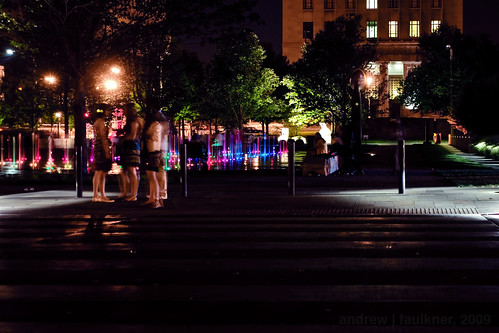
St. Louis skyline at night. Photograph by author.

My adopted city of Saint Louis has increasingly been the focus of national media in the past six months. While coverage formerly focused on Saint Louis being designated as America's Most Dangerous City in 2006 or dwelled on the sordid tale of Michael Devlin. Compared to these stories almost anything would seem an improvement, especially for a city with notoriously low civic esteem. While a lack of vision and regressive attitudes still constitute the largest challenge to Saint Louis, the view from outside has begun to change markedly.

While the summary demolition of Charles Colbert's San Luis Apartments was viewed with concern outside the city, the NorthSide project has been commended for its visionary scale with the caution that "If it's done right, it could be transformative" and potentially an example to the rest of the Rust Belt. Whether that example is positive remains to be seen, but eyes around the nation are watching and we must demand a higher standard and cannot allow this opportunity to become a failure.

Saint Louis CityGarden -- a project by the Gateway Foundation designed by Nelson Byrd Woltz. Photograph by author.

City Garden, the most significant improvement to the city of Saint Louis since the restoration of Forest Park, and like Forest Park, is an extremely positive example of the utility of public/private partnerships in the face of diminished local planning. City Garden has received glowing reviews in a number of sources from parenting and travel magazines to industry publications. East West Gateway's Great Streets pilot program on South Grand has provided momentum for a sorely overdue assessment of the urban design of commercial corridors in the city and provides a vision for a move away from the strict prioritization of single-occupant automobile transit on city streets. While the trial narrowing of Grand has gotten the most attention, the participatory process leading to the proposed option set an excellent local example by combining education with participation.

Visitors to the UrbanNexus conference included Sarah Szurpicki of the Great Lakes Urban Exchange and Sharon Carney of the Michigan Suburbs Alliance pictured here with Jeff Vines at Chouteau's Landing. Photograph by author.

Perhaps it was the growing national recognition of a changing attitude that brought Next American City to St. Louis for a conference. I was honored to be invited to participate on a panel of emerging voices in the Vanguard Regional Roundtable. As Michael Allen has noted, the Next American City conference was fated to be in both chronological and philosophical opposition to another event: the hearing on the McKee NorthSide TIFF request.

The latest public exposure is perhaps the most striking: Richard Layman, author of Rebuilding Place in the Urban Space is examining St. Louis Metro's Moving Transit Forward planning campaign. As a transplant to St. Louis I find the transit issue infuriating. While most outsiders will readily admit that both the St. Louis Metrolink light rail system and MetroBus system is effective and even unexpectedly good for a city of St. Louis's resources, the local perception is that public transportation here is defunct, unworkable, and that ownership of an automobile is essential for daily life. At a recent conference on urban issues Alvin Reid, editor of the St. Louis Argus compared the MetroLink to a toy. As an example of a functional system he pointed to Washington's metro system.

This is exactly what makes Layman's post so interesting. The subtitle is "St. Louis regional transit planning process as a model for what needs to be done in the DC Metropolitan region." Layman focuses on the efforts of metro to educate the public as part of the process. This is a long overdue effort. In hindsight it was poor communication and an inability to justify the importance of Metro funding that doomed last year's Proposition M. In a vacuum of information it ceased to be an initiative on badly needed expansion, and instead became a referendum on past problems. Metro must take an active role in justifying its importance to the region and in educating residents. To echo Layman, another needed step would be to clarify the subsidization of automotive transportation to eliminate the transit-welfare stigma. Despite the antipathy towards transit frequently evidenced here, it is gratifying to know that Metro's ambitious and inclusive new initiative is at least recognized outside of the Mississippi valley.

For the first time in years Saint Louis is receiving noteworthy attention on the national stage. With attention comes increased expectations. We must build on the foundation of participatory involvement and education evidenced in the best projects of this past year, reject negativity and insecurity, and advocate for a city that can once again serve as an example to the region and to the nation beyond.

Open Source urbanism?


Via Baltimore Inner Space blog comes an interesting approach to participatory redevelopment. I have quoted Paul Davidoff's assesment of participatory planning in an earlier post: "Lively political dispute aided by plural plans could do much to improve the level of rationality in the process of preparing the public plan."

This level of lively discourse is often exceedingly difficult in developer driven projects where significant monies have already been invested. In many cases the illusive veil of a public participation process may be used to control and appease the opposition. The manipulation of statistics derived from resident surveys works to a similar end. These abuses continue to occur because the financial stakeholders of the new plan feel threatened by the efforts of resident and community members to challenge decisions. The often beneficial act of initial investment becomes the stumbling block for participation in the process.

While participatory planning processes began in the 1960's due to the enormous impact of Jane Jacobs's The Death and Life of Great American Cities (Modern Library Series) and Davidoff's work, it rarely transcended a reactionary methodology. Some efforts did begin as the result of resident groups lobbying for improvements, but most public participation existed due to legal mandate or as a reaction to proposed developments.

While it might be dismissed as utopian to reverse the equation to emphasize proactive community participation and reactive development, such a process would have strong advantages. The community would become the major source for ideas and inspiration and developers would vet such proposals for economic feasibility. The major advantage for such a procedural change would be the Collective Intellegence available to developers by utilizing the community as an open-source network of proposals and focus groups. While this concept seems radical, it is currently the primary advantage between of design competitions and charrettes.

Even if one remains decidedly skeptical of a technologist viewpoint it remains impossible to ignore the impact that social networking and internet-based communication has had on activism in the last decade. While the power of such technological advances was aptly demonstrated in the last presidential campaign, urban professionals are using such methods to create coalitions and advocacy organizations that may reshape local planning organizations in the decade to come.

One example of effective citizen activism is the 8664 project in Louisville. 8664 seeks to prevent a massive and illogical 23 lane highway interchange expansion on Louisville's riverfront. Furthermore, this 10,000 member grassroots organization has proved that by replacing the proposed two bridge/multi-lane expansion with a single bridge and an urban boulevard their plan will save billions of dollars, improve on a civic amenity and retain 99% of the traffic efficiency of the government's proposed plan.

While 8664 is a case study for the organizational power of new technology and is an example of the current state of many civic-powered development advocacy organizations, The Baltimorphosis proposal for the Franklin-Mulberry corridor in Baltimore shows the full potential of technology to revolutionize participatory planning. The Franklin-Mulberry corridor is a unfinished urban spur freeway through some of the most abandoned and underdeveloped neighborhoods in Baltimore. Baltimorphosis seeks to replace the existing highway trench with a combination of light rail, commuter rail, an urban boulevard and multi-story development. By developing construction within the ditch larger 4-6 story buildings can be visually accommodated in a predominately 2 story rowhouse area.


A more intensive scheme involves capping light rail and commuter rail lines and creating a large multi-story parking garage in the remaining highway right of way with new construction on the surface.


The difference between Baltimorphosis and other similar civic proposals is the incorporation of open-source design. The images above come from dimensionally accurate 3-D sketchup models which can be downloaded and reworked by interested members of the public:
You can submit designs in a variety of formats, including straight Photoshop. Humorous ideas are okay, but we prefer ideas that have some bearing on the real world. Model 2 to the right is a good starting point if you like to work in 3D. The blue and brown buildings are just placeholders that you will replace. If you have are more comfortable with 3D modeling, you might start with Model 1, an existing two-block section of the highway ditch, which is more of a blank slate.
If enough people apply their brains to this challenge, the results will prove that Franklin Mulberry has too much potential to let slip away.
If you're really ambitious, you can take a stab at the Ice House or Social Security districts at the West and East ends of the corridor by downloading Models 3 and 4.
Whatever you do, send us images of your designs so we can post them to our Gallery section. Send your name and occupation if you like, but that's up to you
-- taken from baltimorphosis.com

While this degree of public involvement is excellent for generating a vast array of proposals, it also works to build a wide coalition of citizens who can pressure government for a better solution.

Compare this process with the process that resulted with the aborted construction of the highway. In that case, a technologist
bureaucracy implemented a massive plan resulting in the demolition of hundreds of buildings and the destruction of a neighborhood. There was little civic participation and the planning took place using aerial maps behind closed doors. Today technology gives us the chance to work experientially in three dimensions and to consider hundreds or permutations of a design while utilizing the practical knowledge of residents. In effect a proactive participant planning process initiates the "lively political dispute" and will "improve the level of rationality" before development... a practice Paul Davidoff anticipated forty years ago.

Open source urban design (via Baltimorphosis Gallery).

UPDATED - Streetcars: things just ain't what they used to be


There has been much consideration and discussion here in Saint Louis about Joe Edwards's plan to reintroduce a streetcar on Delmar Boulevard. The conversation here has been the duplicate of a similar debate raging in my birthplace of Columbus, Ohio. In the case of Columbus, financing was never fully established and that uncertainty, combined with the economic downturn, led to the project being put on indefinite hold.

There are some major differences between the proposals for streetcar lines in Columbus and Saint Louis. In Columbus, the effort was led by a task force formed by the mayor. In Saint Louis, the impetus has come from a private developer, Joe Edwards, who has been the key player in the incremental revitalization of the Delmar Loop. In this case the politicians involved seem to have caught trolley fever and were extremely disconcerted to learn that even in Portland fares only make up 16% of total funding. While this is not earth-shattering if you consider streetcars another form of transit (streetcars pay a larger percentage through revenue than interstate highways for example) but troubling if this is envisioned as merely a novelty.

More tellingly, the philosophy behind each proposal has been different. The lines in Columbus were conceived to connect the 40,000+ population at Ohio State University with jobs downtown and the entertainment and nightlife destinations in the Arena District and Brewery District. The initial plans also involved connecting Columbus State Community College and the Columbus College of Art and Design. As Mayor Michael B. Coleman stated:
I think connecting the Ohio State University to the Brewery District, and the Arena District to the Discovery District, which is CCAD area and Columbus State, is something I think will add to the value of the city, and will be an element of the quality of life to young professionals finding Columbus as a place they want to stay. And anywhere that streetcar is located, you will see restaurants, retail, offices, and residential, all along the line. It will be the spur and difference-maker for economic development in our downtown, in addition to getting around. So it’s a huge catalyst for vibrancy, a huge catalyst for economic development, and a huge catalyst for just getting folks around…

In comparison, the Loop Streetcar connects an already developed area (named one of America's 10 Greatest Streets in 2007 by the American Planning Association) with Forest Park and would run a mere two and one quarter miles. Of this length, only around eight blocks have any potential for the streetcar to serve as a catalyst for significant redevelopment. The Columbus proposal would have been greater than five miles in length, would have connected five distinct economic centers and could have provided the catalyst for over thirty blocks of undervalued property.

The difference is stark, and it is clear that the proposed Loop Trolley (just the use of the term trolley instead of streetcar makes it clear it is planned solely around nostalgia) is meant entirely as a tourist attraction rather than as real transit. This is dangerous for two major reasons. First, as a tourist vehicle, it is especially susceptible to bad publicity. People tend to act much more strongly to entertainment and non-vital establishments once a problem has occurred. Compare the shopping malls to grocery stores; non-essential venues such as shopping malls are exceedingly susceptible to bad publicity. A failure of the Loop Trolley could set back surface transit in Saint Louis for thirty years to come. Furthermore as commenter "Adam" noted at Saint Louis Urban Workshop the brevity of the line is a huge liability in terms of operational sustainability :
When you build only one line, that one line has to absorb all the overhead for operating a streetcar system. It has to have a carbarn; it has to have the electrical substation; it has to have a dedicated trained staff to drive them. And, perhaps worst of all, if there's only one line, it has to be completely shut down for any street maintenance instead of being able to shunt around maintenance on an alternate line. Look at a map of most major cities, including St. Louis, before World War II. Streetcar lines ran up and down practically every major street. They didn't cost $30 million for one mile because resources were shared across many lines (also because labor was cheap). Frankly, $30 million for a single mile along existing streets is absolutely absurd. That's more than $5000 per foot--unless the rails are made of truffles, what is costing that much?

Setting aside the majority of these concerns, how could the proposed streetcar be improved?

It is clear that the trolley backers have not studied the ways trolley traditionally functioned in their proposed study area. A few design changes would have a great impact in recreating a successful streetcar urbanism and increasing safety along the route.

Loop trolley - conceptual rendering.

Looking at the conceptual rendering it is evident that the streetcar is proposed to run in the traffic lanes of already-congested Delmar Boulevard. While running the trolley in traffic lanes romantically hearkens back to the big city urbanism we know from grainy footage, by the time neighborhoods like the Delmar Loop were designed, it was clear that headtimes and safety were improved by separating surface transit from cars.


As this undated image shows, the handicap of streetcar systems is its general inability to detour in the event of accidents

The lushly landscaped boulevards we know today were a design response to this issue. Instead of running in traffic lanes, the streetcars were given a dedicated right of way in the center of the street. In some cities streetcar actuated traffic lights stopped cross-median traffic. The result was increased safety and efficiency for surface transit.


Video from separated ROW of Illinois Terminal Company interurban streetcars, Venice, Illinois.

Former streetcar right of way, now landscape in median, Wydown Bvld..

While not every potential streetcar route has enough width to support a separated system (streetcars typically need at least eighteen feet for unidirectional service) many of St. Louis's boulevards are in excess of 54' in width and some, such as Gravois are in excess of 75' in width. Additional space can also be made on streetcar arteries by limiting parking. Currently Delmar between Kingsland and the Wabash (metrolink) tracks has two lanes of parallel curb parking, two traffic lanes, and a continuous center turn lane (known as a "suicide lane"). The street width from the Wabash (Metrolink) tracks to the end of the line is approximately 48' from curb to curb. In this instance it would make sense to split the line and have one direction loop to the north using Vernon Ave. to avoid overly crowding Delmar and drastically reducing system efficiency.

East of the Wabash tracks the situation is far different. Both Delmar and DeBaliviere have ample street width due to their conscious planning for transit in the early 20th century. The street width is 75' on Delmar and 72' on DeBaliviere allowing in both cases for two dedicated tracks in the median and four traffic lanes with bike lanes or expanded sidewalks on either side. To get an idea of how a revised Delmar streetscape might appear we can look to St. Charles in New Orleans.

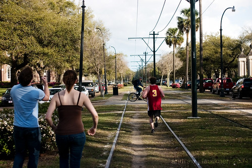
Neutral ground on St. Charles Ave. at Calhoun St., a transit right of way and pedestrian refuge.

St. Charles Avenue in New Orleans falls roughly between Delmar Boulevard and Gravois in street width. However, due to the streetcar right of way the street is humanized to a much greater extent. Please also note the picture above was taken in the midst of rush hour gridlock and shows how the neutral ground can create a space for recreation while diminishing car/streetcar contact and greatly increasing system efficiency. Such a right of way could also be flanked with bike lanes to increase efficiency.

In future posts I will propose realignments to the Loop Trolley route as well as future expansions, and examine the often overlooked urban design traits and infrastructure that enabled streetcar-based transit to be so successful, and assess what lessons we may learn from these examples to apply to the revitalization of our cities.

7.9.09 UPDATE:
I was unable to attend the forum on the Loop Trolley, but the presentation is online here:

Alex Ihnen, as usual, has thorough coverage at his blog.

I left the following comment:

While the added expense of running the trolley in the median is certainly an important consideration, I am concerned there is no conceivable way the Loop Trolley will be able to maintain efficient service competing with traffic on Delmar in the Loop during peak hours without separation. Note that Portland's "Streetcar System Concept Plan" (http://www.portlandonline.com/transportation/index.cfm?c=46134) expects an average speed of 7 mph riding in traffic as compared with 15mph in a median right of way.

If lanes are used, there should be a one direction bypass such as Des Peres/Rosedale/Vernon/Kingsland because any accident on the Loop with current levels of congestion would shut down the entire system. Ideally it would be best to limit street parking to one side and remove the continuous center turn lane. While politically divisive this would only eliminate around 100 parking spaces which could be accommodated in future development. The implementation of the Loop Trolly is a serious commitment to transit and should not be hindered by the automobile preference that currently dominates the region.

Three Blocks on Washington Avenue


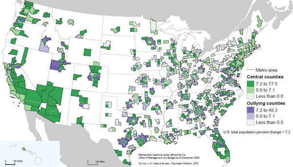
New Geography has just reported that a new Bureau of the Census report has found that exurban growth rates continue to far outstrip urban growth. While this finding might seem somewhat shocking in the face of nascent urbanism upswelling throughout most major midwestern cites and loft developments arising from Salt Lake City to Peoria, the scale at which urban redevelopment is occurring is not and cannot match the scale of greenfields development. The reason should be obvious. It is far easier to sprout houses on 400 acres of farm field without any neighbors or existing infrastructure then it is to assemble a massive urban tract for development. While I will not spend much time discrediting the author's slant (after all, the reviews of his book on amazon do that quite efficiently), attempting to deliberately ignore these differences in scale in order to deflate the significance of new urban population growth is a cynical manipulation of analysis at best. Positive Population Change for Cities and Outlying Areas.


Whatever the case, many Americans are continuing to seek their dreams in suburban and exurban areas. With the recent onslaught of coverage on suburban foreclosures it is germane to ask what will the suburban landscape look like in half a century? Will foreclosed houses become productive gardens for remaining residents? That possibility, while alluring, seems unlikely without concerted effort and regulation. It is more realistic to assume that the suburbia of the future will look like the cities of the present. With these thoughts in my head I decide to take a walk.

Washington Avenue is one of the significant streets of Saint Louis. It spans almost eight miles with fits and starts, beginning at the riverfront and ending in the streetcar suburb of University City outside the city limits. It is best known as the main artery of the former Garment District which has been redeveloped as a concentration of lofts and restaurants. Further west Washington Avenue (neé Terrace) is one of the most exclusive gated streets in the city. In between these two poles, and just north of the posh Central West End, Washington holds clues to the future of the suburb.

Like many thoroughly urban areas, Washington was once a suburb itself. Extending beyond the limits of city development across a wide area known as the Grand Prairie the development of the street was made possible by a new type of transportation: the electric streetcar. A number of car lines ran nearby, including the #10 on Delmar, the #15 Hodiamont on a private right of way several blocks north, and another line running on Olive from Lindell to Walton. [For the 1910 Map, click here.] Much of Washington was built as speculative development, and as we walk through the intersection of Walton and Washington we will see a perfect example.

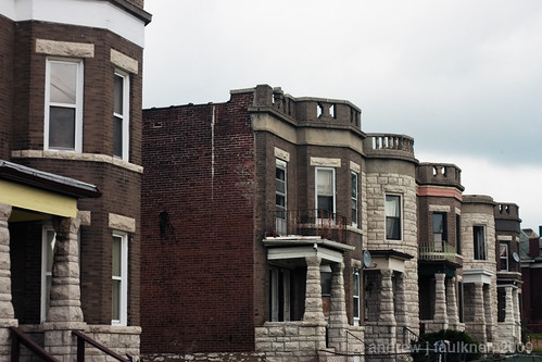
4617-4641 Washington Avenue.
These two family flats were built as part of a row of eight in 1901. Their lot division, atypically small even for this area, was the result of being near the junction of Washington with Olive and the streetcar line. At the time these flats were built, land value was a direct function of distance from fixed-route public transportation. It was only with the switch to buses and the uncertainty of a potentially variable route that this relation was severed.

Despite alternating brick and stone units, common features such as the placement of the turret and Jefferson windows above the porch tie the composition together. Two units have been demolished and the windowless one is in the clutches of Bowood Gardens, but despite the removal of integral context the power of the alternating repetition still makes for an excellent streetwall. Compare this image mentally with a typical modern suburban street. If every third house was replaced with an overgrown lot, how would it compare with the above image?

Wash Walt Taylor

Looking at the 1909 Sanborn map of the block it is evident just how much urban fabric the area bounded by Walton, Washington, Taylor and Delmar has lost. All of the red markings denote buildings replaced by vacant lots or parking, the green marks denote buildings replaced by more recent buildings. While I was unable to find any information on it, the loss of the courtyard apartment at Taylor and Washington was tragic. Despite all the losses, the relatively narrow block depths and remaining buildings still manage to keep the block from feeling like a wasteland. With suburban lots typically three to five times wider than these lots, the loss of a single foreclosed house to fire or demolition would have a much more severe impact on surrounding values on the cul-de-sac or road.

I continue walking east on Washington, crossing Taylor and then Newstead. The block of Washington between Newstead and Pendleton has seen some of the most dramatic loss of urban fabric.

Wash Newstead Pendleton


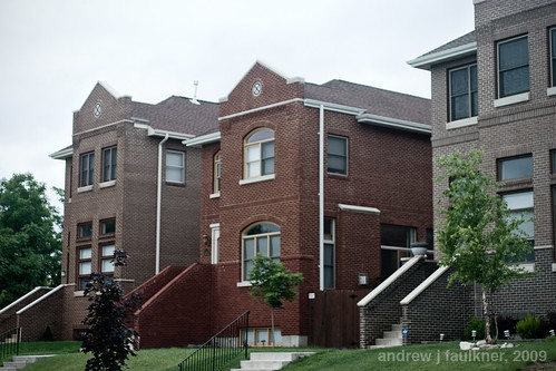
While this block has retained the wide-lot platting that belies its upper class origins, most of the original houses have been demolished. On the south side eight remain standing, on the north side only six. In contrast to the suburban style infill built on the south side in 1997 across two lots, the 2006 infill homes by X3 Developers are striking in their competency.

Three infill houses on Washington by X3 Developments.

Built at 4341-4347 Washington to replace three houses dating to the mid-1890's that had unfortunately been lost, these three infill units notably carry the masonry entirely around the building (unlike some recent failures). While the arched windows on 4345 are kitchy and not architecturally appropriate to Saint Louis, the flanking models have a nicely understated referencing of Richardsonian Romanesque. Since these sold for half a million dollars apiece, I feel compelled to note that the hipped roofs are a let down, the tectonics are too flat without more complicated brickwork and the stoop/stair combination is a blatant and unnecessary reference to brownstones over 1,000 miles away. While I would prefer for infill to refer to surrounding structures but ditch the weak historicism like Anthony Robinson's recent projects I would still not be disappointed if they filled in the rest of the empty lots on this block with more considered variations of these.

The true gem on this block is not the new infill, but an old remnant.
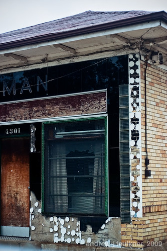
Service Station at Pendleton and Washington.

This service station was built to replace a mansion sometime in the 1920s to serve the growing motoring demand of the wealthy residents in surrounding neighborhoods. The beautiful black Vitrolite facade probably dates from the 1950s. Note the elegant reveals of glass block at the sides of the facade as well as the combination of green window mullion and chrome. The architecture of this facade displays a confidence not found even in the half million dollar infill houses. At the time of the facade installation this service station was a block away from the epicenter of St. Louis nightlife at Gaslight Square. The decline of Gaslight Square meant the decline of business for this little gas station. It served for a time as the home of Kugman Motors, but it has been vacant since at least 1989.

Wash Pendleton Whittier

The block of Washington between Pendleton and Olive has seen much change in the century since the Sanborn Map was complied. The failure of Gaslight Square led to the demolition of the north side of Olive between Newstead and Whittier in the early 1990s. As part of the Gaslight Square redevelopment Pendleton was realigned to connect with Boyle. This ironically eliminated the jog that gave Gaslight Square its name. The two institutions that anchored the block disappeared decades ago. Bishop Robertson Hall was a private Episcopalian school with a 2,000 volume library that closed in 1915. The Episcopalian nuns of the Good Shepard then moved to Baden. The more significant of the two, Hosmer Hall had been established as an elite girls school in 1884. Today it is remembered as the alma mater of poet Sara Teasdale and for infamously banning hair extensions in 1909. A decade after the World's Fair Hosmer Hall moved to Clayton. The school closed and sold their building to Clayton in 1936 and it became known as the Wydown School until it was raised and replaced in 1965 by the present Wydown Middle School.

The final stop on our walk is in front of one of my favorite buildings in Saint Louis. Often I daydream about having unlimited resources to realize any project in the city. While a part of me longs to save and rehabilitate the apartments at 5315 Cabanne, the building at 4005 Delmar, or maybe even the San Luis, only one house calls to me.

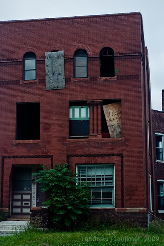
4243 Washington.

4243 Washington avenue is unique. For every building in Saint Louis exploding with ornate terra cotta or wrought iron ornament there are many buildings that derive their aesthetic power from restrained geometries that presage the modern movement by decades. In that class 4243 Washington stands out with an unprecedented geometric purity that reinforces its three powerful stories.

4243 Washington.

Built in 1891 on the northern edge of the Central West End 4243 Washington anticipated a density and level of income that was never to coalesce. Unlike the majority of the houses on the block 4243 had three full stories combining for 5,200 square feet on a standard 50'-0"x150'-0" lot. In 1909 it was the only house on the block to have a two story carriage house. It is unclear when the carriage house was demolished, but a garage constructed in 1994 now has taken its place.

By the late 1950's the neighborhood had changed. Upper and upper middle class residents had either retreated into the private streets to the south or left the city entirely. According to a twenty year resident of the block named Lee, during the heyday of Gaslight Square older neighbors recollected Tina Turner stayed with a friend at 4243 when she was avoiding Ike Turner. After the fall of Gaslight Square Lee recollected that there was a lot of crime and prostitution in the area. As buildings burned and were demolished most of the residents left. 4243 survived under the same owner as the neighborhood got quieter and quieter. In November 2003 long-time owner Louise Holland sold 4243 for $125,000. New owners Ralph and Katrina Russell bought the property and began to reahab the house. Unfortunately they lost it in foreclosure in 2007 while in the process of replacing the windows. The empty shell was then sold for $79,000 to a Kevin Settle who sold it to M&J Enterprise for $95,000. The new owners have not paid property taxes since they have purchased the building.

If ever there was a building uniquely suited for a vacant building registry, stabilization, seizure, and resale this is it! However, even boarding second floor windows (let alone tarping roofs!) is "too expensive" despite the far greater economic and environmental costs of demolition. Disregard that: in this city, like in our equally visionary sister city, demolition means jobs.

Stoplight Urbanism Pt.II: The current condition


Today I will continue with the second part of my essay on the effect of traffic control on urbanism and my modest anarchic proposal for change.

To recap the first part:

For millenia movement through cities and villages was regulated by mutual interest and rooted in a notion of common-law that began to be restricted with the enclosure movements of the eighteenth and early nineteenth centuries. Under such a system no traveller had a superior right over another; no person or vehicle had dominance and all spatial claims to the space of the road were recognized to have equal value.
...
While in many western countries the establishment of the primacy of the automobile led to a drastic shift in custom and space, in developing nations the assimilation of motorized transportation in society has been unable to change customs regarding road use. Such intense systems of concession, predicated in intense interaction, result in the ability to change formation instantaneously and avoid obstacles and stoppages as they occur. These fluid dynamics utilize the whole of human reaction and intellect and exhibit a complex relation of communication and instinct not present in the smartest mechanical control.

At the dawn of the twentieth century urban areas exploded with growth as millions abandoned rural lives to seek fortune in the industrialized cities of the world. With the overwhelming concentration of people in small geographic areas, the sixty years spanning the years between 1890 and 1950 would see an obsession with congestion as the gravest threat to cities. In some cases, although technological innovations had allowed such congestion to occur, technology was again proposed as the answer. Thomas Edison predicted the wide-scale adoption of automobiles would “so relieve traffic as to make Manhattan Island resemble the ‘The Deserted Village’” [Fogelson, 253]. Others sought less sweeping measures to fight congestion through regulation and traffic control.

Today the concept of right of way is so ingrained in our daily lives that it is shocking to learn that this is a construct of the past century. Initially such rights were based on arbitrary designations that varied erratically between municipalities. In a parochial age each municipality prescribing right of way to either North/South or East/West traffic [Todd, 10] may have been a plausible solution. However over twenty five years after the adoption of standard time in a society of increasing mobility, such an answer was destined to be unsuccessful. The interim solution came in a custom borrowed from France in which vehicles defer to the vehicle on their right. Such a system still relies on informal means and becomes increasingly difficult when applied to the major intersections being constructed as part of ambitious street widening projects. By the 1920’s the current system of rights of way predicated on a deference of minor roads to major roads was in firmly in place. Since that time the only alteration has been the use of traffic light systems weighted to give precedence to the major thoroughfare.


"Only" by BrittneyBush on Flickr

The first modern traffic light was deployed in Salt Lake City in 1912 [Wikipedia, 1]. Although a direct refinement of the London Signal of 1868, the traffic light would undergo a decade of nearly continuous refinement in form and operation until the first interconnected automatic three color traffic lights were installed in Houston.


The traffic lights that we encounter every day are similar to the 1922 Houston traffic lights, with a small degree of technological refinement. Interestingly, several of the most prevalent innovations are designed to subvert the very concept of a signalling system. Most common are the walk light buttons that advance the traffic light cycle to allow pedestrians to cross in a timely manner. Another common subversion is the actuated signal in which embedded sensors in the pavement detect the weight of a waiting vehicle and override arterial right of way at non-peak times. More controversial are devices that allow emergency vehicles to bypass red lights by emitting an infrared signal; predictably such devices were manufactured and sold to general consumers and, as a result, federal law now criminalizes the possession of such devices for consumer use.


Traffic management center in the Twin Cities. Image from Minnesota DOT

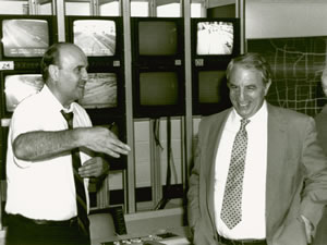
The most advanced systems of traffic lights are coordinated control systems that utilize computers to enable motorists on major thoroughfares to travel miles without encountering lights by adjusting for predicted speed or, in the most advanced systems, average speed as detected by numerous embedded sensors. These systems “signal the dream of the liberal state ... They work best when no one notices them, and when regulation becomes cooperation and facilitation”[Pile, 263]. One subset of such systems are centrally controlled systems (as made famous by the original Italian Job) where data and video are directed to command centers that control entire street networks throughout the city.


While refinements continue to advance the technology of traffic signalling, safety has not improved. More than three decades after the adoption of the traffic light there were still over ten traffic fatalities for every murder [Ross, 231] and this gap continued to widen, despite safer automotive design. Traffic signals are rendered unsafe by human psychology. Traffic light systems “make drivers go fast and keep close behind to the vehicle in front for fear of missing the green light” and furthermore cause drivers to cross intersections “with their eyes up in the air rather than on the road” [Todd, 11] The coordinated control systems previously discussed can actually encourage reckless driving by causing “drivers [to] use excessive speed in order to ‘make’ as many lights as possible” [Wikipedia, 10]. Additionally such systems have become the norm and are frequently demanded by residents leading to the chronic under-funding of local transportation agencies. In a recent survey “68 percent said they have... no documented management plan for their traffic signal operation” [U.S. Traffic Signals get Poor Grades, 1] resulting in the typically poor calibration of signals.


Traffic lights also contribute to more dangerous streets by altering the psychological and sociological relationships of drivers to their surroundings. The traffic light is responsible in large part for an abnormal conditioning of motorists. Traffic lights alter the standard control relationships seen in society for, once the visible police officer is replaced by the unseeing mechanical device, the “guilt and ... recognition of the gap between our actions and those of the ideal citizen” [Pile, 263] is lessened by proxy. This condition has recently given rise to the use of red-light cameras to remind motorists that traffic lights have all the authority and power of a live police officer. Another, more dangerous, conditioning resulting from acclamation to traffic lights is complacency. Drivers develop expectations for operating within the current system and that deprives them of the necessity to be aware.


"Playing in Traffic" by Geognerd on Flickr

It is assumed that merely following the rules should keep them safe. Of course when externalities inevitably arise drivers are ill-prepared to adapt.

Malfunctioning traffic light causes mayhem in Russia.

This complacency can be seen in the vast rise of alternative motoring activities such as grooming, eating, and cellular phone use while driving. While these behaviors are a result of expectations conditioned by the system, another problem lies in the conditioning of actions. In those rare occasions, such as power failures, when drivers must actively negotiate passage they are not confident in their abilities to physically negotiate and communicate with other drivers.


A second problematic result of modern traffic control should be plainly evident to anyone who has walked, cycled or run on public streets: The controlled situation of driving has resulted in a systemic aggrandizement of the driver over other forms of transportation. Modern right-of-way rules, one-way streets and traffic lights encourage “motorists to travel at high speed on urban arterial roads and intersections without looking for opposing traffic” [Todd, 11]. The physical and often psychological separation of thoroughfares into vehicular roads and pedestrian walkways or bicycle paths has caused the “driver to see that he or she has priority. And the child who forgets for a moment ... is a child in the wrong place” [Baker 2004, 2]. The conditioning leads to inadvertent or intentional arrogance on the part of drivers and, at its worst, is manifested in the much discussed phenomena of road rage.


The aggrandizement of the driver is mirrored in society at large as illegal traffic acts are “not stigmatized by the public as criminal” [Ross, 241] except in extreme cases of negligence and the majority of traffic crimes receive much more lenient sentencing than other categories such as drug or weapons offences. This situation has been examined through a Marxist lens by some who observe that because “the law is made and operated in the interests of the well-to-do,” then driving offenses such as speeding “are not ordinarily thought to ‘count’ as crimes” [Ross, 235].


In part III I will examine alternatives to structured traffic control and theorize an urbanism without stoplights.


Works Cited:

1. Baker, Linda. “Why Don’t We Do It in the Road?” 25 October 2007. Salon.com. .

2. Fogelson, Robert M. Downtown: Its Rise and Fall, 1880-1950. New Haven, Connecticut: Yale University Press, 2001. p, 253

3. “Report: U.S. Traffic Signals Get Poor Grades”. 25 October 2007. MSNBC.com. .

4. Ross, H. Lawrence. "Traffic Law Violation: A Folk Crime." Social Problems, Vol. 8. 1960-1961: 231-241.

5. Todd, Kenneth. “Traffic Control: An Exercise in Self-Doubt.” Regulation. Fall 2004: 10.

6. “Traffic Light”. 10 October 2007. Wikipedia. .

7. City A-Z: Urban Fragments. Ed. Steve Pile and Nigel Thrift. New York: Routledge, 2000. p. 263.

Stoplight Urbanism Pt. I


Many of the interventions that have most radically reconfigured the urban environment are also those which paradoxically have evaded examination and refinement through their ubiquity. On a walk or drive through the city recent interventions such as parking meters, traffic lights, signage and one-way streets remain out of mind due to their prosaic and common nature. While some degree of control is of course necessary, there has been little inquiry into the effects of the present systems and into the possibilities that exist beyond the current reality. The following series of writings on the traffic light seek to detail its history, to examine its effect on social life, and to explore alternatives to the automated device. While almost any such element in the city could have been chosen, the traffic light poses an intriguing subject at the confluence of philosophies of control, technologic determination, and modernization.


For millenia movement through cities and villages was regulated by mutual interest and rooted in a notion of common-law that began to be restricted with the enclosure movements of the eighteenth and early nineteenth centuries. Under such a system no traveller had a superior right over another; no person or vehicle had dominance and all spatial claims to the space of the road were recognized to have equal value. Such informal systems did not end with the enclosure movement or industrial revolution, they continued decades into the early twentieth century.

While in many western countries the establishment of the primacy of the automobile led to a drastic shift in custom and space, in developing nations the assimilation of motorized transportation in society has been unable to change customs regarding road use. In this regard, Stanford Gregory’s comparison of the informal driving practices of Egyptians with the linguistics of pidgin languages is fascinating. As a modern western observer, Gregory paints the typical first impression of chaos but is able to “discern an order in the madness,” which he believes is clearly emblematic of “social interaction at a fever pitch” [Gregory, 337]. Such intense systems of concession, predicated in intense interaction, result in the ability to change formation instantaneously and avoid obstacles and stoppages as they occur. These fluid dynamics utilize the whole of human reaction and intellect and exhibit a complex relation of communication and instinct not present in the smartest mechanical control.

In the developed world the industrial revolution initiated an era of technological determinism in which centuries of developments in civilization were rejected or radically reconfigured by an increasing reliance on totalizing rationalism and a preoccupation with efficiency through mechanical means. The technological pace of development was far faster than ever seen in human history. As a result of this pace, nothing other than the easily quantifiable instantaneous result was considered to have value. In the face of the accepted perfection of the machine, humans, especially those of lesser breeding and education, were considered to have little value.

The first traffic signal in human history was installed on December 10th 1868, outside the Houses of Parliament in London. The signals were intended to protect Members of Parliament crossing the busy street. They also helped to afford them a degree of separation from those whose interests they ostensibly represented. Like many traffic control devices, it had its lineage in railroads, who had been using semaphores for several decades. The London signal was a combination of a standard railroad semaphore arms and gas warning lamps but was not automatically controlled. The signal acted as a mechanical appendage of the constable who stood on the traffic island by telegraphing his orders to the mass of carriages, carts, and pedestrians. The signal was a technological aid but not a technological determinant. The London Signal was also an epitomization of the uneasy relationship between human and technological control: less than a month after the signal was installed the gas lamps exploded injuring the police officer “who had thought he was in control” [Pile and Thrift, 262]
and the age of the machine in traffic control had begun.

To be continued in Part II.

Works Cited

1. Gregory Jr, Stanford W. “Auto Traffic in Egypt as a Verdant Grammar.” Social
Psychology Quarterly, Vol. 48, No.4. 1985: 337.

2. City A-Z. Ed. Steve Pile and Nigel Thrift. New York: Routledge, 2000. p. 262.