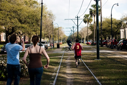
In the first article I compared the Loop Trolley project to a streetcar project in Columbus, Ohio:
"...the Loop Streetcar connects an already developed area (named one of America's 10 Greatest Streets in 2007 by the American Planning Association) with Forest Park and would run a mere two and one quarter miles. Of this length, only around eight blocks have any potential for the streetcar to serve as a catalyst for significant redevelopment. The Columbus proposal would have been greater than five miles in length, would have connected five distinct economic centers and could have provided the catalyst for over thirty blocks of undervalued property."
My contention is that the Loop Trolley should not be envisioned as a tourist attraction as it is now, but should be understood to be the start of a restoration of an effective surface transit network and as an engine for incremental growth.
"Cleveland’s[St. Louis's] leadership has no apparent theory of change. Overwhelmingly, the strategy is now driven by individual projects. These projects, pushed by the real estate interests... confuse real estate development with economic development. This leads to the 'Big Thing Theory' of economic development: Prosperity results from building one more big thing."
- Ed Morrison, "Cleveland: Reconstructing the Comeback" via The Urbanophile
St. Louis, like many mid-sized cities, represents Morrison's assessments of Cleveland to a tee. The influential industrialists that motivated major changes a century ago are gone. Names like Wachovia have replaced the financial firms that outlasted the demise of industrial powerhouses like the St. Louis Car Company or the American Stove Company. Other powerhouses such as Anheuser-Busch have been sold overseas. As the Urbanophile describes, transactional businesses such as real estate have completely replaced the industrial/commercial ogliarchy of old. Thus, real-estate development is conceptualized as economic development, and the major infrastructural improvements that could drive the development of revitalization and attract the necessary workforce for innovation are sacrificed for strip malls, warehouses, or failed commercial redevelopments.
The political and economic situation bears striking similarities to Paul Collier's assessment on post-conflict recovery:
The first principle is, it's the politics that matters. So, the first thing that is prioritized is politics.
[Development should proceed in the most apolitical way possible. Decisions should be made with the entire city and region in mind, not for one ward at the expense of another or one region at the expense of another.]
And then the second step is to say, "The situation is admittedly dangerous, but only for a short time."
[Development decisions should be made with a view towards fostering sustainable growth and future development, not through short-term job creation and TIF-baiting]
And thirdly, what is the exit strategy for the peacekeepers? It's an election. That will produce a legitimate and accountable government.
[Development (especially infrastructure development) should be freed from electoral cycles and the control of aldermanic discretion]
So that's the conventional approach. I think that approach denies reality. We see that there is no quick fix. The reality is that we need to reverse the sequence. It's not the politics first; it's actually the politics last. The politics become easier as the decade progresses if you're building on a foundation of security and economic development. The rebuilding of prosperity.
Why does the politics get easier? And why is it so difficult initially? Because after years of stagnation and decline, the mentality of politics is that it's a zero-sum game. If the reality is stagnation, I can only go up, if you go down. And that doesn't produce a productive politics. And so the mentality has to shift from zero-sum to positive-sum before you can get a productive politics. You can only get positive, that mental shift, if the reality is that prosperity is being built...
But the objective of facing reality is to change reality.
--Paul Collier "New Rules for Rebuilding a Broken Nation", 2009.
(emphasis and bracketed comments added)
In the interest of changing reality, I will show how extending the Loop Trolley beyond Joe Edwards's vision could begin to act as an economic driver for urban redevelopment and could be leveraged in subsequent phases for future growth.
Phase I: 2015
Changes to proposed route: Light Blue
Beginning with the initial route proposal, I examined the street widths along the route and efficiency statistics from several cities. The Loop Trolley is currently planned to occupy two traffic lanes (two way traffic) on Delmar through the Loop. At this point Delmar is only 48' wide and Loop Trolley planners intend to retain two lanes of street parking. Note that Portland's Streetcar System Concept Plan predicts an average speed of 7 mph riding in traffic. By comparison, a streetcar in a median right of way will typically achieve a speed twice as fast.
In order to facilitate a separated right of way, the streetcar has been routed to run westbound on Delmar, looping around to Kingsland via Loop S. The streetcar would the head north on Kingsland before heading eastbound on the Vernon Ave. Loop bypass and would rejoin Delmar at the MetroLink station (Des Peres Ave.).
View Streetcar Proposal in a larger map
This route would have other benefits beyond merely increasing line speed. The eastbound routing on Vernon follows the #2 Bus and would connect the 1,500 residents in the Parkview Gardens neighborhood with the MetroLink station. This proximity to transit would also spur redevelopment of the underutilized commercial strip along Vernon between Kingsland and Westgate.
Amendments to proposed route: Light Blue
The two major problems with the existing route are that the History Museum is not a strong enough draw for a terminus, and it does not service any major job centers. In the turn of the twentieth century streetcar companies addressed this issue by building amusement parks at the end of their lines to draw more traffic.
To solve this problem, I proposed extending the route on Delmar to the Central West End and looping around the West End. While the Olive streetcar originally ran in a zigzag west from McPherson to Waterman (at Kingshighway) to Pershing (at Union), Delmar is an excessively wide boulevard with ample width for two dedicated and separated tracks.
The CWE loop would take advantage of the wide median on Kingshighway to loop south to Laclede (within easy walking distance of the Barnes Jewish/Wash U/Children's hospital complex) and then continue on Buckingham (reversed one way from present) to North Ct./York Ave. and then through the heart of the CWE on the old Maryland #12 Streetcar ROW. The loop would then follow that ROW left on Boyle and turn westbound at Delmar.
View Streetcar Proposal in a larger map
Besides connecting an estimated 26,000 employees at the hospital with numerous commercial businesses in the Loop and the CWE, this alignment would provide a major impetus towards redevelopment on the north side of the CWE. Over 14 blocks of underdeveloped land would see an increase in value and the streetcar would provide considerable assistance to redevelopment efforts in the former Gaslight Square area. This route, around seven miles in length, would require more route investment, but would not require additional carbarns or maintenance areas. Such an extension would drastically increase boarding and would secure the viability of the Loop Trolley proposal.
Phase II: 2020: Green
Pending successful operation of the Delmar Loop/Central West End, an expansion could be easily planned along the former Olive St. ROW and McPherson/Washington. This expansion would be a compact figure eight meant to connect the Delmar Loop/Central West End with the museums and entertainment facilities in Grand Center. The figure eight would run as a spur from the CWE route during designated hours. The estimated time on the extended original line from City Hall in University City to the Fox theater would be 25 minutes.
At the same time construction would begin on the reinstallation of the #70 Grand streetcar line between a loop opposite John Cochran VA hospital to a loop just north of Grand and Gravois. This section would completely follow former streetcar right of way and be able to run in a dedicated median as a result of the wide street width.
View Streetcar Proposal in a larger map
This route would replicate one of St. Louis's most used streetcar routes and would connect the VA Hospital with Saint Louis University Hospital, and the cultural institutions in Grand Center with the populations of both University City and the near south side. The CWE extension could bring more redevelopment on the eastern fringes of the Central West End and both routes provide valuable support to the nascent efforts of the Locust Business District.
Phase III: 2025: Yellow
Phase III would include a Washington Avenue/Olive Street line that would run from the Blue line loop east of Grand through the loft district to Laclede's landing and the Arch MetroLink station. In addition, a new line would be built running south on Florissant from Palm St. through downtown on Tucker with a connection to the 14th St. Greyhound/Amtrack/MetroLink station, and south on Gravois to Grand.
View Streetcar Proposal in a larger map
The Washington/Olive route would provide economic support for the underdeveloped areas between Grand Center and the Loft District and would integrate the faltering entertainment district at Laclede's Landing with downtown institutions such as the Convention Center. The Florissant/Tucker/Gravois route would connect some of the most densely populated areas of the city with jobs downtown and with other necessary amenities while spurring redevelopment in St. Louis Place and integrating Old North St. Louis with downtown.
Phase IV: 2035: Purple
Phase IV would include an extension on the #70 line north from the VA Hospital to N. Florissant Ave, an extension south on the Gravois line from Grand to Germania St, and a line on Natural Bridge from the UMSL South MetroLink stop to Palm and North Florissant.
View Streetcar Proposal in a larger map
These routes would leverage existing streetcar routes and would connect with existing transit corridors. Furthermore these routes would tap into dense population centers in the city and would facilitate small scale economic and storefront redevelopment.
Phase V: 2050: Brown
The final planned phase would consist of three lines along former streetcar routes. A Goodfellow/Union/Hampton line would connect from the Riverfront transit center to Forest Park and the end of the Gravois streetcar in far south city. A Martin Luther King/Cass Avenue streetcar would provide an East/West connection on the near north side from the St. Charles Rock Road MetroLink Station to downtown. A Broadway/Chippewa line would connect the Cass Ave. line through downtown/Soulard and south city to the Shrewsbury MetroLink station. While it is too far in the future to prognosticate development potential, this line could provide a great development impetus to the neglected industrial land along the south riverfront.
View Streetcar Proposal in a larger map
While this was an intellectual exercise, it emphasized some key lessons. First, any proposed transit as expensive as a streetcar line must serve a vital connection need and must connect key employment destinations. Cultural destinations are important draws, but major employers are vital. Secondly, while there are parts of the city that suffer from a lack of transit, the best route is an already successful route. More revenue upon opening will provide a greater impetus to expand the system. Finally, due to the era of development in St. Louis, the built environment and infrastructure was specifically designed for streetcar-based transit and a considerable amount of infrastructure remains to this day. Therefore, implementation is not as difficult as in other cities.
For other route proposals look here and here.