Showing posts with label Feature. Show all posts

Realpolitik and Transformational Change for Saint Louis


Current I-70/Memorial Right of Way looking North from Spruce St. Photograph by author.

The next several years present a unique opportunity for the city of Saint Louis. As I have previously detailed, a series of ill advised post-war decisions severed the vital connection between Saint Louis and the Mississippi River. We now have a unique opportunity to fix these mistakes and enhance the potential of downtown while reconnecting to a vital identity for 21st century Saint Louis. The convergence of the first new bridge over the Mississippi in 40 years, renewed interest due to an international design competition, and an urban resurgence present a once in a lifetime opportunity. We must take advantage of these circumstances to remove the depressed and elevated lanes that sever the arch grounds and Laclede's Landing from the city, for this transformative change will become the driver for future incremental redevelopment on a scale not currently feasible.

In a recent study by Development Strategies the replacement of 1.2 miles of the existing 12 lane corridor with an adequately sized boulevard would open up to 500,000 square feet of developable land. These properties, in conjunction with adjacent vacant lots, could generate a value of $1.2 billion dollars in the next two decades. Based on this estimate, highway removal and redevelopment could provide as much as $6.3 million in annual property taxes to the city. An observer might bet that this windfall alone would be enough to attract political support, but they would have paradoxically long odds at this point.

In his 2009 presentation at TED Paul Collier prescribes a radical fix for global post-conflict recovery:
The reality is that we need to reverse the sequence. It's not the politics first; it's actually the politics last. The politics become easier as the decade progresses if you're building on a foundation of security and economic development. The rebuilding of prosperity ... The objective of facing reality is to change reality.
This matches the trajectory taken by City to River. The grassroots organization has found it far easier and more productive to engage those people and organizations who have a profound interest in the outcome. Unlike the typical convention center/stadium/museum attraction trope of urban development and more like the civic projects of a century ago, the development of an at-grade boulevard provides an armature for growth rather than a single deal to be closed. This potential and complexity requires a robust conversation with numerous parties and the negotiation of hundreds of varying interests. To echo Ed Morrison: If we were just building a convention center then "civic engagement [would be] a carefully circumscribed event, not a process; a meeting, not a collaboration." The problem with which we are confronted resulted from just such a hierarchical and artificial process -- to be successful our solution must be organic. City to River is developing what Morrison would describe as "complex public/private strategies [that] are developed in a “civic space” outside the four walls of any one organization;" and since January 2010 we have given over a hundred presentations to property owners, business associations, neighborhood groups, non-profits, design teams, and interested citizens.

The end result of this process has been a lengthy series of endorsements and a robust network of potential partners. This network includes non-profits such as the William Kerr Foundation, advocacy organizations such as The Open Space Council, The St. Louis Convention & Visitors Commission, developers such as Spinnaker, LoftWorks, and Chivvis, The US Bank Community Development Corporation, Laclede's Landing Merchant's Association, and the St. Louis Post-Dispatch. For a full list of organizations that endorse the City to River boulevard concept please view the City to River Blog.

As the above list of supporters demonstrates, the network of organizations and individuals that support the idea of reconnecting the C.B.D. of Saint Louis with the Arch Grounds, Laclede's Landing, Chouteau's Landing, and the North Riverfront incorporates diverse sectors: development, real estate, advocacy, non-profit, business, and media. Although updates from the CityArchRiver competition have been regrettably sparse, a recent email highlights major supporters of the CityArchRiver competition:
Congressional leaders from both sides of the Mississippi River have officially voiced their support for the international design competition set to frame the area around the Gateway Arch. The nine Democratic and Republican members of the St. Louis area delegation from Missouri and Illinois have sent a joint letter to the CityArchRiver 2015 Foundation, the group sponsoring the competition to select a design team to invigorate the Arch grounds and connect the Arch to downtown St. Louis, the Mississippi River and the Illinois side. The letter - signed by U.S. Senators Kit Bond, R-Mo., Roland Burris, D-Ill., Dick Durbin, D-Ill. and Claire McCaskill, D-Mo., as well as Congressmen Todd Akin, R-Mo., Russ Carnahan, D-Mo., William Lacy Clay, Jr., D-Mo., Jerry Costello, D-Ill., and John Shimkus, R-Ill. - praises the competition as an event that will have "indelibly positive impact on our region."
...
The competition organizers say the official endorsement reinforces the region's commitment to making sure the vision of a new iconic setting for the Arch on both sides of the river becomes a reality. "We are thrilled that our region's lawmakers have joined to communicate their support and to recognize the significance of the competition and the Arch project," said Walter Metcalfe Jr., senior counsel with Bryan Cave LLP and a member of the foundation board.

While I echo Metcalf's sentiments, I hope that the signatory politicians will find the political foresight to meet the growing mass of City to River supporters by embracing the potential of replacing the obsolete highway with an at-grade urban boulevard.

Please consider leaving a comment supporting highway removal at the CityArchRiver competition website, please examine the competition finalists and give input during the comment period (August 17th-24th), and please contact your representatives and elected officials.

The time is now to reopen our front door!
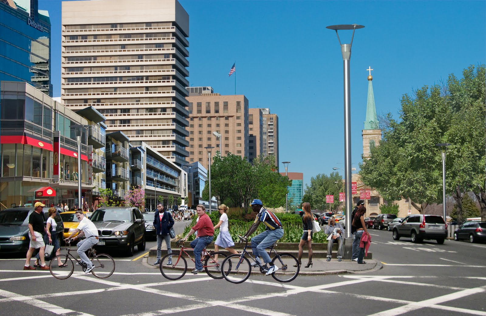
A potential vision of the New Memorial Drive. Rendering by author for City to River.

Can Saint Louis be the Next American City?


In recent days, the Saint Louis Post-Dispatch has run a number of stories examining what Saint Louis must to to transition from being a formerly powerful industrial city to a successful 21st century city. Of note are the articles challenging Saint Louisans' reliance on organizational mentality and large corporations and difficulty attracting and retaining talent.
As someone who spends a considerable amount of time considering the future of Saint Louis and its potential sustainability, I feel this will prove to be an extremely productive conversation even if the only produce is a heightened a sense of urgency.

I would like to contribute to this discussion by running an as yet unpublished opinion piece that was originally submitted to St. Louis Tableau in 2009.


“The idea of a great city never has occupied a comfortable place in the American imagination”
-- Lewis H. Lapham. “City Lights.” Harper’s Magazine, Issue 285. July, 1992. p. 4.

“If the city were to decline, no one would rebuild it according to the present plan. That alone discloses our own judgement on our cities.”
--Henry Ford as quoted in
“Detroit Vacant Land Survey,” Detroit: City Planning Commission, 24 August, 1990.

American cities have occupied a culturally vulnerable position since the coalescence of our nation. The United States was founded on a doctrine of equality and self-sufficiency. While the urban center had once represented a freedom from feudalism in Europe, American freedom was, from the beginning, predicated on land-ownership and independence of labor. As the French philosopher Henri Lefebvre notes "Urban democracy would imply an equality of places" while the traditional urban ideal of centrality “would produce hierarchy and therefore inequality"1. Urbanized cities were therefore associated with monarchies and empires. It was Thomas Jefferson’s utopic vision of a nation of gentlemen farmers that precipitated a feud with Alexander Hamilton’s urban Federalists; this philosophical difference led to no less than the birth of American political parties. A century later, the eminent historian Frederick Jackson Turner explained the American psyche using a frontier thesis:
“the existence of an area of free land, its continuous recession, and the advance of American settlement westward, explain American development.”2
While Turner himself thought that the closing of the frontier would result in “the birth of a new nation in America,”3 Jefferson’s vision still resonates strongly in current debates about suburbanization and in NIMBY resistance to density throughout the country.

The decline of American cities is most commonly attributed to the destructive structural changes of the postwar period. While factors such globalized economic forces are geographically neutral, many other changes were certainly motivated or effected by the anti-urban ethos that has permeated American culture and politics since the beginning of the country. The Federal-Aid Highway Act of 1956 spawned the interstate system, decentralized industry, and led to the demolition of significant tracts of every large city. The National Housing Act of 1937 created the Federal Housing Administration loan program. FHA subsidized mortgages reflected the anti-urban convictions of the period through numerous measures including the disinclination for multifamily building loans, prioritization of single-family home loans, and limitation of rehabilitation loans to short durations with miniscule amounts.

The net result of these policies was the subsidization of a climate where it was easier and cheaper for a family to buy a new home in the suburbs than to renovate an existing one in the city. With a clear prioritization away from the city, the population shares of cities within metropolitan areas decreased from roughly seventy to forty percent. Cities such as St. Louis lost over sixty percent. The result of this migration was a declining commercial base combined with a service intensive and poorer population. This caused cities to become more reliant on public revenue. With less power, cities assumed a lower profile in American culture and “Americans [were] thereby inclined to be more accepting of the many disruptions and disparities that engulf them and to acquiesce more readily to society’s dominant interests.”4

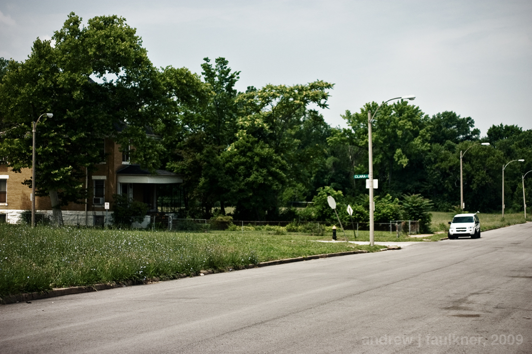
The transfer of wealth from the cities left them unable to address escalating problems. Photo by author.

The cultural neglect of cities in combination with an increased population of disadvantaged residents led decreased accountability. Self-interested bureaucracies either grew ineffectual or, failing at traditional redevelopment strategies, desperately grasped for larger and less advantageous forms of development. Most cities entirely neglected small businesses and committed to an increasingly cutthroat gamble to attract and subsidize large corporations. This reactive strategy had its root in anti-urban attitudes and was predicated on an understanding of development as an adversarial game of zero sums.

St. Louis Marketplace, built with generous Tax Increment Financing, is now failing due to metropolitan retail competition. Photo by author.

As Kingsley Davis wrote in 1965:
“In the later stages of the cycle ... urbanization in the industrial countries tends to cease. Hence the connection between economic development and the growth of cities also ceases”5.
The economic gains of the city had to be won from outlying suburbs or other regions, and all political effort should be expended towards these ends rather than fostering growth at a larger scale. These stopgap strategies resulted in an urban core characterized by vast swaths of neglected and deteriorating neighborhoods and punctuated by autonomous complexes and speculative developments.

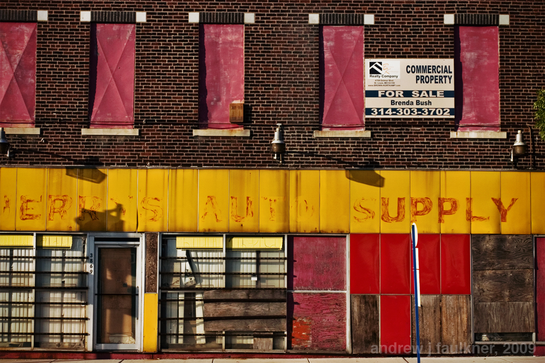
Resources are withdrawn from deteriorating sections of the city to enable high profile development projects. Photo by author.

It is this form of urban redevelopment that U.S. News & World Report reporter William Allman assessed on his homecoming to St. Louis:
“Coming back to St. Louis after many years ... the city’s surface has changed considerably... [T]hese changes, while putting a shine on the old city, are merely cosmetic. The downtown areas seemed designed primarily for tourists”6.

That cities have suffered extensively in the past decades as a result of cultural bias and legislative subsidization is well established, but where do we go from here? Allman’s assessment still rings true in St. Louis today. One smirking critic derisively assessed improvement efforts surrounding the 2009 All Star Game as “lipstick on a pig”7. Clearly current paradigms are not wholly succeeding, nor are they taking advantage of several assets possessed by St. Louis and many other shrinking cities.

First, the low property values throughout the city and the fine grain of existing development and platting are an asset, not a liability. Low property values mean a substantially more affordable cost of life and greatly increase the potential to cement ties to a community through property ownership. For a small businessperson, cheap rents can mean the difference between failing or expanding to buy the premises. Furthermore, the small scale of neighborhoods and buildings makes renovation and maintenance substantially more manageable and enables more residents to acquire property for rehabilitation and lease. It is counterintuitive given the fragmented nature of urban landholding to continue pursuing large-scale suburban development strategy in urban areas. To do so is to ignore the powerful economic potential for upward mobility and increased tax bases through grass-roots redevelopment. St. Louis’s ravaged but remarkable building stock represents the single greatest asset of the city, and its affordability represents an extraordinary potential to attract the businesspersons and innovators who will shape the next century.

The cycle of economic stagnation described by Kingsley Davis is based on one major variable. His analysis on the decline of urban growth was premised on the cessation of people moving from agrarian areas to the city, for “once urbanization ceases, city growth becomes a function of general population growth”8. Therefore, another potential for city growth in an urbanized society is not based on poaching jobs from other municipalities, but on attracting new immigrants to the nation and to the city. By enabling them to start businesses and facilitating their upward mobility the tax base may rebound from the damage caused by suburban flight. A recent Brookings institute paper studies economic success and the patterns of movement and resettlement in the metropolitan area. The authors note that such upward mobility “may be the most important force operating in metropolitan areas, but urban public policy has taken little account of it”9. St. Louis needs to attract immigrant and young entrepreneurs by making a serious commitment to market its affordability.

The city must connect potential entrepreneurs with real estate opportunity. Photo by author.

Many strategies to attract immigrants and small businesspeople require far less investment than current initiatives. First, an accessible and comprehensive database of vacant and available commercial and retail spaces is urgently needed. If this were coupled with a broad-based homesteading program that would dispose of the approximately 9,300 parcels of land owned by the city Land Reutilization Authority,10 these programs could do more to revitalize the city than any corporate redevelopment. For an example of such a program we need only look down the Mississippi to the small city of Paducah Kentucky. Paducah’s Artist Relocation Program11 combines real estate services with rehabilitation assistance to attract live-work artisanal small businesses to a designated neighborhood. Once entrepreneurs can be attracted to set up businesses, the city must continue assisting them by simplifying permit processes and providing tax incentives to use local suppliers and employees. Finally, the building stock of the city must preserve a range of scales and price points to allow for upward mobility and aging without forcing relocation.

The city can capitalize on its greatest asset, its historic building stock, through a concerted effort to encourage entrepreneurship and immigration.. Photo by author.

The city of St. Louis has a difficult habit of comparing itself with Chicago, but let us examine New York for a change. In a recent article, New Geography reports that a culture of favoritism towards major development interests has led to an increasingly fraught climate for small businesses in America’s most urban city. In a survey of Hispanic business owners “84% believe New York City is no longer a good place for immigrants to open their businesses”12 yet when asked where they would recommend opening a small business the majority still recommended the Northeast.

With an unbiased reappraisal of our assets and a new policy that takes advantage of our low costs, publicizes our opportunities, favors small business creation, and assists upward mobility St. Louis could take over where New York has failed. What are we waiting for?


1 Lefebvre, Henri. The Urban Revolution. Minneapolis, Minnesota: University of Minnesota Press, 2003. p, 124 .
2 Turner, Frederick Jackson. The Frontier in American History. New York: Henry Holt and Company, 1921. p. 1. Available online here.
3 Turner, The Frontier in American History p. 311.
4 Beauregard, Robert A. Voices of Decline. New York: Routledge, 2003. p. 245.
5 Kingsley Davis “The Urbanization of the Human Population,” in the City Reader, ed. Richard T. LeGates and Frederic Stout (London: Routledge, 2003) p. 30.
6 Allman, William F. “St. Louis” U.S. News & World Report, vol. 107. December 18, 1989: p.49-50. As quoted in Beauregard, Robert A. Voices of Decline. p. 222.
7 Hamilton, Keegan. “Extreme Makeover: All-Star Edition: St. Louis is cleaning house for the midsummer classic, but is it, well, lipstick on a pig?” Riverfront Times. July 7, 2009.
8 Davis, “The Urbanization of the Human Population” p. 30.
9 Bier, Thomas. "Moving Up, Filtering Down: Metropolitan Housing Dynamics and Public Policy." Available online here. September 2001.
10 Montee, Susan, et al. "Audit of the City of St. Louis Community and Economic Development Offices." Available online here. April 2009.
11 For more on the Paducah Artist Relocation Program see http://www.paducaharts.com/
12 Null, Steve. "New York City Closes Shop." Available online here. August 7 2009.

Necropoli Pt. II: The Only Constant?


Part one of this essay examined the rise of the cemetery in the western world and considered the relationship of cemetery to urban form. This passage considers the effects of changing attitudes on the traditional cemetery and attempts to uncover the potential benefits of rethinking the cemetery.
Cemetery at the edge of Romney, West Virginia by John Vachon for the FSA.

Cemeteries stand in cities throughout the world as memento mori -- monuments reminding us of our own mortality. Intensely loaded with religious symbology and cultural allegory through their design, these places often represent the values of a place most clearly. The character of the cemetery runs the gamut from touching intimacy to cold and unsettling monumentalism. Whatever the scale, however, the immense labor needed to build and maintain cemeteries is always owed to the eternal human desire to be remembered after death. Whether this desire for immortality represents mankind's philosophical need to detach from natural processes remains debatable, but it has led to the development of an architecture that outlasts culture and it is the cause for the underutilization of significant tracts of land today.

Throughout the twentieth century there have been frequent calls to re-envision the methods and rituals with which we take leave of our dead. The most significant shift has been the gradual progression towards acceptance of cremation. While we take this method for granted now, it has only become an option within the past fifty years. Many of those who crusaded for cremation saw it as a more dignified method of interment. As the twentieth century began, popular culture became obsessed with strategies of mummification and preservation which have continued into the current interest in cryogenic freezing. As Unitarian Rev. Thomas R. Slicer was quoted in a 1921 study by S. Adolphus Knopf1:

“Nothing seems to me to be a more direct affront to nature than hermetically to seal up a human body and then place it in the ground, as though one defied nature to have access to which belongs in it: -- Unitarian Rev. Thomas R. Slicer in Knopf, S. Adolphus. “Cremation Versus Burial--A Plea for More Sanitary and More Economical Disposition of Our Dead,” New York: American Public Health Association, 1921.

This statement marks an early challenge to the egotistical desires to preserve human remains in perpetuity. If mortality has proved incompatible with productivity driven modern culture, then cemeteries exist as a precarious third space.

Beyond the effect that cultural changes have had on cemeteries, modern life also conspires to reduce their importance. As globalization has increased mobility, the bond between the living and their ancestors is frequently severed by distance, time and culture. The historical ideal of a cemetery is represented above in the image by John Vachon; cemeteries were steeped in place and personal history and represented an axis mundi between settled inhabitants and their ancestors. With a distinct minority of the population entertaining any expectation of spending their lives near their birthplace cemeteries cannot fulfill the same social role they once did. The extreme result of mobility has been frequent abandonments and derelictions of burial grounds as descendants lose touch and funeral societies die off. 2.
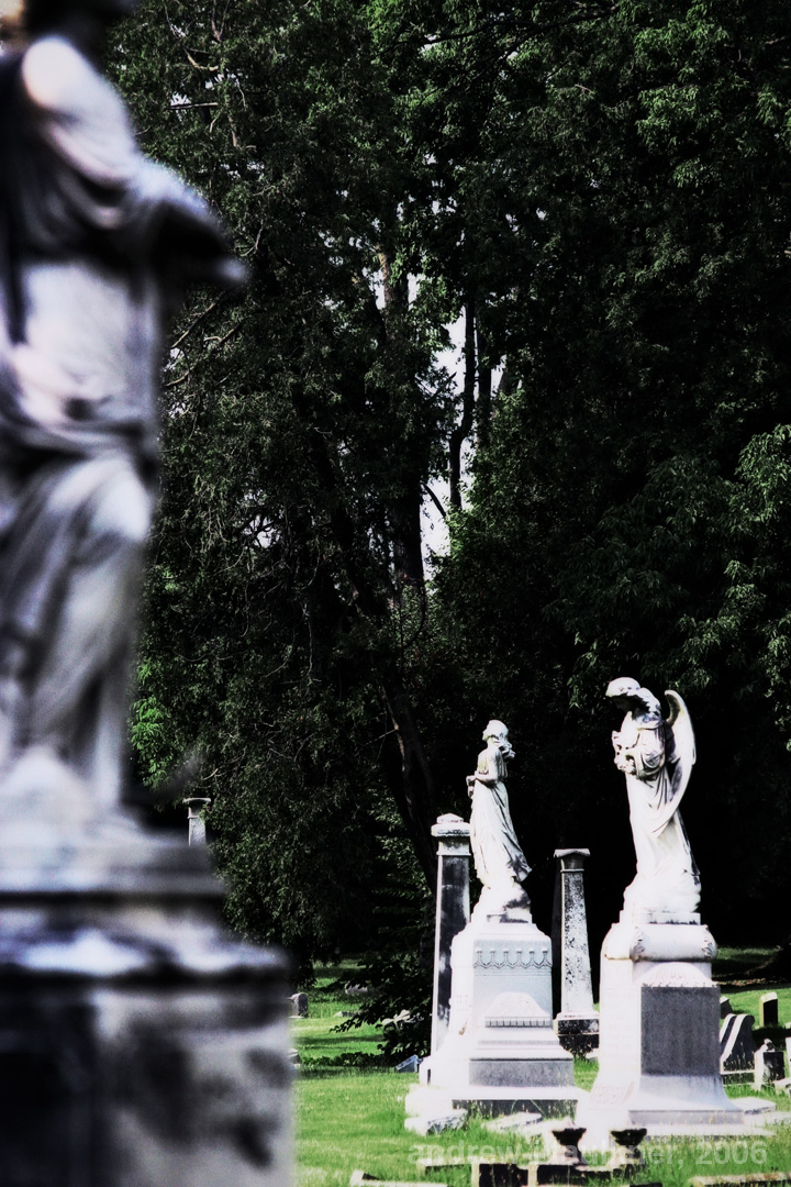
Headstone at Old St. Marcus Cemetery Park, St. Louis. Photo by author.

In addition to the dereliction of cemeteries, widely dispersed cemeteries decentralize land use and facilitate sprawl. The difficulty of assembling urban land forced the modern cemetery to the periphery of urbanized areas. Today many cities are constrained by a noose of cemeteries and floundering golf courses. In St. Louis County both cemeteries and golf courses were developed outside city limits along interurban streetcar lines for ease of access. This has led to a clustering of such facilities near St. Charles Rock Road and along Gravois/Hampton. Many of these cemeteries are faltering and several have been cited for questionable practices or have fallen into default. The most striking example of this phenomenon is Old St. Marcus cemetery at 6638 Gravois Rd. Old St. MArcus was founded in 1856 by the congregation of the St. Marcus German Evangelical Church. Only around 3,000 of the 19,500 burials were provided for under perpetual care. The cemetery was succeeded by New St. Marcus cemetery in 1896 and was defunct by the 1950's. It was abandoned for almost thirty years leading to intense vandalism, crime, and rumors of grave robbing. By the late 1970's the weeds in the cemetery was completely overgrown and the city seized it for a park. What few headstones were left were stacked into walls and the grounds today are an eerily empty park punctuated by remaining gravestones that frame views of an adjacent public pool.
Old St. Marcus Cemetery Park. Photograph by author.


As Julia Levitt wrote at Worldchanging.com: "The next time you're waiting at an intersection, look around and imagine how much of the built (and furnished) environment stands empty and unused at any given time.”3 This examination should be applied to all land uses. Can we devise alternative uses for these overlooked cemetery spaces? Can we reutilize them or redevelop them to spur greater density and increase transit feasibility outside urban cores and in postwar suburbs?

The next part of this series will deal with a vision for redeveloping cemeteries as part of a sustainable infrastructure network.

Necropoli pt 1: Urbanism of the Dead


No earthly state stands less fickle,
As with the wind that waves the wicker,
So waves this world's vanity--

Fear of death unsettles me.
...
Unto the Death go god's estates,
Princes, lawyers, Heads of state,
Both rich and poor in all degrees--

Fear of death unsettles me.


--Joe Scanlan, "Lament for the Makers"


Headstone at Greenlawn Cemetary, Columbus, Ohio.

This is the first part of a three part series that will focus on cultural/spatial responses toward death, the tenuous position that cemetery ritual has in modern culture, and a radical rethinking of burial practice as sustainable infrastructure.

Part One: The Emergence of the Cemetery

Burial grounds stand in cities throughout the world as memento mori or monuments reminding us of our own mortality. Intensely loaded with religious symbology and cultural allegory through their design, these places often represent the values of a culture most clearly. Originally intended as places of mystic ritual, burial grounds are the spatial reification of humanity’s struggle with that which lies beyond understanding.

Before the modern area burial grounds served as an anchor of community. People were born, families were created and members died within eyesight of their place of worship. In the western world the church graveyard served as an extension of the home. The church graveyard was so expropriated by its living constituents that “the church finally had to forbid such activities as gambling and dancing within cemeteries”1.

That such an idea seems alien to the modern observer is a result of the massive cultural shift in the modern age. In the seventeenth and eighteenth century numerous church graveyards had begun to give way towards organized cemeteries in many European cities. These early cemeteries were orderly necropoli containing a grid of small mausoleums where the dead were interred in an urban environment resembling that in which they lived their lives. Such cemeteries are rare in this country. The best examples can be found in New Orleans, which as a far outpost of France did not witness the post-revolutionary cultural change that the motherland did.

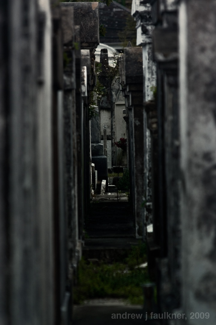
Lafayette Cemetery Number One, New Orleans, Louisiana.

After the French Revolution, the strict rectilinear order with elite districts of ostentatious interment was believed to represent the ancien regime. Those that laid out new cemeteries sought a more egalitarian design and looked to the culture of rural laborers for a new order. As this type of cemetery was built in England and the United States, this practice coalesced into a structured reinterpretation of a pastoral landscape. While such cemeteries strive to seem untouched idylls they harnessed the very latest engineering and hydraulic innovation to reshape the landscape.

As a result of their bucolic appearance cemeteries assumed the public life that once characterized the church yard. In the high Victorian area cemeteries, like asylums, were not seen as places of difference, but rather served as needed islands of nature in industrial cities. It was common for families to travel to the cemetery or asylum grounds for weekend picnics or recreation. Such practices led to efforts to create publicly accessible parks. Despite their popularity, cemeteries still were redolent of human mortality, and, as the nineteenth century ended, parks displaced cemeteries as grounds for recreation.

The idyll of death: landscape at Greenlawn Cemetary, Columbus Ohio.

While cemeteries were seen primarily as places of recreation that would provide religious and moral instruction in Victorian times, these sentiments have become incompatible with modern lifestyles. "There is no available ideology to integrate them comfortably into the rhythms of the metropolis."2 Cemeteries have again changed to reflect current culture. While burial once emphasized the deceased’s ties to kin with demarcated family plots, ornamental fencing, common design, and often communal monuments, modern monuments seem designed to accentuate the individual. The landscape has become an unsuccessful hybrid of the idyllic and the Euclidean with a gridded aggrandizement of individuality overlaid over an impotent derivation of a depoliticized peasant landscape. Furthermore, the loss of the cemetery as communal space has also led to the relegation of the dead to the margins of society.

In the premodern area, through shared ritual and spatial proximity the dead were allowed to exist within society. Today, disease is viewed from the lens of unproductivity, and death is the anthesis of the productive life that defines success. Our culture banishes death to the margins and refuses to contemplate its meaning, for “In a society that officially recognizes ‘rest’ only in the forms of inertia and waste, death is given over for example. to religious languages that are no longer current, returned to rites that are now empty of the beliefs that once resided in them”3. Today cemeteries exist as dualistic monuments: monuments to the desire of eternal memory in the face of death and monuments to the practices and customs of our ancestors.

Modern headstones contrast with empty attempts at romantic landscapes, Laurel Hill Cemetery St. Louis.

Works Cited in this Article:
1 Kearl, Michael C. Endings: a Sociology of Death and Dying. New York: Oxford University Press, 1989. p. 50. 2


2. City A-Z. Ed. Steve Pile and Nigel Thrift. New York: Routledge, 2000. p. 92.


3 De Certeau, Michel. The Practice of Everyday Life. Berkeley: University of California Press, 1988. p. 192


Coming Soon: Part 2: The Psycho-spatial disconnect of Modern Cemeteries

Streetcar Urbanism in St. Louis: A Proposal


Note: This piece is the continuation of a previous post examining the proposal by Joe Edwards to build a two mile streetcar (neé Trolley) line to connect the Delmar Loop area with the Missouri History Museum and Forest Park.

In the first article I compared the Loop Trolley project to a streetcar project in Columbus, Ohio:

"...the Loop Streetcar connects an already developed area (named one of America's 10 Greatest Streets in 2007 by the American Planning Association) with Forest Park and would run a mere two and one quarter miles. Of this length, only around eight blocks have any potential for the streetcar to serve as a catalyst for significant redevelopment. The Columbus proposal would have been greater than five miles in length, would have connected five distinct economic centers and could have provided the catalyst for over thirty blocks of undervalued property."


My contention is that the Loop Trolley should not be envisioned as a tourist attraction as it is now, but should be understood to be the start of a restoration of an effective surface transit network and as an engine for incremental growth.

"Cleveland’s [St. Louis's] leadership has no apparent theory of change. Overwhelmingly, the strategy is now driven by individual projects. These projects, pushed by the real estate interests... confuse real estate development with economic development. This leads to the 'Big Thing Theory' of economic development: Prosperity results from building one more big thing."
- Ed Morrison, "Cleveland: Reconstructing the Comeback" via The Urbanophile

St. Louis, like many mid-sized cities, represents Morrison's assessments of Cleveland to a tee. The influential industrialists that motivated major changes a century ago are gone. Names like Wachovia have replaced the financial firms that outlasted the demise of industrial powerhouses like the St. Louis Car Company or the American Stove Company. Other powerhouses such as Anheuser-Busch have been sold overseas. As the Urbanophile describes, transactional businesses such as real estate have completely replaced the industrial/commercial ogliarchy of old. Thus, real-estate development is conceptualized as economic development, and the major infrastructural improvements that could drive the development of revitalization and attract the necessary workforce for innovation are sacrificed for strip malls, warehouses, or failed commercial redevelopments.

The political and economic situation bears striking similarities to Paul Collier's assessment on post-conflict recovery:
The first principle is, it's the politics that matters. So, the first thing that is prioritized is politics.

[Development should proceed in the most apolitical way possible. Decisions should be made with the entire city and region in mind, not for one ward at the expense of another or one region at the expense of another.]

And then the second step is to say, "The situation is admittedly dangerous, but only for a short time."

[Development decisions should be made with a view towards fostering sustainable growth and future development, not through short-term job creation and TIF-baiting]

And thirdly, what is the exit strategy for the peacekeepers? It's an election. That will produce a legitimate and accountable government.

[Development (especially infrastructure development) should be freed from electoral cycles and the control of aldermanic discretion]

So that's the conventional approach. I think that approach denies reality. We see that there is no quick fix. The reality is that we need to reverse the sequence. It's not the politics first; it's actually the politics last. The politics become easier as the decade progresses if you're building on a foundation of security and economic development. The rebuilding of prosperity.

Why does the politics get easier? And why is it so difficult initially? Because after years of stagnation and decline, the mentality of politics is that it's a zero-sum game. If the reality is stagnation, I can only go up, if you go down. And that doesn't produce a productive politics. And so the mentality has to shift from zero-sum to positive-sum before you can get a productive politics. You can only get positive, that mental shift, if the reality is that prosperity is being built...

But the objective of facing reality is to change reality.
--Paul Collier "New Rules for Rebuilding a Broken Nation", 2009.
(emphasis and bracketed comments added)

In the interest of changing reality, I will show how extending the Loop Trolley beyond Joe Edwards's vision could begin to act as an economic driver for urban redevelopment and could be leveraged in subsequent phases for future growth.

Phase I: 2015
Changes to proposed route: Light Blue
Beginning with the initial route proposal, I examined the street widths along the route and efficiency statistics from several cities. The Loop Trolley is currently planned to occupy two traffic lanes (two way traffic) on Delmar through the Loop. At this point Delmar is only 48' wide and Loop Trolley planners intend to retain two lanes of street parking. Note that Portland's Streetcar System Concept Plan predicts an average speed of 7 mph riding in traffic. By comparison, a streetcar in a median right of way will typically achieve a speed twice as fast.

In order to facilitate a separated right of way, the streetcar has been routed to run westbound on Delmar, looping around to Kingsland via Loop S. The streetcar would the head north on Kingsland before heading eastbound on the Vernon Ave. Loop bypass and would rejoin Delmar at the MetroLink station (Des Peres Ave.).


View Streetcar Proposal in a larger map

This route would have other benefits beyond merely increasing line speed. The eastbound routing on Vernon follows the #2 Bus and would connect the 1,500 residents in the Parkview Gardens neighborhood with the MetroLink station. This proximity to transit would also spur redevelopment of the underutilized commercial strip along Vernon between Kingsland and Westgate.

Amendments to proposed route: Light Blue
The two major problems with the existing route are that the History Museum is not a strong enough draw for a terminus, and it does not service any major job centers. In the turn of the twentieth century streetcar companies addressed this issue by building amusement parks at the end of their lines to draw more traffic.

To solve this problem, I proposed extending the route on Delmar to the Central West End and looping around the West End. While the Olive streetcar originally ran in a zigzag west from McPherson to Waterman (at Kingshighway) to Pershing (at Union), Delmar is an excessively wide boulevard with ample width for two dedicated and separated tracks.
The CWE loop would take advantage of the wide median on Kingshighway to loop south to Laclede (within easy walking distance of the Barnes Jewish/Wash U/Children's hospital complex) and then continue on Buckingham (reversed one way from present) to North Ct./York Ave. and then through the heart of the CWE on the old Maryland #12 Streetcar ROW. The loop would then follow that ROW left on Boyle and turn westbound at Delmar.


View Streetcar Proposal in a larger map

Besides connecting an estimated 26,000 employees at the hospital with numerous commercial businesses in the Loop and the CWE, this alignment would provide a major impetus towards redevelopment on the north side of the CWE. Over 14 blocks of underdeveloped land would see an increase in value and the streetcar would provide considerable assistance to redevelopment efforts in the former Gaslight Square area. This route, around seven miles in length, would require more route investment, but would not require additional carbarns or maintenance areas. Such an extension would drastically increase boarding and would secure the viability of the Loop Trolley proposal.

Phase II: 2020: Green
Pending successful operation of the Delmar Loop/Central West End, an expansion could be easily planned along the former Olive St. ROW and McPherson/Washington. This expansion would be a compact figure eight meant to connect the Delmar Loop/Central West End with the museums and entertainment facilities in Grand Center. The figure eight would run as a spur from the CWE route during designated hours. The estimated time on the extended original line from City Hall in University City to the Fox theater would be 25 minutes.

At the same time construction would begin on the reinstallation of the #70 Grand streetcar line between a loop opposite John Cochran VA hospital to a loop just north of Grand and Gravois. This section would completely follow former streetcar right of way and be able to run in a dedicated median as a result of the wide street width.


View Streetcar Proposal in a larger map

This route would replicate one of St. Louis's most used streetcar routes and would connect the VA Hospital with Saint Louis University Hospital, and the cultural institutions in Grand Center with the populations of both University City and the near south side. The CWE extension could bring more redevelopment on the eastern fringes of the Central West End and both routes provide valuable support to the nascent efforts of the Locust Business District.

Phase III: 2025: Yellow
Phase III would include a Washington Avenue/Olive Street line that would run from the Blue line loop east of Grand through the loft district to Laclede's landing and the Arch MetroLink station. In addition, a new line would be built running south on Florissant from Palm St. through downtown on Tucker with a connection to the 14th St. Greyhound/Amtrack/MetroLink station, and south on Gravois to Grand.


View Streetcar Proposal in a larger map

The Washington/Olive route would provide economic support for the underdeveloped areas between Grand Center and the Loft District and would integrate the faltering entertainment district at Laclede's Landing with downtown institutions such as the Convention Center. The Florissant/Tucker/Gravois route would connect some of the most densely populated areas of the city with jobs downtown and with other necessary amenities while spurring redevelopment in St. Louis Place and integrating Old North St. Louis with downtown.

Phase IV: 2035: Purple
Phase IV would include an extension on the #70 line north from the VA Hospital to N. Florissant Ave, an extension south on the Gravois line from Grand to Germania St, and a line on Natural Bridge from the UMSL South MetroLink stop to Palm and North Florissant.


View Streetcar Proposal in a larger map

These routes would leverage existing streetcar routes and would connect with existing transit corridors. Furthermore these routes would tap into dense population centers in the city and would facilitate small scale economic and storefront redevelopment.

Phase V: 2050: Brown
The final planned phase would consist of three lines along former streetcar routes. A Goodfellow/Union/Hampton line would connect from the Riverfront transit center to Forest Park and the end of the Gravois streetcar in far south city. A Martin Luther King/Cass Avenue streetcar would provide an East/West connection on the near north side from the St. Charles Rock Road MetroLink Station to downtown. A Broadway/Chippewa line would connect the Cass Ave. line through downtown/Soulard and south city to the Shrewsbury MetroLink station. While it is too far in the future to prognosticate development potential, this line could provide a great development impetus to the neglected industrial land along the south riverfront.


View Streetcar Proposal in a larger map

While this was an intellectual exercise, it emphasized some key lessons. First, any proposed transit as expensive as a streetcar line must serve a vital connection need and must connect key employment destinations. Cultural destinations are important draws, but major employers are vital. Secondly, while there are parts of the city that suffer from a lack of transit, the best route is an already successful route. More revenue upon opening will provide a greater impetus to expand the system. Finally, due to the era of development in St. Louis, the built environment and infrastructure was specifically designed for streetcar-based transit and a considerable amount of infrastructure remains to this day. Therefore, implementation is not as difficult as in other cities.

For other route proposals look here and here.

UPDATED - Streetcars: things just ain't what they used to be


There has been much consideration and discussion here in Saint Louis about Joe Edwards's plan to reintroduce a streetcar on Delmar Boulevard. The conversation here has been the duplicate of a similar debate raging in my birthplace of Columbus, Ohio. In the case of Columbus, financing was never fully established and that uncertainty, combined with the economic downturn, led to the project being put on indefinite hold.

There are some major differences between the proposals for streetcar lines in Columbus and Saint Louis. In Columbus, the effort was led by a task force formed by the mayor. In Saint Louis, the impetus has come from a private developer, Joe Edwards, who has been the key player in the incremental revitalization of the Delmar Loop. In this case the politicians involved seem to have caught trolley fever and were extremely disconcerted to learn that even in Portland fares only make up 16% of total funding. While this is not earth-shattering if you consider streetcars another form of transit (streetcars pay a larger percentage through revenue than interstate highways for example) but troubling if this is envisioned as merely a novelty.

More tellingly, the philosophy behind each proposal has been different. The lines in Columbus were conceived to connect the 40,000+ population at Ohio State University with jobs downtown and the entertainment and nightlife destinations in the Arena District and Brewery District. The initial plans also involved connecting Columbus State Community College and the Columbus College of Art and Design. As Mayor Michael B. Coleman stated:
I think connecting the Ohio State University to the Brewery District, and the Arena District to the Discovery District, which is CCAD area and Columbus State, is something I think will add to the value of the city, and will be an element of the quality of life to young professionals finding Columbus as a place they want to stay. And anywhere that streetcar is located, you will see restaurants, retail, offices, and residential, all along the line. It will be the spur and difference-maker for economic development in our downtown, in addition to getting around. So it’s a huge catalyst for vibrancy, a huge catalyst for economic development, and a huge catalyst for just getting folks around…

In comparison, the Loop Streetcar connects an already developed area (named one of America's 10 Greatest Streets in 2007 by the American Planning Association) with Forest Park and would run a mere two and one quarter miles. Of this length, only around eight blocks have any potential for the streetcar to serve as a catalyst for significant redevelopment. The Columbus proposal would have been greater than five miles in length, would have connected five distinct economic centers and could have provided the catalyst for over thirty blocks of undervalued property.

The difference is stark, and it is clear that the proposed Loop Trolley (just the use of the term trolley instead of streetcar makes it clear it is planned solely around nostalgia) is meant entirely as a tourist attraction rather than as real transit. This is dangerous for two major reasons. First, as a tourist vehicle, it is especially susceptible to bad publicity. People tend to act much more strongly to entertainment and non-vital establishments once a problem has occurred. Compare the shopping malls to grocery stores; non-essential venues such as shopping malls are exceedingly susceptible to bad publicity. A failure of the Loop Trolley could set back surface transit in Saint Louis for thirty years to come. Furthermore as commenter "Adam" noted at Saint Louis Urban Workshop the brevity of the line is a huge liability in terms of operational sustainability :
When you build only one line, that one line has to absorb all the overhead for operating a streetcar system. It has to have a carbarn; it has to have the electrical substation; it has to have a dedicated trained staff to drive them. And, perhaps worst of all, if there's only one line, it has to be completely shut down for any street maintenance instead of being able to shunt around maintenance on an alternate line. Look at a map of most major cities, including St. Louis, before World War II. Streetcar lines ran up and down practically every major street. They didn't cost $30 million for one mile because resources were shared across many lines (also because labor was cheap). Frankly, $30 million for a single mile along existing streets is absolutely absurd. That's more than $5000 per foot--unless the rails are made of truffles, what is costing that much?

Setting aside the majority of these concerns, how could the proposed streetcar be improved?

It is clear that the trolley backers have not studied the ways trolley traditionally functioned in their proposed study area. A few design changes would have a great impact in recreating a successful streetcar urbanism and increasing safety along the route.

Loop trolley - conceptual rendering.

Looking at the conceptual rendering it is evident that the streetcar is proposed to run in the traffic lanes of already-congested Delmar Boulevard. While running the trolley in traffic lanes romantically hearkens back to the big city urbanism we know from grainy footage, by the time neighborhoods like the Delmar Loop were designed, it was clear that headtimes and safety were improved by separating surface transit from cars.


As this undated image shows, the handicap of streetcar systems is its general inability to detour in the event of accidents

The lushly landscaped boulevards we know today were a design response to this issue. Instead of running in traffic lanes, the streetcars were given a dedicated right of way in the center of the street. In some cities streetcar actuated traffic lights stopped cross-median traffic. The result was increased safety and efficiency for surface transit.


Video from separated ROW of Illinois Terminal Company interurban streetcars, Venice, Illinois.

Former streetcar right of way, now landscape in median, Wydown Bvld..

While not every potential streetcar route has enough width to support a separated system (streetcars typically need at least eighteen feet for unidirectional service) many of St. Louis's boulevards are in excess of 54' in width and some, such as Gravois are in excess of 75' in width. Additional space can also be made on streetcar arteries by limiting parking. Currently Delmar between Kingsland and the Wabash (metrolink) tracks has two lanes of parallel curb parking, two traffic lanes, and a continuous center turn lane (known as a "suicide lane"). The street width from the Wabash (Metrolink) tracks to the end of the line is approximately 48' from curb to curb. In this instance it would make sense to split the line and have one direction loop to the north using Vernon Ave. to avoid overly crowding Delmar and drastically reducing system efficiency.

East of the Wabash tracks the situation is far different. Both Delmar and DeBaliviere have ample street width due to their conscious planning for transit in the early 20th century. The street width is 75' on Delmar and 72' on DeBaliviere allowing in both cases for two dedicated tracks in the median and four traffic lanes with bike lanes or expanded sidewalks on either side. To get an idea of how a revised Delmar streetscape might appear we can look to St. Charles in New Orleans.

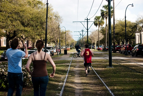
Neutral ground on St. Charles Ave. at Calhoun St., a transit right of way and pedestrian refuge.

St. Charles Avenue in New Orleans falls roughly between Delmar Boulevard and Gravois in street width. However, due to the streetcar right of way the street is humanized to a much greater extent. Please also note the picture above was taken in the midst of rush hour gridlock and shows how the neutral ground can create a space for recreation while diminishing car/streetcar contact and greatly increasing system efficiency. Such a right of way could also be flanked with bike lanes to increase efficiency.

In future posts I will propose realignments to the Loop Trolley route as well as future expansions, and examine the often overlooked urban design traits and infrastructure that enabled streetcar-based transit to be so successful, and assess what lessons we may learn from these examples to apply to the revitalization of our cities.

7.9.09 UPDATE:
I was unable to attend the forum on the Loop Trolley, but the presentation is online here:

Alex Ihnen, as usual, has thorough coverage at his blog.

I left the following comment:

While the added expense of running the trolley in the median is certainly an important consideration, I am concerned there is no conceivable way the Loop Trolley will be able to maintain efficient service competing with traffic on Delmar in the Loop during peak hours without separation. Note that Portland's "Streetcar System Concept Plan" (http://www.portlandonline.com/transportation/index.cfm?c=46134) expects an average speed of 7 mph riding in traffic as compared with 15mph in a median right of way.

If lanes are used, there should be a one direction bypass such as Des Peres/Rosedale/Vernon/Kingsland because any accident on the Loop with current levels of congestion would shut down the entire system. Ideally it would be best to limit street parking to one side and remove the continuous center turn lane. While politically divisive this would only eliminate around 100 parking spaces which could be accommodated in future development. The implementation of the Loop Trolly is a serious commitment to transit and should not be hindered by the automobile preference that currently dominates the region.

Three Blocks on Washington Avenue


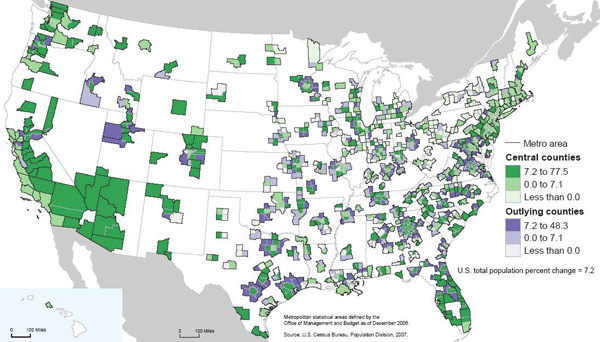
New Geography has just reported that a new Bureau of the Census report has found that exurban growth rates continue to far outstrip urban growth. While this finding might seem somewhat shocking in the face of nascent urbanism upswelling throughout most major midwestern cites and loft developments arising from Salt Lake City to Peoria, the scale at which urban redevelopment is occurring is not and cannot match the scale of greenfields development. The reason should be obvious. It is far easier to sprout houses on 400 acres of farm field without any neighbors or existing infrastructure then it is to assemble a massive urban tract for development. While I will not spend much time discrediting the author's slant (after all, the reviews of his book on amazon do that quite efficiently), attempting to deliberately ignore these differences in scale in order to deflate the significance of new urban population growth is a cynical manipulation of analysis at best. Positive Population Change for Cities and Outlying Areas.


Whatever the case, many Americans are continuing to seek their dreams in suburban and exurban areas. With the recent onslaught of coverage on suburban foreclosures it is germane to ask what will the suburban landscape look like in half a century? Will foreclosed houses become productive gardens for remaining residents? That possibility, while alluring, seems unlikely without concerted effort and regulation. It is more realistic to assume that the suburbia of the future will look like the cities of the present. With these thoughts in my head I decide to take a walk.

Washington Avenue is one of the significant streets of Saint Louis. It spans almost eight miles with fits and starts, beginning at the riverfront and ending in the streetcar suburb of University City outside the city limits. It is best known as the main artery of the former Garment District which has been redeveloped as a concentration of lofts and restaurants. Further west Washington Avenue (neé Terrace) is one of the most exclusive gated streets in the city. In between these two poles, and just north of the posh Central West End, Washington holds clues to the future of the suburb.

Like many thoroughly urban areas, Washington was once a suburb itself. Extending beyond the limits of city development across a wide area known as the Grand Prairie the development of the street was made possible by a new type of transportation: the electric streetcar. A number of car lines ran nearby, including the #10 on Delmar, the #15 Hodiamont on a private right of way several blocks north, and another line running on Olive from Lindell to Walton. [For the 1910 Map, click here.] Much of Washington was built as speculative development, and as we walk through the intersection of Walton and Washington we will see a perfect example.

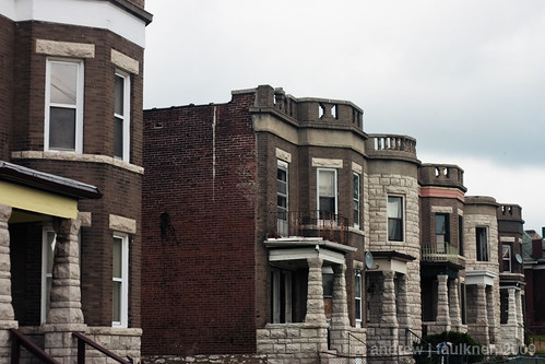
4617-4641 Washington Avenue.
These two family flats were built as part of a row of eight in 1901. Their lot division, atypically small even for this area, was the result of being near the junction of Washington with Olive and the streetcar line. At the time these flats were built, land value was a direct function of distance from fixed-route public transportation. It was only with the switch to buses and the uncertainty of a potentially variable route that this relation was severed.

Despite alternating brick and stone units, common features such as the placement of the turret and Jefferson windows above the porch tie the composition together. Two units have been demolished and the windowless one is in the clutches of Bowood Gardens, but despite the removal of integral context the power of the alternating repetition still makes for an excellent streetwall. Compare this image mentally with a typical modern suburban street. If every third house was replaced with an overgrown lot, how would it compare with the above image?

Wash Walt Taylor

Looking at the 1909 Sanborn map of the block it is evident just how much urban fabric the area bounded by Walton, Washington, Taylor and Delmar has lost. All of the red markings denote buildings replaced by vacant lots or parking, the green marks denote buildings replaced by more recent buildings. While I was unable to find any information on it, the loss of the courtyard apartment at Taylor and Washington was tragic. Despite all the losses, the relatively narrow block depths and remaining buildings still manage to keep the block from feeling like a wasteland. With suburban lots typically three to five times wider than these lots, the loss of a single foreclosed house to fire or demolition would have a much more severe impact on surrounding values on the cul-de-sac or road.

I continue walking east on Washington, crossing Taylor and then Newstead. The block of Washington between Newstead and Pendleton has seen some of the most dramatic loss of urban fabric.

Wash Newstead Pendleton


While this block has retained the wide-lot platting that belies its upper class origins, most of the original houses have been demolished. On the south side eight remain standing, on the north side only six. In contrast to the suburban style infill built on the south side in 1997 across two lots, the 2006 infill homes by X3 Developers are striking in their competency.

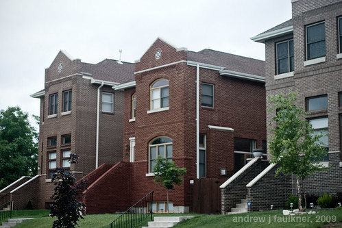
Three infill houses on Washington by X3 Developments.

Built at 4341-4347 Washington to replace three houses dating to the mid-1890's that had unfortunately been lost, these three infill units notably carry the masonry entirely around the building (unlike some recent failures). While the arched windows on 4345 are kitchy and not architecturally appropriate to Saint Louis, the flanking models have a nicely understated referencing of Richardsonian Romanesque. Since these sold for half a million dollars apiece, I feel compelled to note that the hipped roofs are a let down, the tectonics are too flat without more complicated brickwork and the stoop/stair combination is a blatant and unnecessary reference to brownstones over 1,000 miles away. While I would prefer for infill to refer to surrounding structures but ditch the weak historicism like Anthony Robinson's recent projects I would still not be disappointed if they filled in the rest of the empty lots on this block with more considered variations of these.

The true gem on this block is not the new infill, but an old remnant.
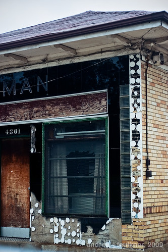
Service Station at Pendleton and Washington.

This service station was built to replace a mansion sometime in the 1920s to serve the growing motoring demand of the wealthy residents in surrounding neighborhoods. The beautiful black Vitrolite facade probably dates from the 1950s. Note the elegant reveals of glass block at the sides of the facade as well as the combination of green window mullion and chrome. The architecture of this facade displays a confidence not found even in the half million dollar infill houses. At the time of the facade installation this service station was a block away from the epicenter of St. Louis nightlife at Gaslight Square. The decline of Gaslight Square meant the decline of business for this little gas station. It served for a time as the home of Kugman Motors, but it has been vacant since at least 1989.

Wash Pendleton Whittier

The block of Washington between Pendleton and Olive has seen much change in the century since the Sanborn Map was complied. The failure of Gaslight Square led to the demolition of the north side of Olive between Newstead and Whittier in the early 1990s. As part of the Gaslight Square redevelopment Pendleton was realigned to connect with Boyle. This ironically eliminated the jog that gave Gaslight Square its name. The two institutions that anchored the block disappeared decades ago. Bishop Robertson Hall was a private Episcopalian school with a 2,000 volume library that closed in 1915. The Episcopalian nuns of the Good Shepard then moved to Baden. The more significant of the two, Hosmer Hall had been established as an elite girls school in 1884. Today it is remembered as the alma mater of poet Sara Teasdale and for infamously banning hair extensions in 1909. A decade after the World's Fair Hosmer Hall moved to Clayton. The school closed and sold their building to Clayton in 1936 and it became known as the Wydown School until it was raised and replaced in 1965 by the present Wydown Middle School.

The final stop on our walk is in front of one of my favorite buildings in Saint Louis. Often I daydream about having unlimited resources to realize any project in the city. While a part of me longs to save and rehabilitate the apartments at 5315 Cabanne, the building at 4005 Delmar, or maybe even the San Luis, only one house calls to me.

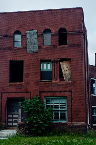
4243 Washington.

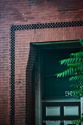
4243 Washington avenue is unique. For every building in Saint Louis exploding with ornate terra cotta or wrought iron ornament there are many buildings that derive their aesthetic power from restrained geometries that presage the modern movement by decades. In that class 4243 Washington stands out with an unprecedented geometric purity that reinforces its three powerful stories.

4243 Washington.

Built in 1891 on the northern edge of the Central West End 4243 Washington anticipated a density and level of income that was never to coalesce. Unlike the majority of the houses on the block 4243 had three full stories combining for 5,200 square feet on a standard 50'-0"x150'-0" lot. In 1909 it was the only house on the block to have a two story carriage house. It is unclear when the carriage house was demolished, but a garage constructed in 1994 now has taken its place.

By the late 1950's the neighborhood had changed. Upper and upper middle class residents had either retreated into the private streets to the south or left the city entirely. According to a twenty year resident of the block named Lee, during the heyday of Gaslight Square older neighbors recollected Tina Turner stayed with a friend at 4243 when she was avoiding Ike Turner. After the fall of Gaslight Square Lee recollected that there was a lot of crime and prostitution in the area. As buildings burned and were demolished most of the residents left. 4243 survived under the same owner as the neighborhood got quieter and quieter. In November 2003 long-time owner Louise Holland sold 4243 for $125,000. New owners Ralph and Katrina Russell bought the property and began to reahab the house. Unfortunately they lost it in foreclosure in 2007 while in the process of replacing the windows. The empty shell was then sold for $79,000 to a Kevin Settle who sold it to M&J Enterprise for $95,000. The new owners have not paid property taxes since they have purchased the building.

If ever there was a building uniquely suited for a vacant building registry, stabilization, seizure, and resale this is it! However, even boarding second floor windows (let alone tarping roofs!) is "too expensive" despite the far greater economic and environmental costs of demolition. Disregard that: in this city, like in our equally visionary sister city, demolition means jobs.