I participated in the second annual dART St. Louis event this month. Using the following quote from Susan Sontag as pretext, dART uses photography coupled with random chance to break down psychological and cultural barriers and draw attention to the multitude of overlooked places in St. Louis.
"The camera makes everyone a tourist in other people’s reality, and eventually in one’s own." -- Susan Sontag
.
Participants exchange a charitable donation for a dart and throw the dart at a wall-sized projected map of the city. Once your dart lands you have one month to create a photograph from within a block of where your dart landed. St. Louis's geographic reality strangely couples with the physics of dart throwing: the favored sector of the Central Corridor extends from downtown straight west across approximately 30º of what is essentially a 180º city. Many of the newly resurgent neighborhoods of the city occupy an additional 30º to the south of the Central Corridor and the middle-class stable and quasi-suburban neighborhoods occupy the outer part of the 20º to the South of that. What this means for dART is that those who are timid in their throw land in comparatively bland neighborhoods. I aimed high and hard and overthrew my intended targets of Vandeventer and Hyde Park, landing near E. Grand in the College Hill neighborhood (not to be confused with the BET series).
Approaching the photography I made several key decisions. The first was to reinforce the concept of dART St. Louis and center my investigation and images on the exact intersection of 19th and Bissell St. where my dart landed. The second was to avoid photographing either one of the iconic standpipe water towers equidistant from my site. Finally, owing to its location, College Hill is one of the first places in the City of St. Louis to see the rays of the morning sun and I decided to shoot as close to dawn as possible.
The blocks around my site have seen a systematic and continued population collapse over the past 50 years. Today, in the four blocks surrounding the site there are only 35 structures within 300 feet of the intersection out of 80 lots and two of the closest eight buildings are owned by the Land Reutilization Authority. The neighborhood was eerily quiet as I began taking pictures at 6:30am.
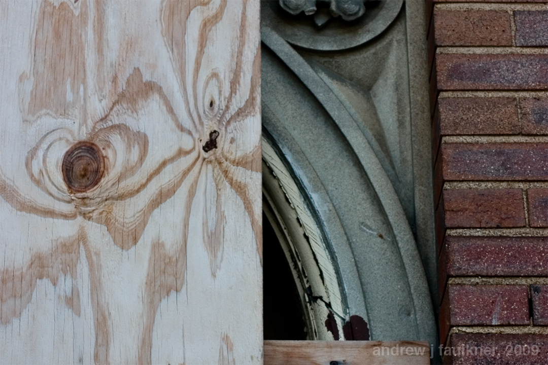
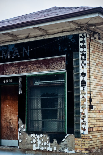
Morning dew The juxtaposition of cooly bleached wood and brick warmed by the rising sun caught my eye. This image was chosen for my submission through a crowd-sourcing effort by my facebook friends.
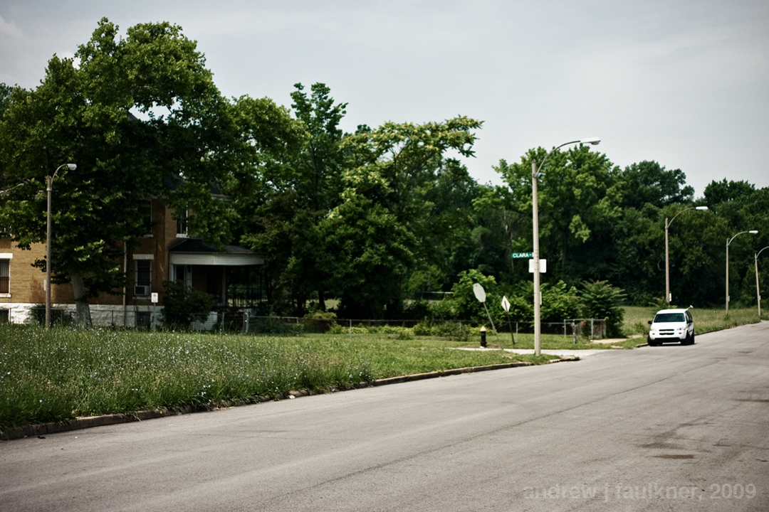
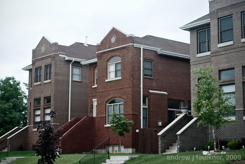
Quiet streets on College Hill This image captures the quiet and desolation of the particular corner quite well.
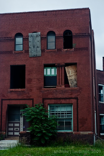
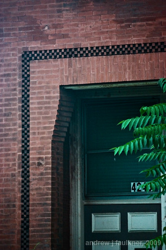
A worrisome detail As I began to look more closely at the details of the place a hidden narrative of tragedy emerged.
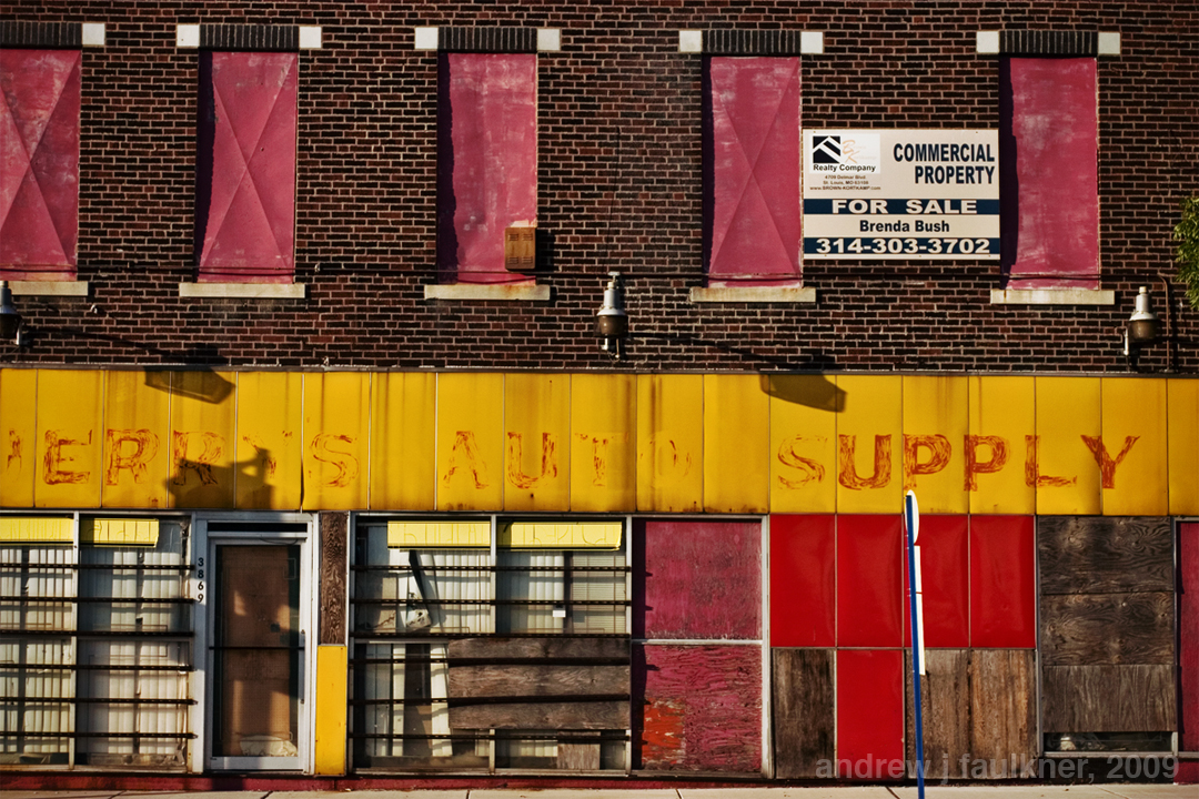
momento mori? Once I got home and was working on the images in post-production, I noticed the small pile of stuffed animals along the wall at the extreme right frame of the image. Whether these were just discarded or a memorial to a victim I do not know, but their presence along with the bullet holes in the storefront casts a pall of unease over the images.
Through a little research, I discovered that almost a year ago an 18 year old male was shot multiple times from a moving car while standing in front of the storefront building I photographed. At the time he was listed in critical condition, but whatever happened afterward remains a mystery.
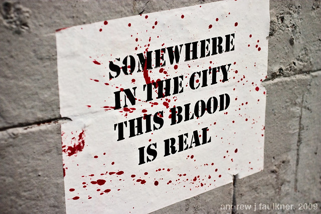
If the object of dART St. Louis is to make one feel like a tourist in one's own city, my experience reminds me of the single most effective piece of street art I have ever seen. I saw the following wheatpasting several times in New Orleans in 2009, where it was prominently put up throughout the touristy French Quarter:
Once again I seem to have fallen off the wagon as far as blogging is concerned. This is not for lack of interest, but rather lack of time. Since my last writing I have worked with Alex Ihen of nextSTL, RJ Koscielniak of Frontier St. Louis, and The Rebuild Foundation to develop a conference on the issue of vacant property in St. Louis. Currently St. Louis ranks second only behind New Orleans for percentage of vacant property with 19.3% of addresses vacant. Despite the scale of the problem, vacancy has not played a major role in civic discussion and both government and residents have turned a blind eye to the corrosive effect of vacant property on community stability.
One of my major complaints with urbanists in St. Louis is that activism has been confined either to the cozy confines of the internet or to ineffectual and late reactions to development issues. With Open/Closed we are taking a proactive stance by directing civic focus to an issue, convening a diverse group of residents, experts, practitioners, and politicians, and driving conversation.
In addition, we would like Open/Closed to serve as a paradigmatic inspiration to a new generation of urban activism. For too long St. Louis has been solely reactive and has waited for someone else to take the initiative. We are simply a group of concerned citizens who decided that this issue needed to be addressed. We organized this free conference in three months with no budget whatsoever. If we can do it, you can too.
Finally, in an unrelated note, I am now covering urban design and urban strategy issues for NextSTL. My first piece will be a three part series examining the recent 2010 Census redistricting data release. I will examine where we are as a city, what implication the data holds for the built environment, and how we should adjust our strategy for the next decade. As I write the pieces for NextSTL I plan to elaborate my thoughts on the data in greater depth here, so watch this space for more nuance.
Yesterday was a big day for the city of St. Louis. Five finalists in the CityArchRiver competition unveiled their proposals for the the St. Louis riverfront. Together we took our first step towards a bold and vibrant re-imagining of the arch grounds that will shape the image of St. Louis for the next half century.
While highway removal was not made explicit in every design scheme, a closer look reveals amazing support for highway removal. To quote the teams themselves:
“City to River articulates an enormous number of benefits arising from such a scheme…”
These proposals make it clear that experts from around the nation and world agree with City to River's growing network of supporters that highway removal is the ultimate solution to reconnect the city and riverfront.
Please join us tonight to learn more about the entries, show support for highway removal, and make your voice heard on this pivotal issue.
The front door of St. Louis has been unlocked. Can you help us open it?
In a recent study by Development Strategies the replacement of 1.2 miles of the existing 12 lane corridor with an adequately sized boulevard would open up to 500,000 square feet of developable land. These properties, in conjunction with adjacent vacant lots, could generate a value of $1.2 billion dollars in the next two decades. Based on this estimate, highway removal and redevelopment could provide as much as $6.3 million in annual property taxes to the city. An observer might bet that this windfall alone would be enough to attract political support, but they would have paradoxically long odds at this point.
In his 2009 presentation at TED Paul Collier prescribes a radical fix for global post-conflict recovery:
The reality is that we need to reverse the sequence. It's not the politics first; it's actually the politics last. The politics become easier as the decade progresses if you're building on a foundation of security and economic development. The rebuilding of prosperity ... The objective of facing reality is to change reality.
This matches the trajectory taken by City to River. The grassroots organization has found it far easier and more productive to engage those people and organizations who have a profound interest in the outcome. Unlike the typical convention center/stadium/museum attraction trope of urban development and more like the civic projects of a century ago, the development of an at-grade boulevard provides an armature for growth rather than a single deal to be closed. This potential and complexity requires a robust conversation with numerous parties and the negotiation of hundreds of varying interests. To echo Ed Morrison: If we were just building a convention center then "civic engagement [would be] a carefully circumscribed event, not a process; a meeting, not a collaboration." The problem with which we are confronted resulted from just such a hierarchical and artificial process -- to be successful our solution must be organic. City to River is developing what Morrison would describe as "complex public/private strategies [that] are developed in a “civic space” outside the four walls of any one organization;" and since January 2010 we have given over a hundred presentations to property owners, business associations, neighborhood groups, non-profits, design teams, and interested citizens.
As the above list of supporters demonstrates, the network of organizations and individuals that support the idea of reconnecting the C.B.D. of Saint Louis with the Arch Grounds, Laclede's Landing, Chouteau's Landing, and the North Riverfront incorporates diverse sectors: development, real estate, advocacy, non-profit, business, and media. Although updates from the CityArchRiver competition have been regrettably sparse, a recent email highlights major supporters of the CityArchRiver competition:
Congressional leaders from both sides of the Mississippi River have officially voiced their support for the international design competition set to frame the area around the Gateway Arch. The nine Democratic and Republican members of the St. Louis area delegation from Missouri and Illinois have sent a joint letter to the CityArchRiver 2015 Foundation, the group sponsoring the competition to select a design team to invigorate the Arch grounds and connect the Arch to downtown St. Louis, the Mississippi River and the Illinois side. The letter - signed by U.S. Senators Kit Bond, R-Mo., Roland Burris, D-Ill., Dick Durbin, D-Ill. and Claire McCaskill, D-Mo., as well as Congressmen Todd Akin, R-Mo., Russ Carnahan, D-Mo., William Lacy Clay, Jr., D-Mo., Jerry Costello, D-Ill., and John Shimkus, R-Ill. - praises the competition as an event that will have "indelibly positive impact on our region." ... The competition organizers say the official endorsement reinforces the region's commitment to making sure the vision of a new iconic setting for the Arch on both sides of the river becomes a reality. "We are thrilled that our region's lawmakers have joined to communicate their support and to recognize the significance of the competition and the Arch project," said Walter Metcalfe Jr., senior counsel with Bryan Cave LLP and a member of the foundation board.
While I echo Metcalf's sentiments, I hope that the signatory politicians will find the political foresight to meet the growing mass of City to River supporters by embracing the potential of replacing the obsolete highway with an at-grade urban boulevard.
Please consider leaving a comment supporting highway removal at the CityArchRiver competition website, please examine the competition finalists and give input during the comment period (August 17th-24th), and please contact your representatives and elected officials.
The time is now to reopen our front door!
A potential vision of the New Memorial Drive. Rendering by author for City to River.
St. Louis County approves Proposition A for increased funding of the Metro system by a 62.91% majority
"This is not a political issue," said Metro President and Chief Executive Robert Baer. "This was a matter of the whole region coming together — the north, south, central, west."
While the passage of Proposition A, a ½-cent sales tax in St. Louis County, is certainly a testament to the tireless efforts of transit campaigners and the effort Metro has put into recuperating its image, the important story here is the hopeful emergence of a new regional consciousness.
The St. Louis region has long been plagued by intense political fragmentation, and the saga of Metro funding reflects this situation. Unlike cities such as Denver, Saint Louis has not been able to enact a Transportation District to provide funding for operations. Rather, in a state that ranks 35th in transit funding, Metro was forced to turn to the relatively unsustainable method of sales taxes to generate operating revenue. Hamstrung by local political realities, Metro was forced to win separate referendums in both the independent city of St. Louis and in St. Louis County. While St. Louis city passed their ¼-cent in 1998, it took three referendums for the county to pass the other part. The situation of Metro was made more dire by the 1998 loss of $22 million in federal funds with the federal change from operations to capital funding, and the 2008 decision by St. Louis county to change the transit/road tax percentage from 63%/37% to 50%/50%. Throughout this time period, the county rejected sales tax referendums twice.
This year has been different. The coalition supporting Proposition M included John Nations -- the mayor of the municipality synonymous with the perceived values of St. Louis county. Yet Nations has realized what many others have failed to. St. Louis county is now fully developed and greenfield development is far outside its ambit. While disconnection from Saint Louis city benefited the County's edge cities twenty years ago, those aging municipalities must now rely on their infrastructure for competitive advantage. Without connectivity, the municipalities of St. Louis County will not be able to avoid becoming the victim of the same job migration to far-flung greenfield development that created them in the first place. This Metro vote marks the first noteworthy step towards regional functionality; hopefully some day April 6, 2010 will be understood as the first corrective to a much closer vote that happened on August 22, 1876.
With the emergence of spring in the past week, I cannot help but cast the current situation in terms of Luke 8:5-8. St. Louis County is the seed on rocky ground; if it doesn't put down roots it will wither. County residents chose to disregard the divisive arguments of a few and to establish the roots of a new growth. Hopefully it will be the first of a long series of such changes.
Residential development downtown received a major boost with the opening of Schnuck's Culinaria last year as the first supermarket downtown since 1997. While the development of that store resulted in the loss of a significant work of architecture, many hoped that the trade would lead to much more investment. Fortunately this has been the case. Cordish Development announced today its new plans for the Ballpark Village site. Ballpark Village, the site of Edward Durrell Stone's Busch Stadium one, was originally proposed to be a multi-story mixed use office development. Since those plans have fallen through it has sat as a muddy lot and as a combination parking lot and softball field.
While Ballpark Village has been a blight on a vibrant and urban scaled part of the city, the plans announced today by Cordish and the City of St. Louis to locate a Wal-Mart Superstore there hold promise for the similar revitalization of the rest of downtown. Wal-Mart has the ability to fill many needs of urban loft dwellers such as family size packages of macaroni, cheap yarn, and health insurance. When reached for comment Trent Miller, director of strategy for Wal-Mart, stated:
We here at Wal-Mart have long coveted a location in St. Louis City. At this point it is the largest city the United States without a Wal-Mart of Sam's Club. We're excited to partner with the city to bring cheap merchandise and lower prices to all. Furthermore, we think that, given our dependance on inexpensive Chinese labor, we will be a great contributor to the economic future of the City of St. Louis and will support you as pursue your China Hub project.
When reached for interview by the St. Louis Globe-Democrat, Barb Geisman, deputy mayor for development, discussed the infrastructure upgrades that had lured Wal-Mart.
This is another great example of a great corporation moving to a great location in the city of St. Louis. As everyone knows highways bring development. Some people say that St. Louis doesn't do anything new. Well this is the first time in the country where a freeway exit ramp will directly connect into a Wal-Mart parking lot. Of course we will have to demolish one or two of those Cupples Station warehouses to realign the 9th street exit, but it's been a year since the Brentwood interchange was reconfigured, and if there's anything this city needs, it's more big box stores directly connected to our highway infrastructure.
A unnamed analyst for the St. Louis Regional Chamber and Growth Association noted that the Wal-Mart plan was extremely popular in South County focus groups:
Frankly, if we're going to have a successful downtown we have to cater to South County. Residents of Arnold and Lemay are the best barometer of our regional success. They were smart enough to leave when things got bad and their return will mean the city is back. Currently these people are afraid to set foot in the city. By building them a Wal-Mart we can give them something comforting and by connecting it directly to 40 and 55 they don't actually have to drive through the city.
In recent days, the Saint Louis Post-Dispatch has run a number of stories examining what Saint Louis must to to transition from being a formerly powerful industrial city to a successful 21st century city. Of note are the articles challenging Saint Louisans' reliance on organizational mentality and large corporations and difficulty attracting and retaining talent. As someone who spends a considerable amount of time considering the future of Saint Louis and its potential sustainability, I feel this will prove to be an extremely productive conversation even if the only produce is a heightened a sense of urgency.
I would like to contribute to this discussion by running an as yet unpublished opinion piece that was originally submitted to St. Louis Tableau in 2009.
“The idea of a great city never has occupied a comfortable place in the American imagination” -- Lewis H. Lapham. “City Lights.” Harper’s Magazine, Issue 285. July, 1992. p. 4.
“If the city were to decline, no one would rebuild it according to the present plan. That alone discloses our own judgement on our cities.” --Henry Ford as quoted in “Detroit Vacant Land Survey,” Detroit: City Planning Commission, 24 August, 1990.
American cities have occupied a culturally vulnerable position since the coalescence of our nation. The United States was founded on a doctrine of equality and self-sufficiency. While the urban center had once represented a freedom from feudalism in Europe, American freedom was, from the beginning, predicated on land-ownership and independence of labor. As the French philosopher Henri Lefebvre notes "Urban democracy would imply an equality of places" while the traditional urban ideal of centrality “would produce hierarchy and therefore inequality"1. Urbanized cities were therefore associated with monarchies and empires. It was Thomas Jefferson’s utopic vision of a nation of gentlemen farmers that precipitated a feud with Alexander Hamilton’s urban Federalists; this philosophical difference led to no less than the birth of American political parties. A century later, the eminent historian Frederick Jackson Turner explained the American psyche using a frontier thesis:
“the existence of an area of free land, its continuous recession, and the advance of American settlement westward, explain American development.”2
While Turner himself thought that the closing of the frontier would result in “the birth of a new nation in America,”3 Jefferson’s vision still resonates strongly in current debates about suburbanization and in NIMBY resistance to density throughout the country.
The decline of American cities is most commonly attributed to the destructive structural changes of the postwar period. While factors such globalized economic forces are geographically neutral, many other changes were certainly motivated or effected by the anti-urban ethos that has permeated American culture and politics since the beginning of the country. The Federal-Aid Highway Act of 1956 spawned the interstate system, decentralized industry, and led to the demolition of significant tracts of every large city. The National Housing Act of 1937 created the Federal Housing Administration loan program. FHA subsidized mortgages reflected the anti-urban convictions of the period through numerous measures including the disinclination for multifamily building loans, prioritization of single-family home loans, and limitation of rehabilitation loans to short durations with miniscule amounts.
The net result of these policies was the subsidization of a climate where it was easier and cheaper for a family to buy a new home in the suburbs than to renovate an existing one in the city. With a clear prioritization away from the city, the population shares of cities within metropolitan areas decreased from roughly seventy to forty percent. Cities such as St. Louis lost over sixty percent. The result of this migration was a declining commercial base combined with a service intensive and poorer population. This caused cities to become more reliant on public revenue. With less power, cities assumed a lower profile in American culture and “Americans [were] thereby inclined to be more accepting of the many disruptions and disparities that engulf them and to acquiesce more readily to society’s dominant interests.”4
The transfer of wealth from the cities left them unable to address escalating problems. Photo by author.
The cultural neglect of cities in combination with an increased population of disadvantaged residents led decreased accountability. Self-interested bureaucracies either grew ineffectual or, failing at traditional redevelopment strategies, desperately grasped for larger and less advantageous forms of development. Most cities entirely neglected small businesses and committed to an increasingly cutthroat gamble to attract and subsidize large corporations. This reactive strategy had its root in anti-urban attitudes and was predicated on an understanding of development as an adversarial game of zero sums.
St. Louis Marketplace, built with generous Tax Increment Financing, is now failing due to metropolitan retail competition. Photo by author.
As Kingsley Davis wrote in 1965:
“In the later stages of the cycle ... urbanization in the industrial countries tends to cease. Hence the connection between economic development and the growth of cities also ceases”5.
The economic gains of the city had to be won from outlying suburbs or other regions, and all political effort should be expended towards these ends rather than fostering growth at a larger scale. These stopgap strategies resulted in an urban core characterized by vast swaths of neglected and deteriorating neighborhoods and punctuated by autonomous complexes and speculative developments.
Resources are withdrawn from deteriorating sections of the city to enable high profile development projects. Photo by author.
It is this form of urban redevelopment that U.S. News & World Report reporter William Allman assessed on his homecoming to St. Louis:
“Coming back to St. Louis after many years ... the city’s surface has changed considerably... [T]hese changes, while putting a shine on the old city, are merely cosmetic. The downtown areas seemed designed primarily for tourists”6.
That cities have suffered extensively in the past decades as a result of cultural bias and legislative subsidization is well established, but where do we go from here? Allman’s assessment still rings true in St. Louis today. One smirking critic derisively assessed improvement efforts surrounding the 2009 All Star Game as “lipstick on a pig”7. Clearly current paradigms are not wholly succeeding, nor are they taking advantage of several assets possessed by St. Louis and many other shrinking cities.
First, the low property values throughout the city and the fine grain of existing development and platting are an asset, not a liability. Low property values mean a substantially more affordable cost of life and greatly increase the potential to cement ties to a community through property ownership. For a small businessperson, cheap rents can mean the difference between failing or expanding to buy the premises. Furthermore, the small scale of neighborhoods and buildings makes renovation and maintenance substantially more manageable and enables more residents to acquire property for rehabilitation and lease. It is counterintuitive given the fragmented nature of urban landholding to continue pursuing large-scale suburban development strategy in urban areas. To do so is to ignore the powerful economic potential for upward mobility and increased tax bases through grass-roots redevelopment. St. Louis’s ravaged but remarkable building stock represents the single greatest asset of the city, and its affordability represents an extraordinary potential to attract the businesspersons and innovators who will shape the next century.
The cycle of economic stagnation described by Kingsley Davis is based on one major variable. His analysis on the decline of urban growth was premised on the cessation of people moving from agrarian areas to the city, for “once urbanization ceases, city growth becomes a function of general population growth”8. Therefore, another potential for city growth in an urbanized society is not based on poaching jobs from other municipalities, but on attracting new immigrants to the nation and to the city. By enabling them to start businesses and facilitating their upward mobility the tax base may rebound from the damage caused by suburban flight. A recent Brookings institute paper studies economic success and the patterns of movement and resettlement in the metropolitan area. The authors note that such upward mobility “may be the most important force operating in metropolitan areas, but urban public policy has taken little account of it”9. St. Louis needs to attract immigrant and young entrepreneurs by making a serious commitment to market its affordability.
The city must connect potential entrepreneurs with real estate opportunity. Photo by author.
Many strategies to attract immigrants and small businesspeople require far less investment than current initiatives. First, an accessible and comprehensive database of vacant and available commercial and retail spaces is urgently needed. If this were coupled with a broad-based homesteading program that would dispose of the approximately 9,300 parcels of land owned by the city Land Reutilization Authority,10 these programs could do more to revitalize the city than any corporate redevelopment. For an example of such a program we need only look down the Mississippi to the small city of Paducah Kentucky. Paducah’s Artist Relocation Program11 combines real estate services with rehabilitation assistance to attract live-work artisanal small businesses to a designated neighborhood. Once entrepreneurs can be attracted to set up businesses, the city must continue assisting them by simplifying permit processes and providing tax incentives to use local suppliers and employees. Finally, the building stock of the city must preserve a range of scales and price points to allow for upward mobility and aging without forcing relocation.
The city can capitalize on its greatest asset, its historic building stock, through a concerted effort to encourage entrepreneurship and immigration.. Photo by author.
The city of St. Louis has a difficult habit of comparing itself with Chicago, but let us examine New York for a change. In a recent article, New Geography reports that a culture of favoritism towards major development interests has led to an increasingly fraught climate for small businesses in America’s most urban city. In a survey of Hispanic business owners “84% believe New York City is no longer a good place for immigrants to open their businesses”12 yet when asked where they would recommend opening a small business the majority still recommended the Northeast.
With an unbiased reappraisal of our assets and a new policy that takes advantage of our low costs, publicizes our opportunities, favors small business creation, and assists upward mobility St. Louis could take over where New York has failed. What are we waiting for?
1 Lefebvre, Henri. The Urban Revolution. Minneapolis, Minnesota: University of Minnesota Press, 2003. p, 124 . 2 Turner, Frederick Jackson. The Frontier in American History. New York: Henry Holt and Company, 1921. p. 1. Available online here. 3 Turner, The Frontier in American History p. 311. 4 Beauregard, Robert A. Voices of Decline. New York: Routledge, 2003. p. 245. 5 Kingsley Davis “The Urbanization of the Human Population,” in the City Reader, ed. Richard T. LeGates and Frederic Stout (London: Routledge, 2003) p. 30. 6 Allman, William F. “St. Louis” U.S. News & World Report, vol. 107. December 18, 1989: p.49-50. As quoted in Beauregard, Robert A. Voices of Decline. p. 222. 7 Hamilton, Keegan. “Extreme Makeover: All-Star Edition: St. Louis is cleaning house for the midsummer classic, but is it, well, lipstick on a pig?” Riverfront Times. July 7, 2009. 8 Davis, “The Urbanization of the Human Population” p. 30. 9 Bier, Thomas. "Moving Up, Filtering Down: Metropolitan Housing Dynamics and Public Policy." Available online here. September 2001. 10 Montee, Susan, et al. "Audit of the City of St. Louis Community and Economic Development Offices." Available online here. April 2009. 11 For more on the Paducah Artist Relocation Program see http://www.paducaharts.com/ 12 Null, Steve. "New York City Closes Shop." Available online here. August 7 2009.
Identity is important because it is the one inducement Saint Louis currently has to attract new residents.
For its first two centuries Saint Louis has relied on its major transportation routes and geographic location as an economic inducement. With the rise of globalization, this will not suffice. As globalized trade decimated the manufacturing lifeblood of the city, governmental focus turned to finance and technology in order to attract well educated residents and maintain tax bases. However, the digital revolution of the past two decades has broken the location-based restraints for this significant segment of the population. Before this time period you had to live in some proximity to your job; now you can work anywhere a suitable communications infrastructure and well-connected airport exists.
If you could live anywhere in the world, why would you live in Saint Louis? We must develop a compelling answer to this question to survive, but given the rate of out-migration of our graduates we have not.
The increased level of competition evident in this century is problematic because, as economist Edward Glaeser understands from studying Boston, the "ability [of a city] to regenerate itself is hinged upon its ability to attract residents, not just firms." In short, a reserve of talent is necessary given the increasing vicissitudes of the economy because skilled and educated workers can react more quickly to massive change and prevent urban decay.
If there is one strategy Saint Louis must embrace, it must take strong action to attract and induce new residents to move here. While policy and subsidy may prove effective, we must overcome an overwhelmingly negative national image first. Until recently, the city has focused on strategies of beautification and tourism promotion rather than creating vibrant livable communities. Over twenty years ago reporter William Allman assessed his native city:
“Coming back to St. Louis after many years ... the city’s surface has changed considerably... [T]hese changes, while putting a shine on the old city, are merely cosmetic. The downtown areas seemed designed primarily for tourists”. Allman, William F. “St. Louis” U.S. News & World Report, vol. 107. December 18, 1989: p.49-50. As quoted in Beauregard, Robert A. Voices of Decline. p. 222
While this mentality is still present in the city, (one snarky commentator described the visionary implementation of City Garden as "putting lipstick on a pig") the influx of 3,800 new residents downtown in the past decade (a 40% increase) marks a turning point for the city. With a modest residential population downtown and amenitiesbeginning to develop, a bold, unifying stroke is still needed.
As I discussed in part I, the riverfront provides the authenticity and ability to attract residents by differentiating Saint Louis from numerous other competing cities. In addition, the reconnection of city and river has the potential to create an unrivaled amenity by serving as a hinge between the revitalized urban space of Gateway Mall with the Arch grounds/riverfront and the regional Great River Ring beyond. The imperative for connection in this area has been in the news for several years as a result of the Danforth Foundation's plan for a three block lid over the depressed lanes of I-70.
The 3 Block Lid would not change the miserable condition under the elevated lanes of I-70. Image by City to River.
While the lid concept is appealing, it is a band-aid solution to a much larger problem. Lids require expensive retrofitting and engineering and entail increased inspection and maintenance. The lid concept should only be used as a last resort. When we examine the use of I-70 alongside with the plans for the New Mississippi River Bridge, better alternatives present themselves.
New highway routings planned for the new Mississippi River Bridge. Image by Andrew Faulkner/City to River.
An examination of the bridge plans reveals that a four lane interstate will be constructed to carry I-70 from the junction of I-70/I-64/I-44/US-40 at St. Clair Avenue in East Saint Louis. From there a new 4 lane roadway designated I-70 will travel north in parallel with Illinois route 3, cross the new bridge and rejoin the current routing of I-70 around Cass Ave. This routing makes eminent sense as the new corridor will have the potential for eventual expansion to 6 lanes.
With the opening of the bridge, the downtown lanes will become a spur connector and duplicate the linkage of eastbound I-44 with westbound I-70. According to MODOTthe downtown lanes are one of the least travelled sections of interstate in the Saint Louis area. Currently the majority of the 73,000 vehicles per day in this section is traveling through Saint Louis to points west. With the rerouting of I-70 it is probable that that amount of traffic could be reduced by greater than 50%.
Given the imminent reduction of traffic on the depressed and elevated segments of I-70, is their contribution worth the depressing effect they have on acres of surrounding property? What could we do instead of maintaining an obsolete eyesore?
We could demolish this section and replace it with an urban boulevard. With synchronized traffic lights, boulevards in many cities throughout the country carry in excess of 40,000 vehicles a day without problems.
Replacing the existing I-70 and Memorial Drive configuration would free land for new development. Image by Andrew Faulkner/City to River.
A boulevard would also be cheaper than the lid concept. The depressed lanes currently feature five bridges and a half mile of elevated viaduct that require annual maintenance. While a boulevard would also require maintenance, it would not be as expensive as the elevated and depressed lanes. Furthermore, the removal of I-70 opens up the potential for revenue generation through new development. Currently, the transportation corridor consists of 4-8 traffic lanes and four interstate lanes that add up to between 200 and 250 feet in width. A sufficient boulevard designed to carry the predicted traffic in this area would only need to be 6 lanes and would only use 70 feet of width (or 90 if it included on-street parking). That would free between 110 and 180 feet per block for 19 blocks. That would create 16 acres of government-owned developable land in a prime location to sell or lease, and this could be used to pay for highway demolition and offset the cost of building the boulevard.
Reopening Our Front Door: Washington Avenue and Memorial Drive. Image by Jeremy Clagett/City to River.
The transformative power of demolishing a highway to reconnect the city and river cannot be ignored either. While Saint Louis is gaining momentum towards walkability, simultaneously reopening our front door to the river and creating an urban and walkable spine downtown will send a message to the region and the nation that this city has finally learned from our mistakes.
The construction of the Ronald Wilson Reagan Mississippi River Bridge and the demolition of the obsolete lanes of I-70 for a more walkable alternative will position our city for a more vibrant and sustainable future. We must take action for the future of the city and
Saint Louis has had a difficult relationship with the Mississippi River through most of its existence. Obviously, the city owes its location to a sizable bluff in proximity to the confluence of two of the largest rivers on the continent and its storied history to the trade generated by its location. The riverfront was a center for economic activity and a melting pot for many distinct races and ethnicities and a stage for some of Saint Louis's greatestfigures. Over time the riverfront became a center of civic identity to the extent that created events like the Veiled Prophet Parade were deliberately intertwined with the setting of the river.
Saint Louis once opened its front door to the river. (1907 aerial view)
The importance of the river began to falter as the city was eclipsed by the rail capital of Chicago. The losing battle for dominance engendered desperation and bold proposals throughout the 20th century. While the clearance of 40 blocks of irreplaceable 19th century cast-iron architecture for the construction Gateway Arch and Jefferson National Expansion Monument was, in the end an even trade, many other decisions were shortsighted at the least.
The demolition of an intact 19th century riverfront in 1940 made way for the arch
Certainly, Saint Louis wasn't alone in undertaking such grand plans. What sets Saint Louis apart was the early date at which it started and the massive scale of operation. As an efficient labor force combined with federal incentives in the postwar period, demolitions for interstate corridors, slum clearance for industry, and the development of massive public housing projects eviscerated the city. By the 1980's over 800 blocks of urban fabric had been erased -- almost 11% of the total land area of the city. The mid-century desire to reinvent the city coincided with the implementation of the The Federal-Aid Highway Act of 1956. While interstates were originally conceived to skirt cities and connect to existing boulevard and parkway networks, powerful interests in the city demanded direct access to lure development. As David J. Masenten writes in his excellent thesis, optimism prevailed and "few thought these elevated expressways would have a serious detrimental effect on the cities they served." This was the case in downtown Saint Louis, where the effort to create a bold new connection between city and river was cut off by the construction of depressed and elevated lanes of Interstate 70.
Interstate 70 blockaded the front door of Saint Louis for half a century.
The existence of Interstate 70 prevented Dan Kiley's masterful landscape from becoming a vital part of Saint Louis. Furthermore, the alternating elevated and depressed lanes have stunted redevelopment on both sides of the highway.
While Saint Louis's front door has been closed for over 50 years, the next decade will be a once in a lifetime chance to reconnect city and river. Three events are converging to make reconsideration of this condition possible. First, The National Parks Service has updated their General Management Plan for the arch grounds. Secondly, the new Ronald Wilson Reagan Mississippi River Bridge will be the first new river crossing since 1967, and will provide a radical restructuring of the current highway network in both Saint Louis and Illinois. Finally, as part of the NPS GMP, an international design competition is underway to rethink the arch grounds and riverfront. This competition, consisting of globally recognized teams of architects, engineers, urban designers and historians will undoubtedly interject some bold new vision into an under-considered area.
As a number of designers and urbanists saw this confluence on the horizon, we formed an advocacy group we call City to River. We successfully lobbied the National Parks Service to issue the following statement in the GMP:
"The National Park Service would prefer and strongly supports the removal of the Interstate highway between Poplar Street Bridge and Eads Bridge at some point in the future. [emphasis added]
We have been meeting with stakeholders ranging from MoDOT to local business associations since that time and have now substantiated our vision enough to present it to the public. We are calling for the removal of 1.3 miles of Interstate 70 to be removed from downtown Saint Louis and replaced with an urban boulevard. Beginning with a presentation at Pecha Kucha STL we have been bringing our vision to the broader community.
Paul Hohmann and I Present at Pecha Kucha STL. Image by Geoff Story.
In Part II of this article I will argue for the replacement of the downtown stretch of I-70 with an urban boulevard and explain the potential for highway removal.
Skis on walkbridge over Metrolink tracks, Forest Park. Photograph by author.
One of the hallmarks of our species is the efficient mobility which has resulted from one hundred millennia of evolution. We developed bipedal locomotion to better watch for predators and locate food and this adaptation drove brain development and led to higher intelligence. Over thousands of years we were able to develop multiple modes of transportation from the the taming of the horse to the cart to the bicycle and the steam locomotive. Many populations in extreme climates tailored specialized transportation devices to their environments. Similar inventions in far flung locations arose separately or became globalized through trade networks. What is striking is that through this entire process humanity did not discard previous solutions, but rather added new solutions alongside existing technologies.
That is until the twentieth century.
If I were to survey today, the vast majority of Americans used automobiles as our only means of transportation. To many, anything other than automotive transportation is "strange", "a novelty", or even worse "exercise". While everyone looks fondly back on their college years when everyone walked or biked to class, loves the freedom and leisure that alternative transportation provides on vacation, or sees it as an enticement to visit the land of fruit and nuts we avoid it in everyday life.
While it may be quite easy to naïvely crusade to enlighten people and yank them from their cars, such effort will run into a half century of governmental subsidization. According to Stanley Hart and Alvin Spivak, government subsidies towards automobile manufacturing and usage account for as much as 10% of the annual Gross National Product. The reason that Amsterdam can boast more bicycle trips than automobile trips on an annual basis is that the Netherlands has never skewed subsidy in the way that the United States has. Raising the gas tax will help to close this gap, but we must rethink our entire way of living and doing business and create corresponding policy.
By favoring the redevelopment of existing urban communities and prioritizing dense, walkable infill on brownfield sites we can begin to (re)build the conditions that make multi-modality possible. However, building construction is not the whole answer. We must also devise financial assistance to small businesses in dense areas, adopt form-based zoning overlays for mixed use districts, drastically reduce existing parking requirements, and require creation of complete street infrastructure . While this will require political courage and effort, such changes will also keep cities competitive and attract a new generation of future entrepreneurs and leaders.
To use a personal example I am a member of the so-called "millennial generation", I can attest that, like myself, the majority of my classmates in graduate school prioritize urban life, transit accessibility, and alternatives to driving when looking for places to live. For every few acquaintances who moved to the sunbelt, many more moved to a handful of multi-modal connected hotspots such as San Francisco, New York, Portland, Seattle, or Chicago.
When I chose to move within Saint Louis, I picked my neighborhood based on a combination of known bike routes, light rail accessibility, amenities, price analysis on Zilpy, and geographic analysis on WalkScore. As Jamais Cascio writes in the Atlantic new web-based technologies "offer the capacity to do something that was once limited to a hermetic priesthood. Intelligence augmentation decreases the need for specialization and increases participatory complexity." This could well be the rallying cry of the millennial generation. We have unimagined access to data, and we have the tools to use it to shape our decisions. These developments will result in increasingly bloodthirsty competition between cities for desired demographics; conversely the complacent will swiftly decline.
Physical conditions alone constitute only half of the battle of sustainable transit alternatives. The remainder is a battle of hearts and minds. When we examine the neighborhood my priorities have led me to select, we find that it has a WalkScore of 94. According to the site, only 4% of users have a higher walkscore. Yet, when I think of my daily life I do not live like I am in the ninety-sixth percentile for walkability. While I am lucky enough to have a part time position less than a mile away, the bulk of my employment requires a commute of four and a half miles. While I am able to commute there by bicycle often, job demands and weather compel me to drive more than I'd like.
Yet, as someone who advocates for access to alternative transportation methods and tries to minimize my car usage accordingly, I was pleased to be pictured on page A2 of the St. Louis Post-Dispatch on January 8th.
I was on my way to my part-time job and unable to bicycle due to four inches of powdery snow on the ground. My next instinct was to drive, but my car had been parked in. Since I was lucky enough to live close enough to that place of employment, I grabbed my skis and headed to work. On the way Ms. Majors spotted me and took a series of pictures.
Soon thereafter I received a letter from Gregory F.X. Daly, the Saint Louis Collector of Revenue commending for my "dedication to my employer". While I appreciate his kind gesture, I think that associating non-automotive transit with extraordinary dedication indicates a conditioning antithetical with the wide-scale acceptance of transportation alternatives. Interestingly enough, an identical response occured in comment thread concerning skiing to work in Madison, Wi, while in Alaska a company pays employees to bike, ski, or skate to work . Perhaps a little latitude makes all the difference?
I do not endorse this skier's disregard for traffic law nor the abuse he causes to the bottoms of his skis
In a related note, I have started a statistical microblog at Daytum where I am tabulating my life. Of particular relevance to this entry is transportation. My resolution for this year is to equalize my sustainable transit usage with automobile usage. I hope that by tracking this over the coming months I can cut down on the 152 gallons of gas (and 2900 pounds of resulting CO2) I used last year.
My adopted city of Saint Louis has increasingly been the focus of national media in the past six months. While coverage formerly focused on Saint Louis being designated as America's Most Dangerous City in 2006 or dwelled on the sordid tale of Michael Devlin. Compared to these stories almost anything would seem an improvement, especially for a city with notoriously low civic esteem. While a lack of vision and regressive attitudes still constitute the largest challenge to Saint Louis, the view from outside has begun to change markedly.
Saint Louis CityGarden -- a project by the Gateway Foundation designed by Nelson Byrd Woltz. Photograph by author.
City Garden, the most significant improvement to the city of Saint Louis since the restoration of Forest Park, and like Forest Park, is an extremely positive example of the utility of public/private partnerships in the face of diminished local planning. City Garden has received glowing reviews in a number of sources from parenting and travel magazines to industry publications. East West Gateway's Great Streets pilot program on South Grand has provided momentum for a sorely overdue assessment of the urban design of commercial corridors in the city and provides a vision for a move away from the strict prioritization of single-occupant automobile transit on city streets. While the trial narrowing of Grand has gotten the most attention, the participatory process leading to the proposed option set an excellent local example by combining education with participation.
Perhaps it was the growing national recognition of a changing attitude that brought Next American City to St. Louis for a conference. I was honored to be invited to participate on a panel of emerging voices in the Vanguard Regional Roundtable. As Michael Allen has noted, the Next American City conference was fated to be in both chronological and philosophical opposition to another event: the hearing on the McKee NorthSide TIFF request.
The latest public exposure is perhaps the most striking: Richard Layman, author of Rebuilding Place in the Urban Space is examining St. Louis Metro's Moving Transit Forward planning campaign. As a transplant to St. Louis I find the transit issue infuriating. While most outsiders will readily admit that both the St. Louis Metrolink light rail system and MetroBus system is effective and even unexpectedly good for a city of St. Louis's resources, the local perception is that public transportation here is defunct, unworkable, and that ownership of an automobile is essential for daily life. At a recent conference on urban issues Alvin Reid, editor of the St. Louis Argus compared the MetroLink to a toy. As an example of a functional system he pointed to Washington's metro system.
This is exactly what makes Layman's post so interesting. The subtitle is "St. Louis regional transit planning process as a model for what needs to be done in the DC Metropolitan region." Layman focuses on the efforts of metro to educate the public as part of the process. This is a long overdue effort. In hindsight it was poor communication and an inability to justify the importance of Metro funding that doomed last year's Proposition M. In a vacuum of information it ceased to be an initiative on badly needed expansion, and instead became a referendum on past problems. Metro must take an active role in justifying its importance to the region and in educating residents. To echo Layman, another needed step would be to clarify the subsidization of automotive transportation to eliminate the transit-welfare stigma. Despite the antipathy towards transit frequently evidenced here, it is gratifying to know that Metro's ambitious and inclusive new initiative is at least recognized outside of the Mississippi valley.
For the first time in years Saint Louis is receiving noteworthy attention on the national stage. With attention comes increased expectations. We must build on the foundation of participatory involvement and education evidenced in the best projects of this past year, reject negativity and insecurity, and advocate for a city that can once again serve as an example to the region and to the nation beyond.
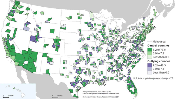
New Geography has just reported that a new Bureau of the Census report has found that exurban growth rates continue to far outstrip urban growth. While this finding might seem somewhat shocking in the face of nascent urbanism upswelling throughout most major midwestern cites and loft developments arising from Salt Lake City to Peoria, the scale at which urban redevelopment is occurring is not and cannot match the scale of greenfields development. The reason should be obvious. It is far easier to sprout houses on 400 acres of farm field without any neighbors or existing infrastructure then it is to assemble a massive urban tract for development. While I will not spend much time discreditingthe author's slant (after all, the reviews of his book on amazon do that quite efficiently), attempting to deliberately ignore these differences in scale in order to deflate the significance of new urban population growth is a cynical manipulation of analysis at best. Positive Population Change for Cities and Outlying Areas.
Whatever the case, many Americans are continuing to seek their dreams in suburban and exurban areas. With the recent onslaught of coverage on suburban foreclosures it is germane to ask what will the suburban landscape look like in half a century? Will foreclosed houses become productive gardens for remaining residents? That possibility, while alluring, seems unlikely without concerted effort and regulation. It is more realistic to assume that the suburbia of the future will look like the cities of the present. With these thoughts in my head I decide to take a walk.
Washington Avenue is one of the significant streets of Saint Louis. It spans almost eight miles with fits and starts, beginning at the riverfront and ending in the streetcar suburb of University City outside the city limits. It is best known as the main artery of the former Garment District which has been redeveloped as a concentration of lofts and restaurants. Further west Washington Avenue (neé Terrace) is one of the most exclusive gated streets in the city. In between these two poles, and just north of the posh Central West End, Washington holds clues to the future of the suburb.
Like many thoroughly urban areas, Washington was once a suburb itself. Extending beyond the limits of city development across a wide area known as the Grand Prairie the development of the street was made possible by a new type of transportation: the electric streetcar. A number of car lines ran nearby, including the #10 on Delmar, the #15 Hodiamont on a private right of way several blocks north, and another line running on Olive from Lindell to Walton. [For the 1910 Map, click here.] Much of Washington was built as speculative development, and as we walk through the intersection of Walton and Washington we will see a perfect example.
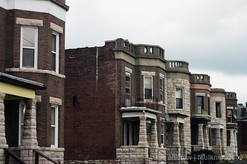
4617-4641 Washington Avenue. These two family flats were built as part of a row of eight in 1901. Their lot division, atypically small even for this area, was the result of being near the junction of Washington with Olive and the streetcar line. At the time these flats were built, land value was a direct function of distance from fixed-route public transportation. It was only with the switch to buses and the uncertainty of a potentially variable route that this relation was severed.
Despite alternating brick and stone units, common features such as the placement of the turret and Jefferson windows above the porch tie the composition together. Two units have been demolished and the windowless one is in the clutches of Bowood Gardens, but despite the removal of integral context the power of the alternating repetition still makes for an excellent streetwall. Compare this image mentally with a typical modern suburban street. If every third house was replaced with an overgrown lot, how would it compare with the above image?
Looking at the 1909 Sanborn map of the block it is evident just how much urban fabric the area bounded by Walton, Washington, Taylor and Delmar has lost. All of the red markings denote buildings replaced by vacant lots or parking, the green marks denote buildings replaced by more recent buildings. While I was unable to find any information on it, the loss of the courtyard apartment at Taylor and Washington was tragic. Despite all the losses, the relatively narrow block depths and remaining buildings still manage to keep the block from feeling like a wasteland. With suburban lots typically three to five times wider than these lots, the loss of a single foreclosed house to fire or demolition would have a much more severe impact on surrounding values on the cul-de-sac or road.
I continue walking east on Washington, crossing Taylor and then Newstead. The block of Washington between Newstead and Pendleton has seen some of the most dramatic loss of urban fabric.
While this block has retained the wide-lot platting that belies its upper class origins, most of the original houses have been demolished. On the south side eight remain standing, on the north side only six. In contrast to the suburban style infill built on the south side in 1997 across two lots, the 2006 infill homes by X3 Developers are striking in their competency.
Three infill houses on Washington by X3 Developments.
Built at 4341-4347 Washington to replace three houses dating to the mid-1890's that had unfortunately been lost, these three infill units notably carry the masonry entirely around the building (unlike some recent failures). While the arched windows on 4345 are kitchy and not architecturally appropriate to Saint Louis, the flanking models have a nicely understated referencing of Richardsonian Romanesque. Since these sold for half a million dollars apiece, I feel compelled to note that the hipped roofs are a let down, the tectonics are too flat without more complicated brickwork and the stoop/stair combination is a blatant and unnecessary reference to brownstones over 1,000 miles away. While I would prefer for infill to refer to surrounding structures but ditch the weak historicism like Anthony Robinson's recent projects I would still not be disappointed if they filled in the rest of the empty lots on this block with more considered variations of these.
The true gem on this block is not the new infill, but an old remnant. Service Station at Pendleton and Washington.
This service station was built to replace a mansion sometime in the 1920s to serve the growing motoring demand of the wealthy residents in surrounding neighborhoods. The beautiful black Vitrolite facade probably dates from the 1950s. Note the elegant reveals of glass block at the sides of the facade as well as the combination of green window mullion and chrome. The architecture of this facade displays a confidence not found even in the half million dollar infill houses. At the time of the facade installation this service station was a block away from the epicenter of St. Louis nightlife at Gaslight Square. The decline of Gaslight Square meant the decline of business for this little gas station. It served for a time as the home of Kugman Motors, but it has been vacant since at least 1989.
The block of Washington between Pendleton and Olive has seen much change in the century since the Sanborn Map was complied. The failure of Gaslight Square led to the demolition of the north side of Olive between Newstead and Whittier in the early 1990s. As part of the Gaslight Square redevelopment Pendleton was realigned to connect with Boyle. This ironically eliminated the jog that gave Gaslight Square its name. The two institutions that anchored the block disappeared decades ago. Bishop Robertson Hall was a private Episcopalian school with a 2,000 volume library that closed in 1915. The Episcopalian nuns of the Good Shepard then moved to Baden. The more significant of the two, Hosmer Hall had been established as an elite girls school in 1884. Today it is remembered as the alma mater of poet Sara Teasdale and for infamously banning hair extensions in 1909. A decade after the World's Fair Hosmer Hall moved to Clayton. The school closed and sold their building to Clayton in 1936 and it became known as the Wydown School until it was raised and replaced in 1965 by the present Wydown Middle School.
The final stop on our walk is in front of one of my favorite buildings in Saint Louis. Often I daydream about having unlimited resources to realize any project in the city. While a part of me longs to save and rehabilitate the apartments at 5315 Cabanne, the building at 4005 Delmar, or maybe even the San Luis, only one house calls to me.
4243 Washington.
4243 Washington avenue is unique. For every building in Saint Louis exploding with ornate terra cotta or wrought iron ornament there are many buildings that derive their aesthetic power from restrained geometries that presage the modern movement by decades. In that class 4243 Washington stands out with an unprecedented geometric purity that reinforces its three powerful stories.
4243 Washington.
Built in 1891 on the northern edge of the Central West End 4243 Washington anticipated a density and level of income that was never to coalesce. Unlike the majority of the houses on the block 4243 had three full stories combining for 5,200 square feet on a standard 50'-0"x150'-0" lot. In 1909 it was the only house on the block to have a two story carriage house. It is unclear when the carriage house was demolished, but a garage constructed in 1994 now has taken its place.
By the late 1950's the neighborhood had changed. Upper and upper middle class residents had either retreated into the private streets to the south or left the city entirely. According to a twenty year resident of the block named Lee, during the heyday of Gaslight Square older neighbors recollected Tina Turner stayed with a friend at 4243 when she was avoiding Ike Turner. After the fall of Gaslight Square Lee recollected that there was a lot of crime and prostitution in the area. As buildings burned and were demolished most of the residents left. 4243 survived under the same owner as the neighborhood got quieter and quieter. In November 2003 long-time owner Louise Holland sold 4243 for $125,000. New owners Ralph and Katrina Russell bought the property and began to reahab the house. Unfortunately they lost it in foreclosure in 2007 while in the process of replacing the windows. The empty shell was then sold for $79,000 to a Kevin Settle who sold it to M&J Enterprise for $95,000. The new owners have not paid property taxes since they have purchased the building.
If ever there was a building uniquely suited for a vacant building registry, stabilization, seizure, and resale this is it! However, even boarding second floor windows (let alone tarping roofs!) is "too expensive" despite the far greater economic and environmental costs of demolition. Disregard that: in this city, like in our equally visionary sister city, demolition means jobs.

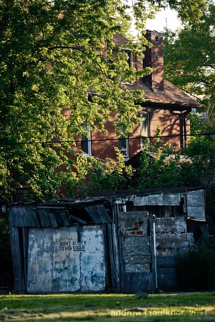 Morning dew
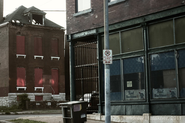 Quiet streets on College Hill
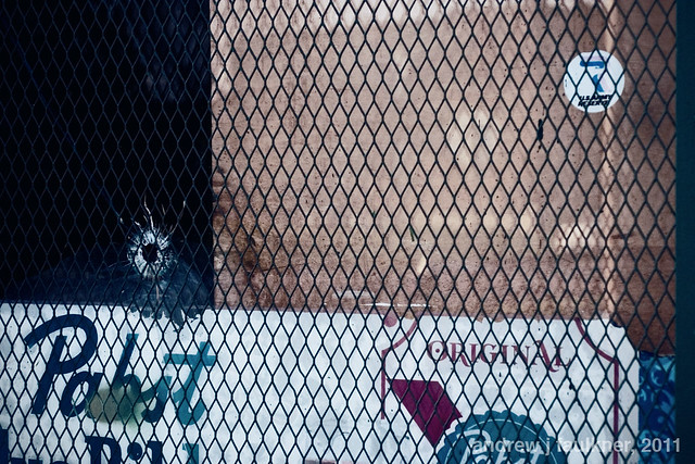 A worrisome detail
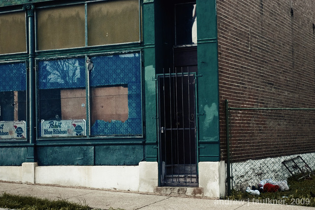 momento mori?